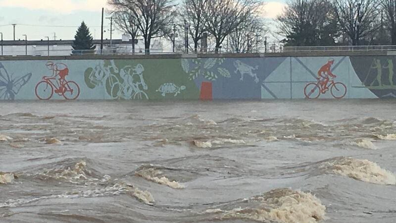
Many rivers are in flood stages due to the recent rains, which included a record-breaking day for Dayton, which saw 1.84 inches of rain Saturday to surpass the old daily rainfall record of 1.63 inches set in 2016.
>> Weekend rain sets record; how much did you get?
With all the rain, the Great Miami River in Dayton is expected to crest around 7 p.m. today at 32.2 feet, Storm Center 7 Meteorologist Brett Collar said.
>> High water blocks some roads; troopers urge driver safety
Other rivers are considered in minor flood stage, such as the Mad River near Springfield, the Little Miami River near Spring Valley in Greene County and the Great Miami River near Middletown in Butler County. These rivers are expected to recede heading into Monday.
The Great Miami River near Sidney is expected to crest in minor flood stage early Monday, then recede, Collar said.
There are flood alerts over the next couple days.
- Flood Warning through 6 p.m. Monday along the Little Miami River in parts of Greene and Warren counties
- Along the Great Miami River, a Flood Warning lasts through 7:32 p.m. Monday in Shelby County; and to 8:30 p.m. Monday in Butler County near Middletown
>> Kasich declares emergency over Ohio flooding
There’s a lag between the heavy rain and water levels rising, which is why creeks, streams and rivers won’t recede until the start to the new week, Zontini said.
The Great Miami River is expected to crest, or hit its highest levels, this weekend.
In Troy, the Great Miami River is expected to crest at 13.6 feet Sunday, and in Dayton, the river is expected to crest, also Sunday, at 32.2 feet. And in Middletown, the Great Miami River is expected to crest at 12.4 feet Sunday.
The Stillwater River in Englewood is expected to crest Monday at 33.6 feet.
>> WHIO Doppler 7 Interactive Radar
When the river does crest, here are the areas that will see flooding, according to the National Weather Service.
ENGLEWOOD (Stillwater River)
- 23 feet: Martindale Road, Old Springfield Road and the road to the MetroPark are all closed
- 25 feet: Martindale Road, old Springfield Road and the road to the MetroPark are covered by 2 to 3 feet of water
DAYTON (Great Miami River)
- 27.5 feet: Bike trail will be flooded
- 30 feet: Flooding occurs near Rip Rap Road between Bridgewater and Little York roads near Huber Heights
SIDNEY (Great Miami River)
- 10 feet: The river approaches the bank on the west side of Custenborder Field. At stages above 10 feet, city officials begin flood operations.
- 11 feet: Custenborder Field has some flooding of perimeter areas, along with flooding occurring in low spots on Miami River Road
- 12 feet: The river reaches the bank on Riverside Drive, with flooding of Custenborder Field at the east river intake. Homes and properties will experience flooding along the river on Riverside Drive from the BK Root Beer stand to the city limits
MIDDLETOWN (Great Miami River)
- 11 feet: Some flooding occurs on private property areas along either side of Ohio 73 from the east side of the river approaching Excello. Middletown is protected by levees and floodgates to 24 feet.


