A sixth tornado touched down Wednesday in Greene County, in addition to the two that hit in Clark County, one in Fayette County, one in Warren County and one in Miami County.
Tornadoes were confirmed in the following locations:
- EF-1 confirmed in Park Layne
- EF-0 confirmed near Medway
- EF-1 confirmed near Piqua
- EF-0 confirmed in Fayette County
- EF-0 confirmed in Warren County near Harveysburg
- EF-0 confirmed in Beavercreek Twp., Greene County
>>DOWNLOAD OUR FREE WHIO WEATHER APP
UPDATE @ 4:25 p.m. (May 30)
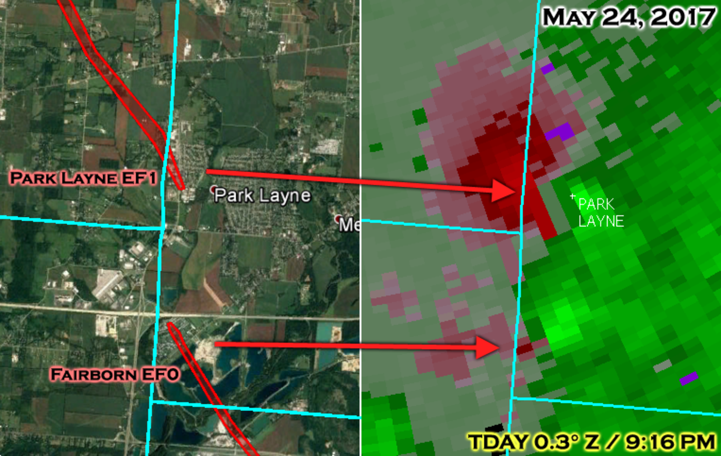
According to a meteorologist with the National Weather Service in Wilmington, the tornadoes that hit the Fairborn/Medway and Park Layne areas May 24 were on the ground at the same time.
>>VIDEO: Funnel cloud over Fairborn
According to Doppler radar velocity data, the EF0 tornado that hit the Medway/Fairborn area on the northeast side of Dayton was touching down at approximately 9:07 p.m. and continued on the ground until 9:16 p.m.
At about 9:15 p.m., the tornado developed in Park Layne and stayed on the ground until 9:32 p.m.
RELATED: Businesses damaged in Park Layne
WHIO cameras caught both touchdowns on the air. At the time, we thought it was the same tornado, but it turns out that we saw two different tornadoes.
UPDATE @ 2:42 p.m. (May 30)
A sixth tornado has been confirmed in Beavercreek Twp., Greene County during the tornado outbreak last week.
According to the National Weather Service, video evidence showed an EF-0 tornado touched down near the 900 block of Trebein Road and was on the ground for 2.7 miles.
The maximum wind speeds in the Beavercreek Twp. tornado were 65 mph.
UPDATE @ 12 pm (May 30)
The confirmed Park Layne tornado on May 24 now has an updated end point. The National Weather Service stated that the track of the tornado now extends to 4.5 miles total. The tornado first touched down near Park Layne in Clark County Ohio. The tornado then continued into southeast Miami County before ending along State Route 571, west of State Route 201.
UPDATE @ 2:52 p.m.:
A fifth tornado is reported to have touched down in the region during Wednesday night’s storm, according to the National Weather Service.
An EF0 tornado briefly touched down in Warren County, in a field four miles north of Harveysburg, according to the NWS.
UPDATE @ 1:30 p.m. (May 26)
In addition to three tornadoes that hit the Miami Valley on Wednesday, a fourth tornado touched down in neighboring Fayette County, according to the National Weather Service in Wilmington.
The EF-0 tornado touched down in the extreme western portion of Fayette County, based on radar data, video evidence and eyewitness reports, according to the weather service.
The tornado had wind gusts of 50 mph, was 25 yards wide and traveled approximately three miles, according to the weather service. it dissipated about four miles southeast of Jamestown.
The tornado traveled primarily through empty farm fields and did not left little damage, according to the weather service.
EARLIER
The National Weather Service has confirmed a third tornado touched down near Medway in Clark County.
Maximum sustained winds for the tornado were 75 mph and it was said to be on the ground for 500 yards, the weather service said.
The tornado touched down on Lower Valley Pike near Princeton Drive, just southwest of the I-70 and Ohio 235 interchange.
Several manufactured homes sustained roof and siding damage and two large trees fell on and destroyed homes on Cordova Drive at McMahan’s Fairview Terrace Mobile Home Park.
RELATED: Multiple mobile homes damaged by downed trees in Clark County
Several homes on Wellington Avenue had mud splattered on the north or east side of the homes, showing evidence of rotation, the weather service said.
According to the weather service, carports and awnings also were destroyed.
The damage quickly lessened in strength further to the northwest with minimal damage along Jason Drive and no evidence of damage by Amy Dee Lane, NWS said.
UPDATE @ 3:46 p.m.:
A second tornado was confirmed by the National Weather Service approximately five miles southeast of Piqua.
The weather service said the maximum winds for the tornado near Piqua were estimated at 90 mph.
UPDATE @ 3:36 p.m.:
A tornado that caused damage in Park Layne and southeast Miami County had maximum sustained winds of 100 mph and was on the ground for nearly four miles, the National Weather Service said.
Officials said the tornado first touched down in the western side of Park Layne as an EF-1 tornado, where damage occurred to some commercial buildings and trees.
RELATED: Businesses damaged in Park Layne
The maximum width of the tornado was 300 yards.
Additional tree damage and minor roof damage occurred along Bellefontaine Road to the northwest, the weather service said.
Sporadic damage, primarily to trees, was found farther to the northwest, ultimately ending along Ohio 201 north of Studebaker Road.
The damage near Studebaker Road was consistent with wind speeds of an EF-0 tornado, the weather service said.
Officials are expected to release additional details later this afternoon.
An EF-1 tornado is classified with wind speeds between 86 to 110 mph and an EF-0 tornado has wind speeds of 65 to 85 mph.
UPDATE @ 2:56 p.m.
Bethel Twp. fire department official gave an update on the damage at Sunoco gas station. The hazard has been secured and no fuel was lost. The fuel tank valves have been secured.
Also, there are six families being assisted in this area of Park Layne.
There has been extensive damage to roofs on homes along Osborne Road, according to Bethel Twp. fire. The department was able to use a drone in the daylight to get a clearer picture of the damage.
Clark County EMA is handling the damage assessment.
Larry Shaffer, Clark County Combined Health District, said eight of 10 restaurants are back in business after the storms caused closures.
The Mel-O-Dee restaurant could be closed for up to three weeks due to broken air conditioning units and a structural truss damaged. The Family Dollar that was damaged will also remain closed.
Tom Hale, Clark County building official, said several businesses remain without power.
UPDATE @ 10:06 a.m.
The National Weather Service has confirmed an EF-1 tornado hit Park Layne Wednesday night.
The weather service estimated maximum winds for the tornado at 100 mph.
Additional details, including the path length and width on the Park Layne tornado will be released later today, NWS said.
UPDATE @ 9:49 a.m.:
The National Weather Service storm survey teams have arrived in Park Layne and are beginning their surveys of suspected tornado damage in Clark, Greene and Miami counties.
>>PHOTOS: Storm damage | Storms, funnel clouds
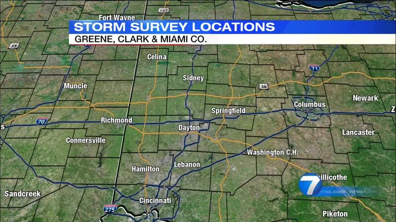
The National Weather Service will be out today to survey damage in Greene, Clark and Miami counties to determine the number, strength and exact locations of tornado touchdowns.
Two survey teams will begin today in Park Layne and then those teams will split up, with one going to Miami County and the other going to Greene County.
>>VIDEO: Funnel cloud over Fairborn
In a statement issued early this morning, weather service officials in Wilmington said some of these damage reports, reported by whio.com and News Center 7, include:
- Wright-Patterson Air Force Base security forces are checking for damage. "At this time, we do not know if a tornado touched down or not" on the base, spokeswoman Marie Vanover said. WPAFB weather casters issued a tornado warning at 8:33 p.m., which was extended twice more. An "all clear" has since been issued, she said.
- In Greene County, several trees and power lines were reported down near Dayton Xenia and Trebein roads in the Xenia area.
- In Miami County, a tornado may be responsible for barn debris, trees and wires in the street the 8000 block of Bellefontaine Road, according to the National Weather Service. The road is closed, according to the Miami County Sheriff's Dispatch.
- In Miami County, trees and power lines down in Bethel Twp. at Bellefontaine Road, between U.S. 40 and Palmer Road.
- In Beavercreek, a tornado may be possible for several trees and power lines reported down near Dayton Xenia and Trebein roads, according to the National Weather Service.
- In Beavercreek, a tornado may be responsible for several trees down along Dayton Yellow Springs Road near Fairborn.
- In Miami County, two homes with structural damage near highway 201 at Studebaker Road.
- In Miami County, Deweese Road at Peterson, closed because of power lines and trees down.
- In Montgomery County, trees were reported down in the 8300 block of National Road
It is believed that a tornado or multiple tornadoes were responsible for the damage in certain locations in these
counties, weather service officials said.
There may be additional locations that require damage surveys that aren't listed above, weather service officials said.
“We will be in contact with emergency managers from the affected counties to determine a specific plan for damage surveys, as well as assess the need for additional surveys in other locations,” weather service officials said in the statement.
INITIAL REPORT
Several tornadoes are being reported in Greene County tonight.
Here are some of the reports (all of these reports have to be verified by the National Weather Service):
>>RELATED: Xenia graduation at Nutter Center disrupted
>>VIDEOS: Sirens, wall clouds in Greene
- One has been reported in Fairborn, reported by Wright-Patterson Air Force Base
- One has been reported, by weather spotters to the National Weather Service, in southwest Miami County
- Another in the area of U.S. 35 at the split with the U.S. 35 Business Route near Xenia
- Near Jeffersonville and the Jackson Twp. line in eastern Greene County
Jason Slyger, of Sabina, said he saw a tornado touch down near Jeffersonville and the Jackson Twp. line about 8:30 p.m.
"You see the storm, you see a V and all of a sudden you see debris in the air," he said.
We are hearing no reports of damage of injuries.
We have been fielding reports of funnel and other threatening clouds.
We will continue to update this report as warranted.
Click here to download our free mobile app for breaking news, news updates and weather.


