QUICK-LOOK FORECAST:
- Comfortable temperatures to start the weekend
- Heatwave starts Sunday
- Potentially the longest run of 90+ since 2021
>>TRACK THE LATEST CONDITIONS: Live Doppler 7 Radar
AIR QUALITY ALERT: Montgomery, Miami, Greene, Clark, Darke, and Preble Counties for Saturday, Sunday, and Monday. This is due to stagnant air and increasing heat and could be expanded.

DETAILED FORECAST:
FRIDAY: A stray shower or storm is possible until sunset, but most stay dry. Mostly clear overnight with lows on either side of 60 degrees.

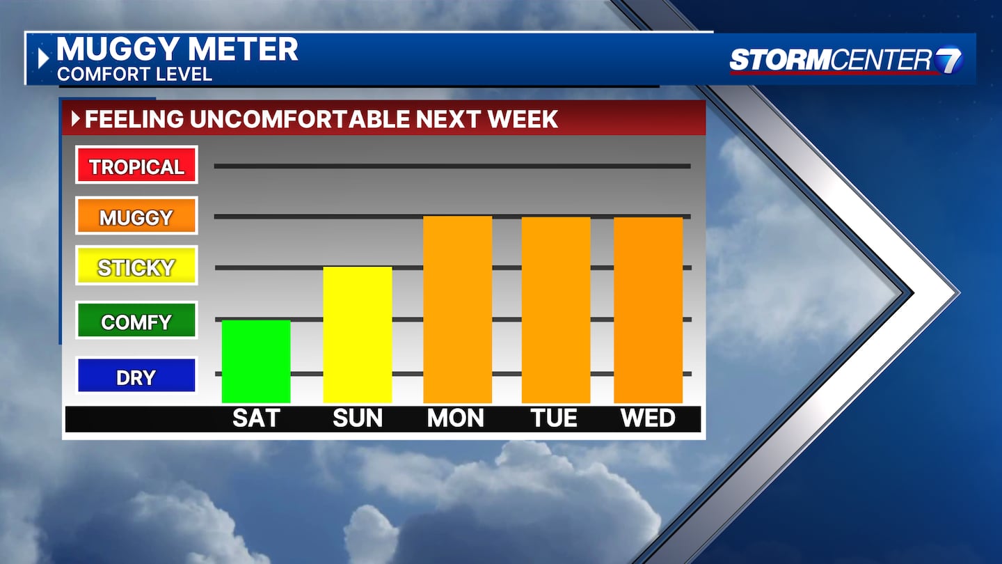
SATURDAY: A nice day with sunshine, and low humidity but still warm. Highs in the mid-80s.
SUNDAY (FATHER’S DAY): Plenty of sunshine and a few clouds. Big heat arrives with highs in the lower 90s. Heat index values in the low to middle 90s.
MONDAY: Near record heat with a high of 97 in Dayton. The record is 98. This will be dangerous heat with heat index values between 100 and 105 degrees.
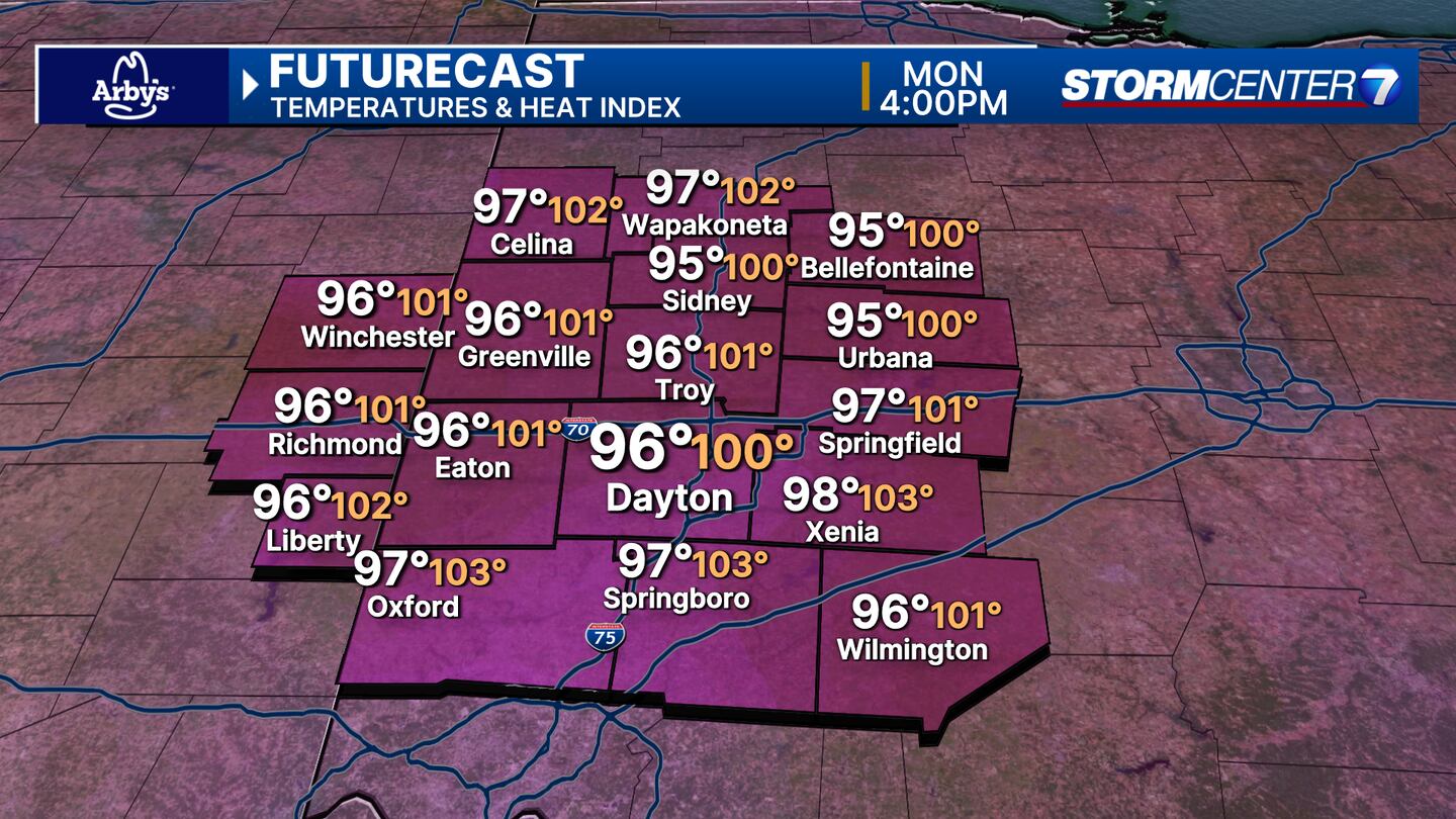
Mostly sunny skies. Increasing humidity may allow for a pop-up storm.
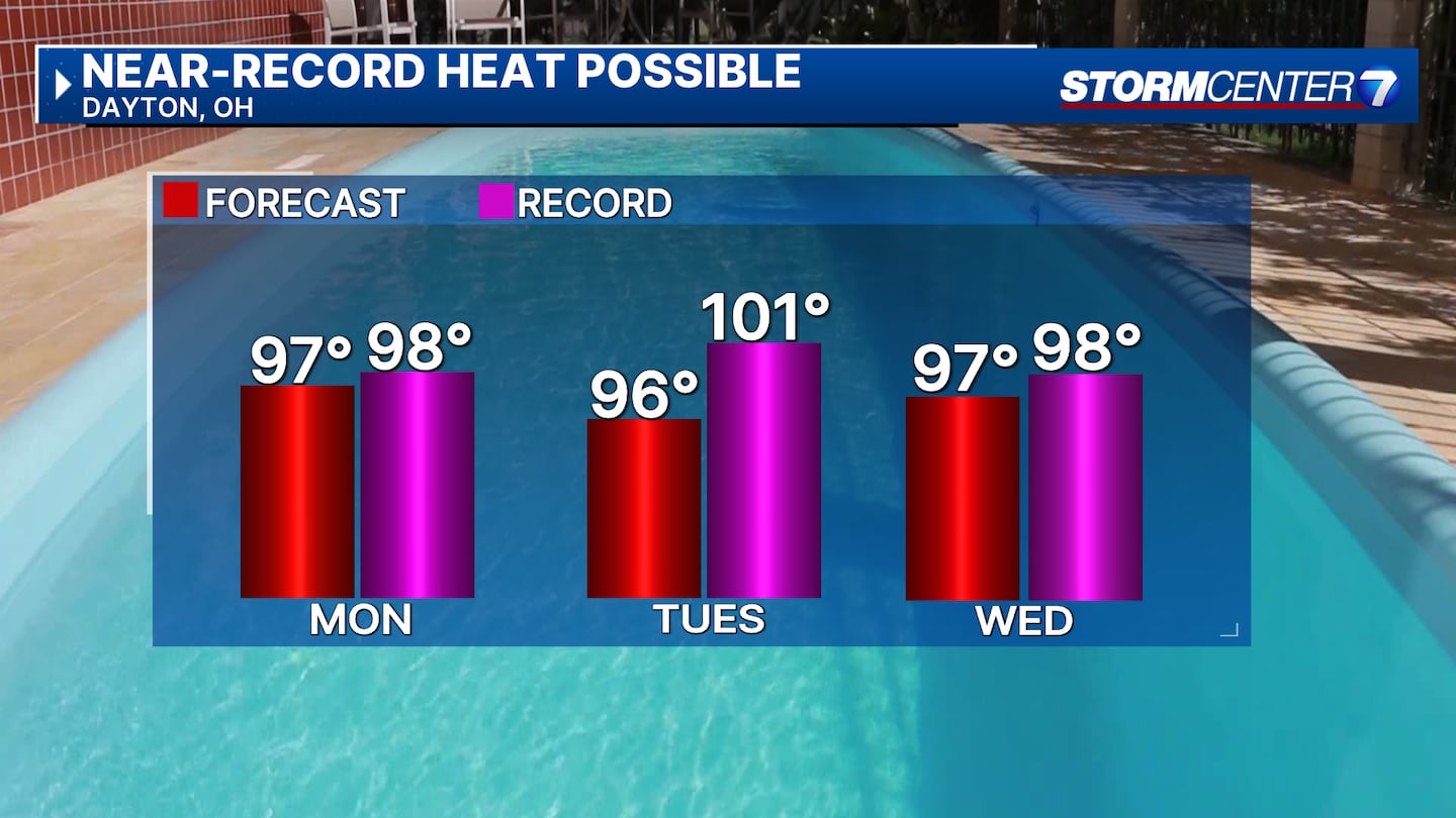
TUESDAY: Heat wave continues with highs in the middle 90s. Heat index values as high as 103. A stray pop-up storm is possible
WEDNESDAY: Staying hot and a bit muggy with highs in the mid to upper 90s and heat index values as high as 104. The record high is 98.
THURSDAY: More heat. Partly cloudy with highs in the upper 90s. Heat index values up to 104.
FRIDAY: Continued heat and no sign of relief with highs in the middle to upper 90s. Heat Index values are possibly over 100 at times.
©2024 Cox Media Group