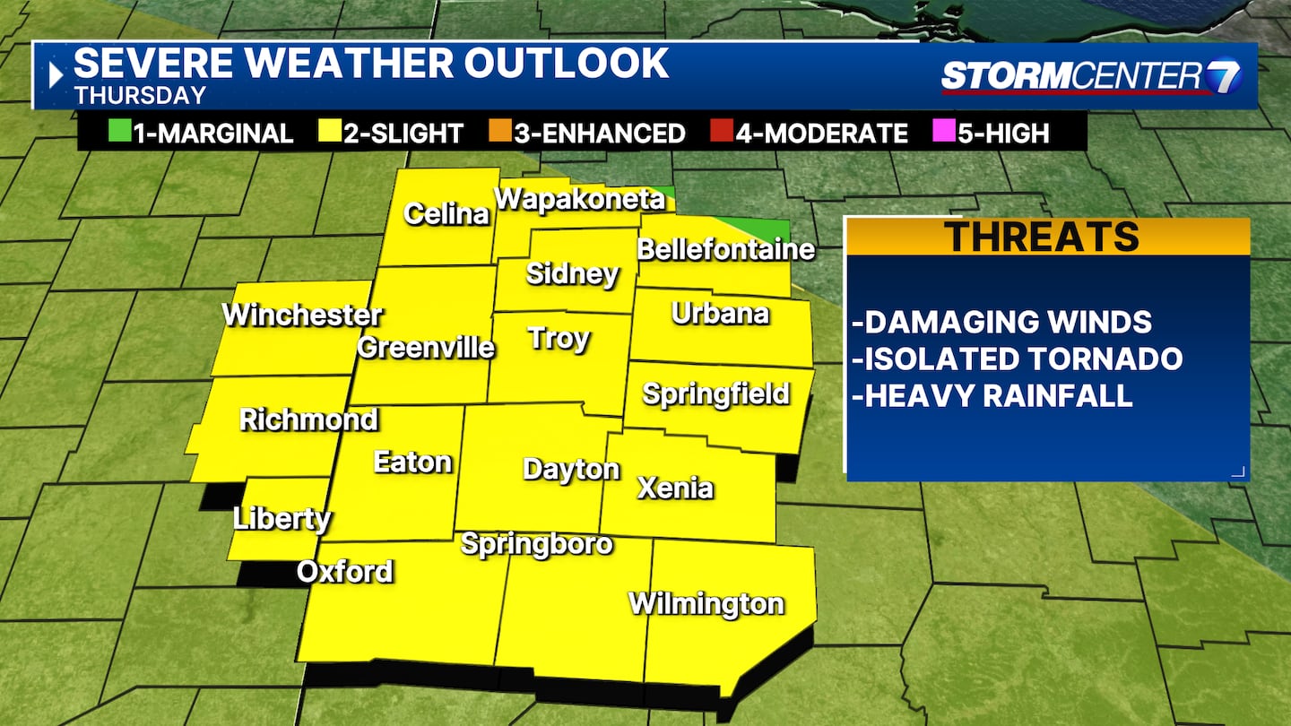
MIAMI VALLEY — Another round of showers and storms are possible Thursday in the Miami Valley, the best chance of stronger thunderstorms being Thursday afternoon and evening, according to Storm Center 7 Chief Meteorologist Austin Chaney. The weather will remain unsettled and humid the next few days.
>>TRACK THE LATEST CONDITIONS: Live Doppler 7 Radar
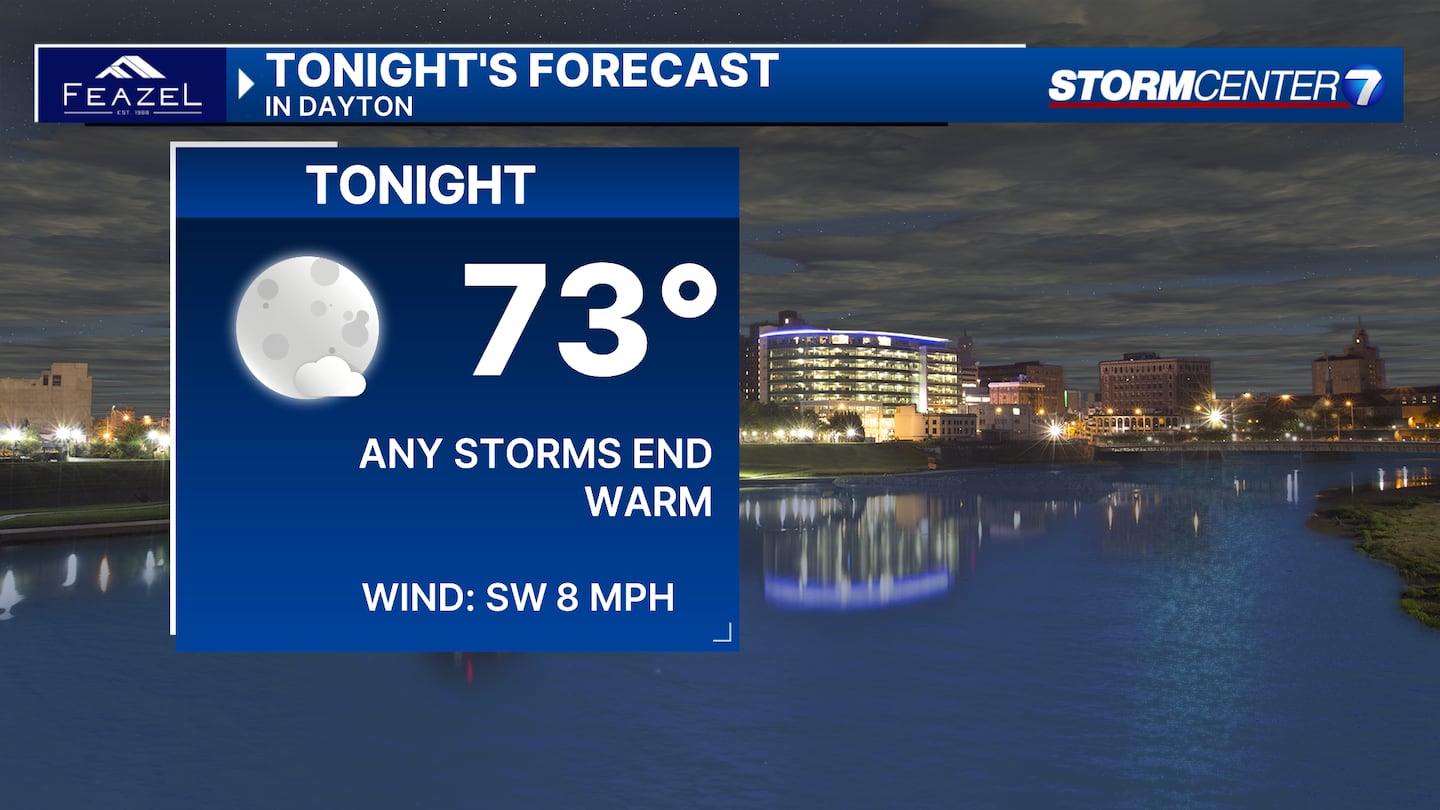
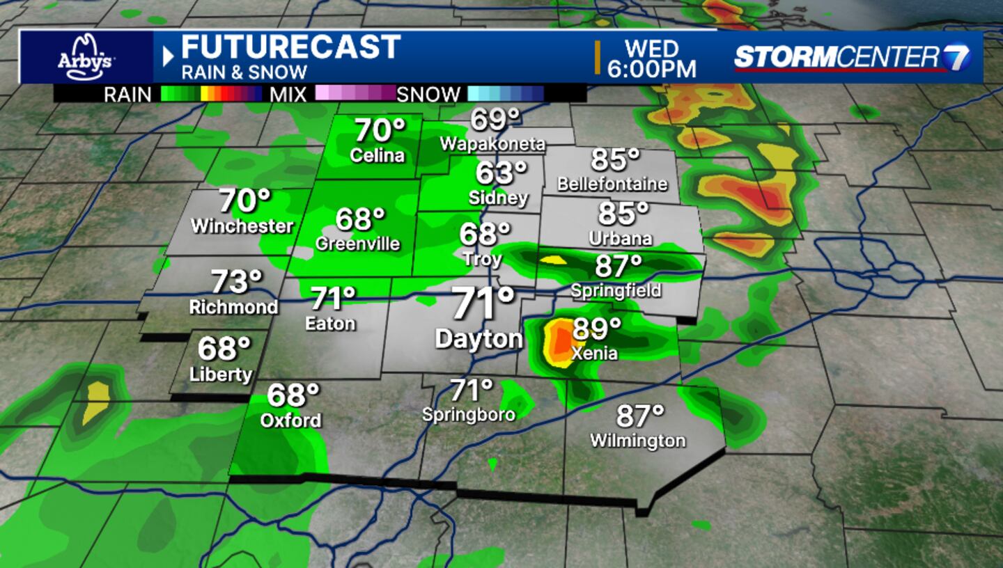
Clouds increased across the Miami Valley on Wednesday night and a few showers or storms may develop as we go through the evening, Chaney said. An isolated storm may be strong to severe. Overall, the worst of the weather misses us just to the southwest. Temperatures in the middle 80s this evening will cool to the lower 70s overnight.
For Thursday, damaging winds will be the main severe weather concern, but hail or a brief spin-up cannot be ruled out. Just like the last few days, it certainly isn’t an all day rain. Partly cloudy, hot and muggy otherwise with highs in the upper 80s.
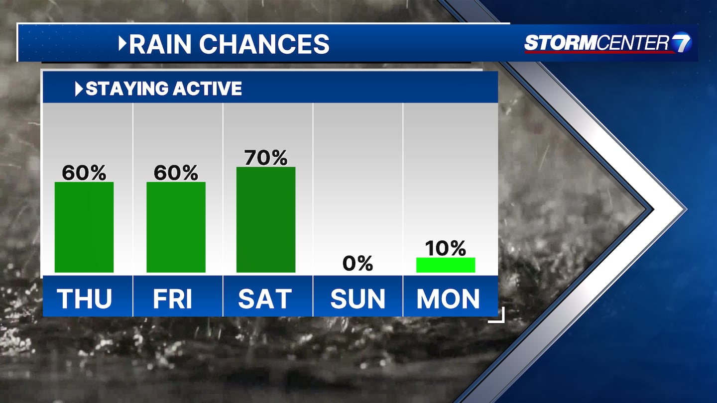
Showers still linger in the Saturday forecast. Not quite as hot with highs in the middle 80s.
But Sunday, we’re looking to dry things out a bit with seasonable temperatures. Highs in the middle 80s.
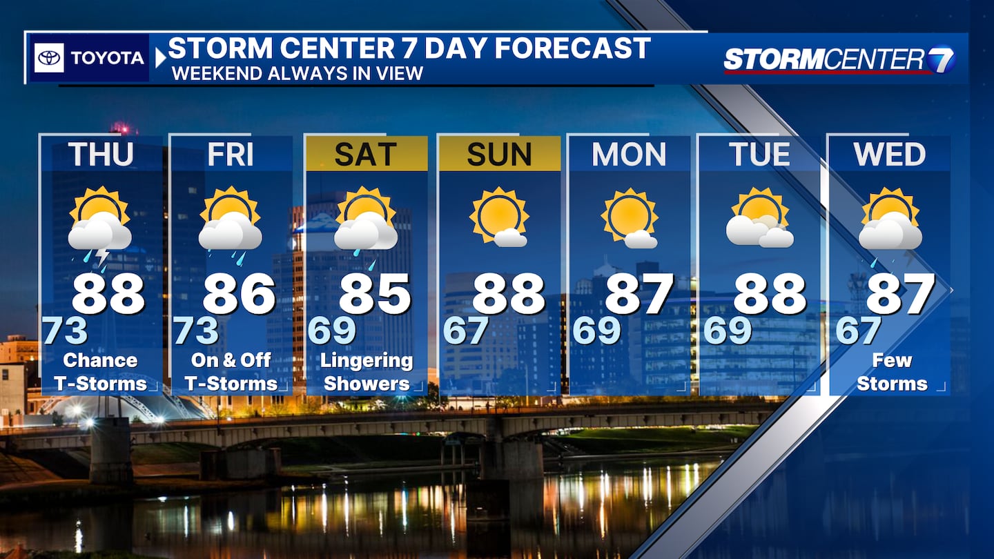
Look for mostly sunny skies Monday through Wednesday, with highs each day in the upper 80s.
Storm Center 7 will continue to provide updates.
©2024 Cox Media Group