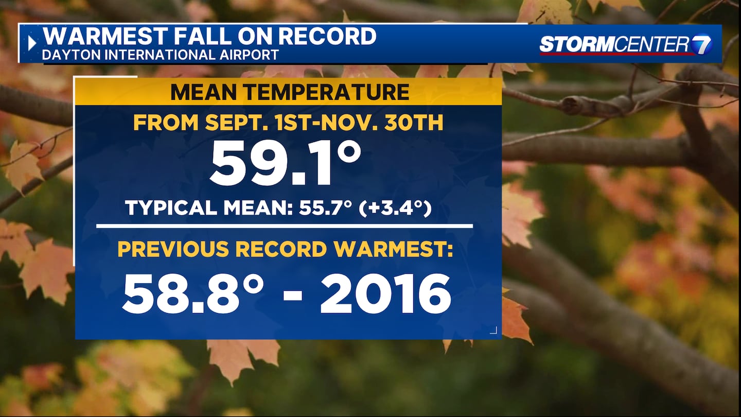
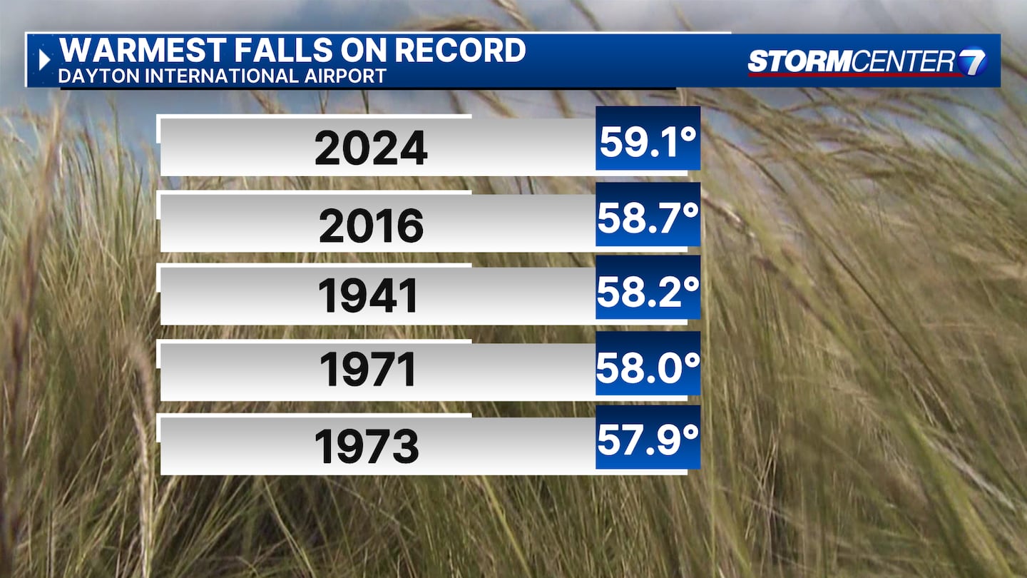
DAYTON — The Dayton International Airport has recorded the warmest Meteorological Fall ever, according to Storm Center 7 Weather Specialist Nick Dunn.
[DOWNLOAD: Free WHIO-TV News app for alerts as news breaks]
Meteorological Fall runs from Sept. 1 to Nov. 30 and the mean temperature is calculated by averaging the daily high and low temperatures over the 3 months.
The previous record was set back in 2016 with the mean temperature at 58.8°, according to Dunn.
TRENDING STORIES:
- Biden pardons his son Hunter despite previous pledges not to
- High school football player suffers ‘traumatic’ brain injury during Thanksgiving game
- ‘Concerned about this;’ Viral photo of letter-marked breadstick sparks response from Olive Garden
Dayton recorded 90° or hotter five times in September during this year’s Meteorological Fall.
After starting well below normal for precipitation and recording one of the driest Octobers ever, Dayton ended up only slightly below normal with 8.66″ of total precipitation, Dunn said.
This fell below the typical 9.33″ over the three-month timeframe.
In November, Dayton also saw its first two snowfall events totaling 2.1″ at the airport, according to Dunn.
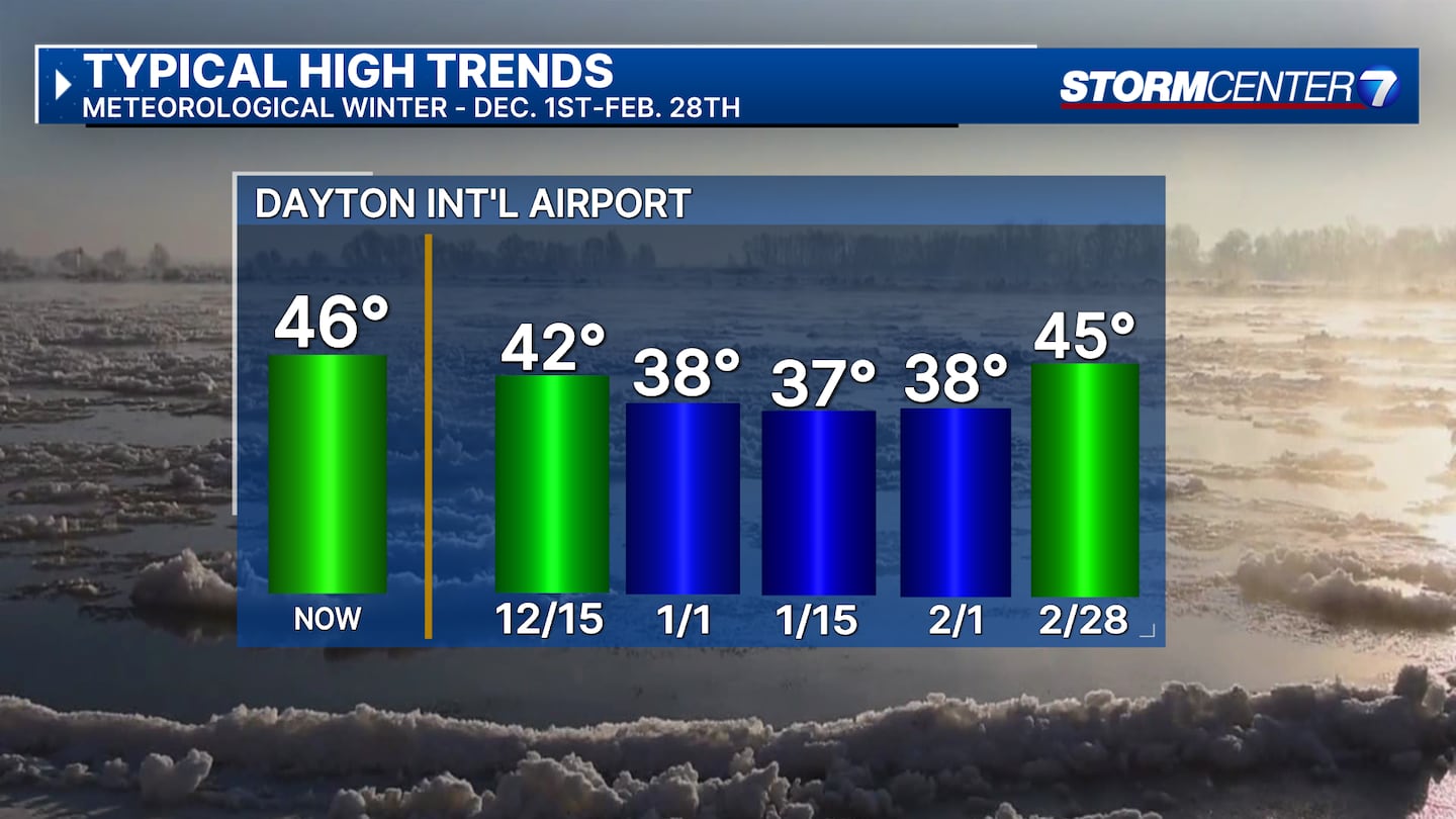
So, what generally happens as we start Meteorological Winter?
The typical highs continue to fall until mid-January when temperatures start to warm up again.
[SIGN UP: WHIO-TV Daily Headlines Newsletter]


