MIAMI VALLEY — An extended stretch of highs above 90 is in the forecast for the Miami Valley!
[DOWNLOAD: Free WHIO-TV News app for alerts as news breaks]
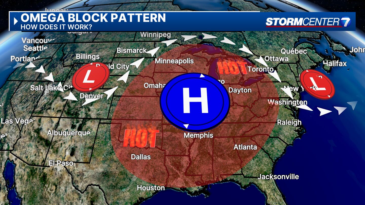
This is being called a heat wave due to the projected 3 or more days in a row with highs above 90. As long as the forecast verifies this will be our 3rd heat wave of 2024. The setup behind our recent dry weather is due to an Omega Blocking Pattern. What exactly is this? The term Omega comes from the Greek Alphabet letter, Omega! This type of blocking pattern for us allows high pressure to remain in control of our weather with no big system to break this block down to give us relief from the heat for several days. As the core of the heat and high pressure shifts our way, increasing heat and humidity can be expected.
There are slim chances of rain just about any afternoon this week due to increased heat and humidity. However, smaller disturbances may try and sneak into the area with slightly better chances for rain. Those disturbances can be tricky to forecast and time out, however, I would not bank on any rainfall. The best chance for rain as of today looks to be on Friday when a cold front will finally break down the blocking pattern and cool us off a bit into next weekend.
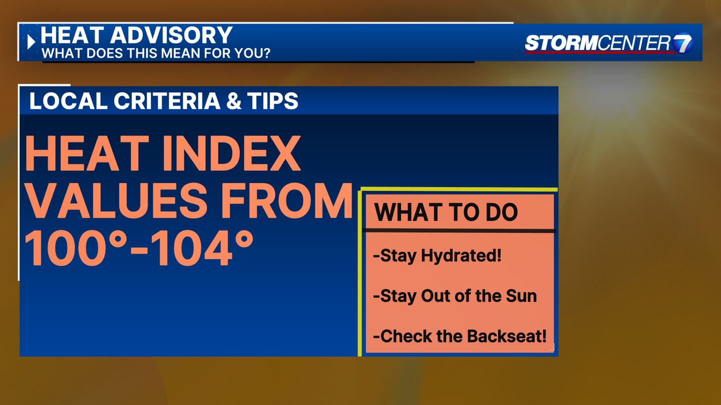
Heat index values exceeding 100 degrees are possible Tuesday and Wednesday, which may lead to the issuance of a Heat Advisory. The criteria for a Heat Advisory is for a “feels like” temperature over 100 degrees. While an advisory is not currently in place, if we do see one that is the reason. Practicing heat safety will be important this week to help you stay cool! Do not forget to check on pets, friends, and neighbors. If you must be outside, drink extra water to stay hydrated!
TRENDING STORIES:
- Rescue crews resume search for swimmer in Madison Lakes
- ‘Experience what has disappointed millions;’ National park trolls critics
- 3 inmates escape custody in Warren County; 2 located, 1 still at large
[SIGN UP: WHIO-TV Daily Headlines Newsletter]