DAYTON — Rainfall is finally coming to an end and looking at visible satellite, clouds are beginning to break across parts of the Miami Valley.
Temperatures are rising back into the 70s and will likely continue to climb into the 80s by noon if the clearing skies continue.
Storm Center 7 Meteorologist Britley Ritz talked with the National Weather Service on Thursday morning, and they said they believe the skies are going to clear. They have continued the heat alerts across the Miami Valley through this evening.
The NWS has dropped the forecast high today to 96 degrees. Originally, NWS had the temperature forecasted for 99 degrees but that has trended back throughout the week.
Storm Center 7 had the forecast predicted at 96 degrees since the beginning of the week. Heat index values are forecasted to remain around 105 degrees.
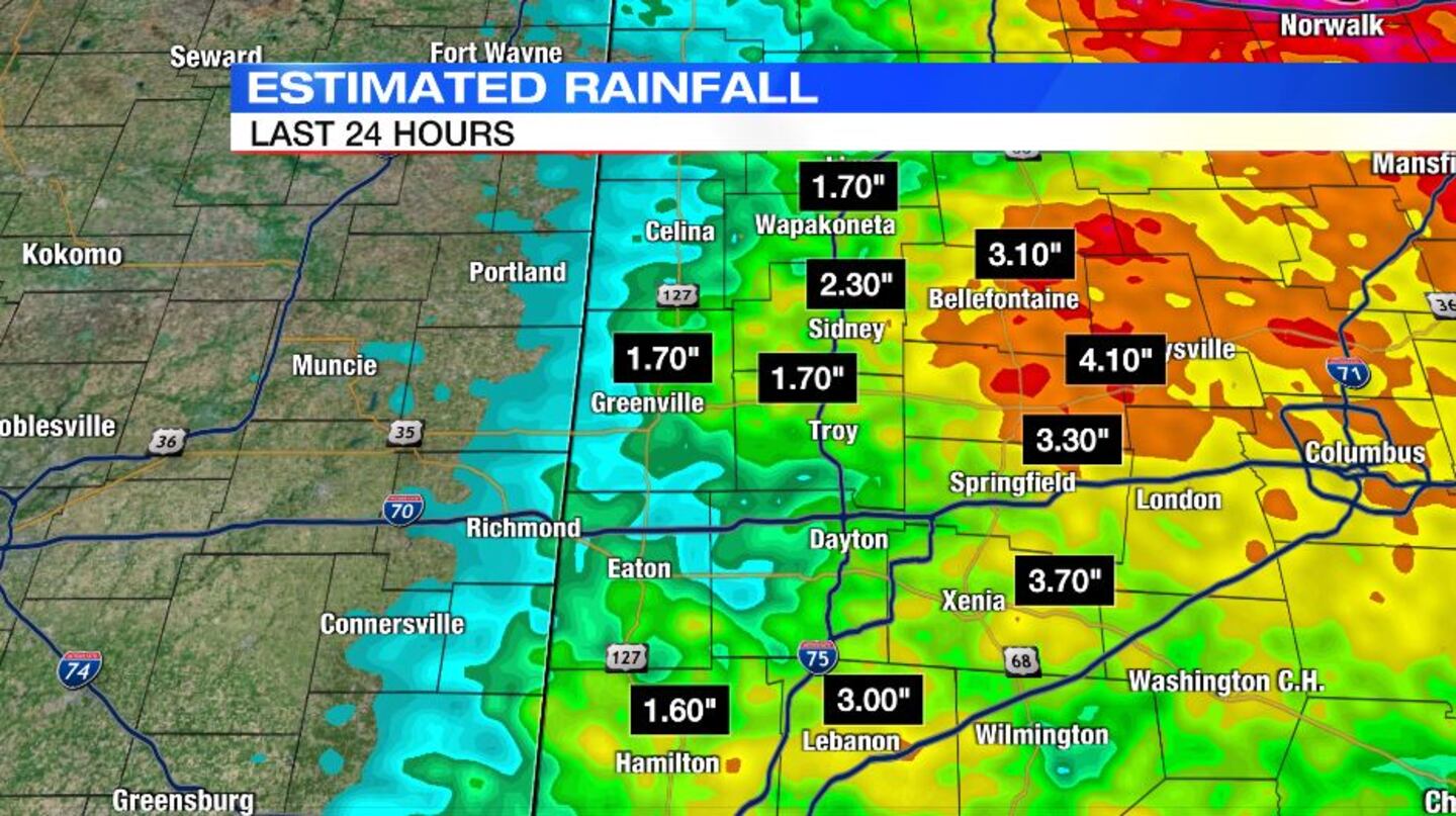
The Miami Valley saw large amounts of rainfall through the early-morning hours. Here’s a breakdown of the rainfall totals:
- Franklin received approximately 2 to 3 inches
- Xenia area received around 3.5 inches
- Greenville area received around 1.70 inches
- Troy area received around 1.70 inches
- Marysville area received more than 4 inches
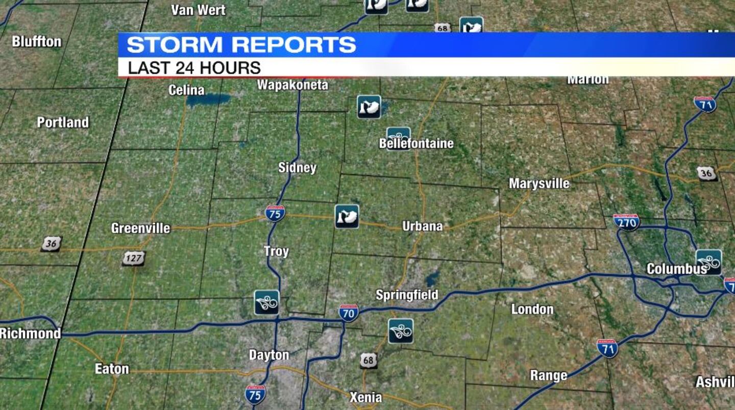
The early-morning storms also brought some strong, damaging winds. Here’s a breakdown of some strong winds:
- Clifton (Clark County) – 61mph at 7:16 am
- Vandalia (Montgomery County) – 48mph at 7:56 am
- St. Paris (Champaign County) – Thunderstorm wind damage at 6:39 am
- Bellefontaine (Logan County) – 51mph at 6:15am
Late this evening and into the early morning hours of Friday, the Miami Valley could see another chance for rain and storms.
© 2023 Cox Media Group