
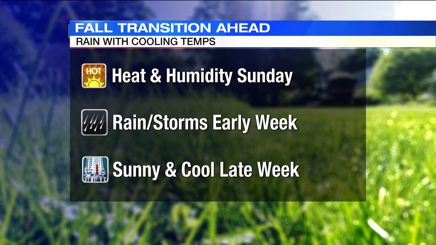
QUICK-LOOK FORECAST:
- Warm & muggy weekend
- Showers and storms starting Monday
- Big cool down arrives Wednesday
>>TRACK THE CONDITIONS: Live Doppler 7 Radar
DETAILED FORECAST:
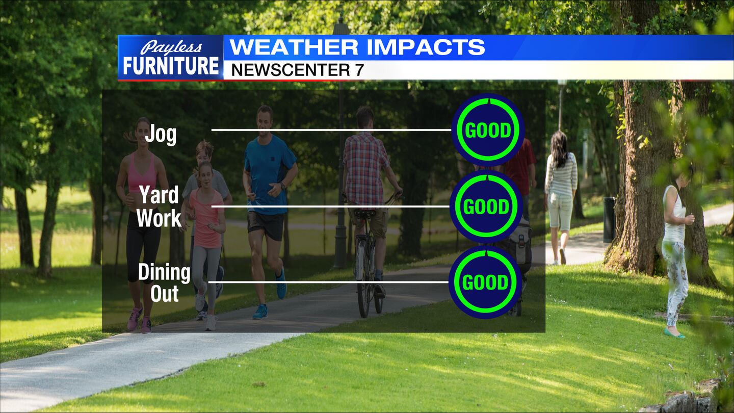
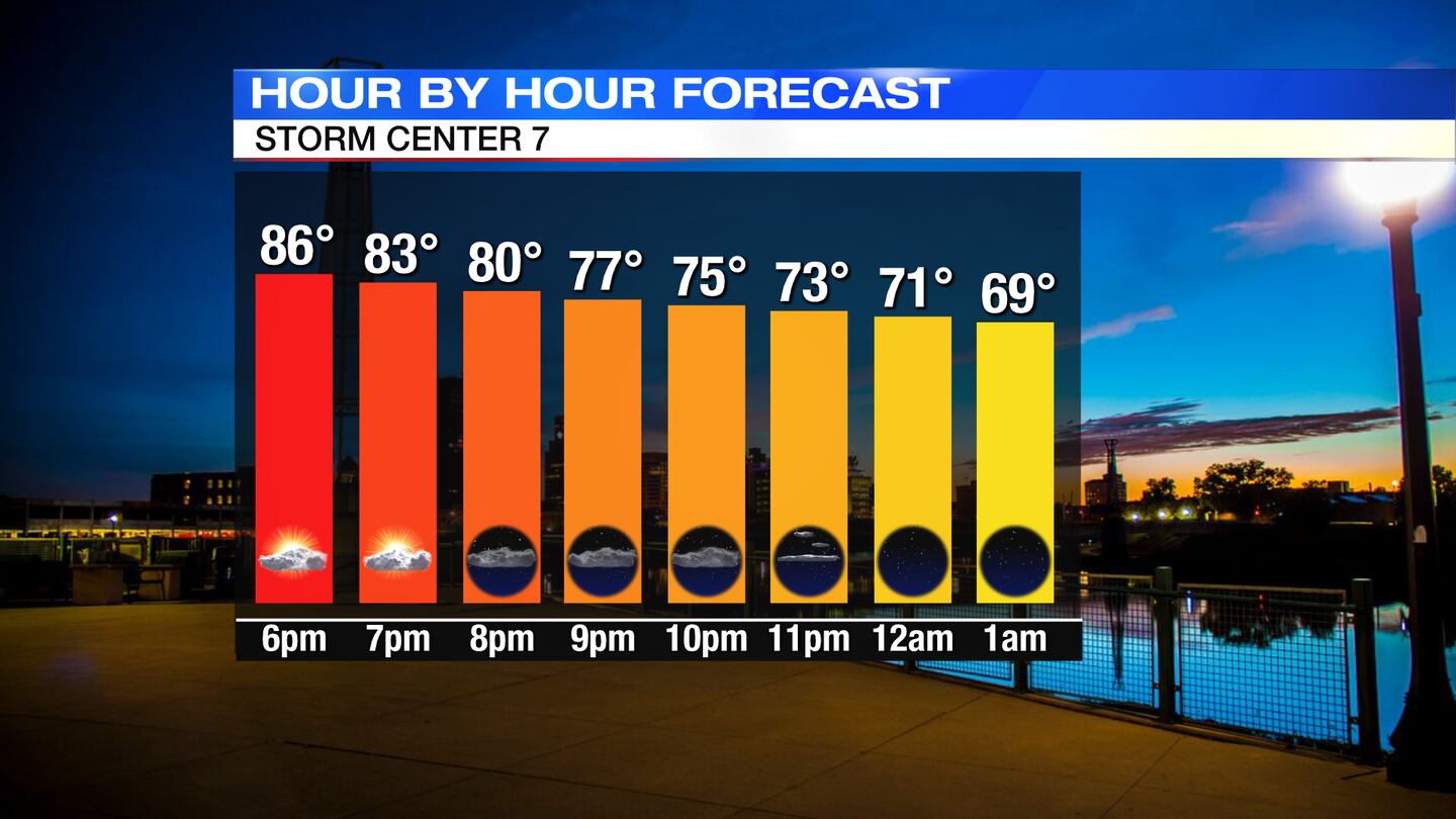
TODAY: Partly cloudy skies with an isolated downpour or t-storm. Temps are warm and muggy with temps in the 80s early then falling through the 70s late, Storm Center 7 Meteorologist Dontae Jones said.
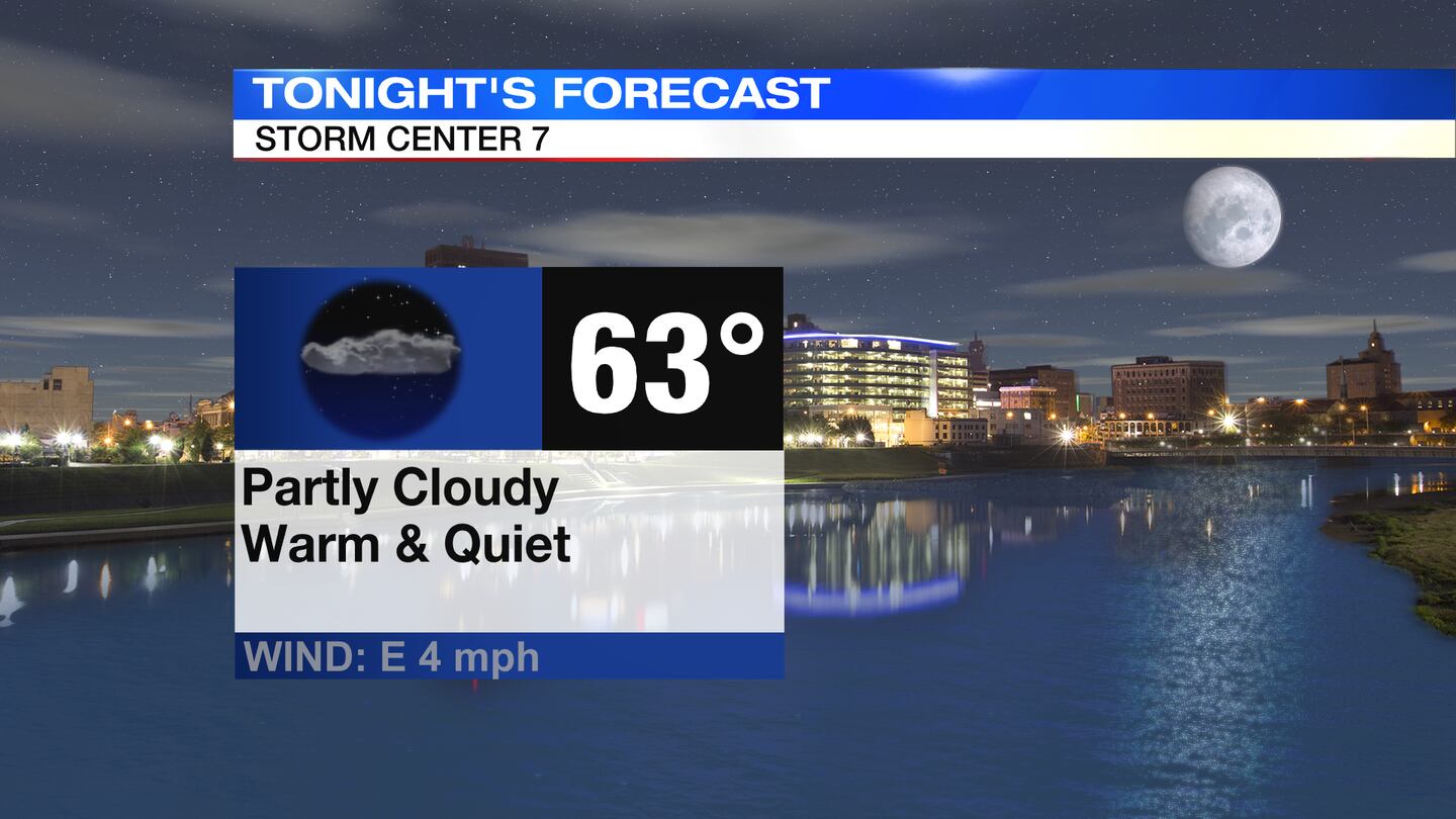
Overnight, partly cloudy, warm but quiet with temps in the lower 60s.
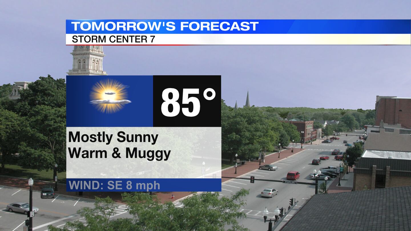
SUNDAY: Mostly sunny, warm, and muggy on Sunday. Highs rise into the middle 80s. A light breeze out of the east/southeast kicks in during the afternoon. More clouds start to move in late in the day.
MONDAY: Mostly cloudy skies for Monday with chances for showers and storms on the rise. It will be breezy with a south wind sustained around 10MPH, higher gusts likely. Not as warm with clouds and showers around. High temperatures in the upper 70s Monday afternoon.
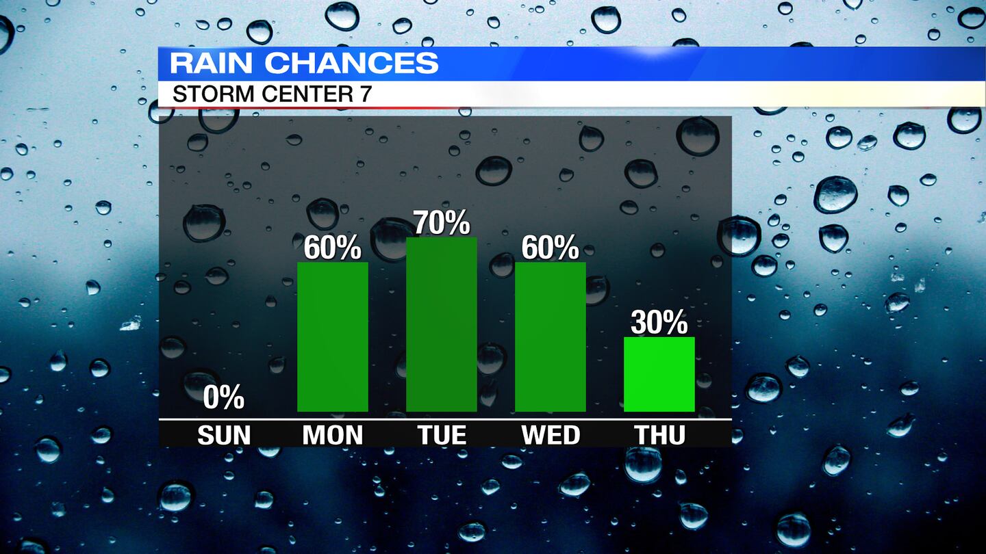
TUESDAY: Cloudy skies with scattered showers/storms. Breezy/windy through the day. High temperatures topping out in the upper 70s.
WEDNESDAY: Cloudy with scattered rain showers, mainly for the first part of the day but a few leftover passing showers possible through the afternoon. Staying breezy. A cooler day with highs in the upper 60s.

THURSDAY: Variably cloudy with a few passing showers still around. Temps are cooler and true to autumn, in the mid 60s.

FRIDAY: Partly/Mostly sunny and not as cool. Highs in the lower 70s.
SATURDAY: Partly/mostly sunny with an isolated passing shower or two. Temperatures remain comfortable, in the lower 70s.
©2021 Cox Media Group