QUICK-LOOK FORECAST:
- Drying out tonight, but still windy
- Much cooler temps ahead
- Few flying flakes this weekend
>>TRACK THE CONDITIONS: Live Doppler 7 Radar
DETAILED FORECAST:
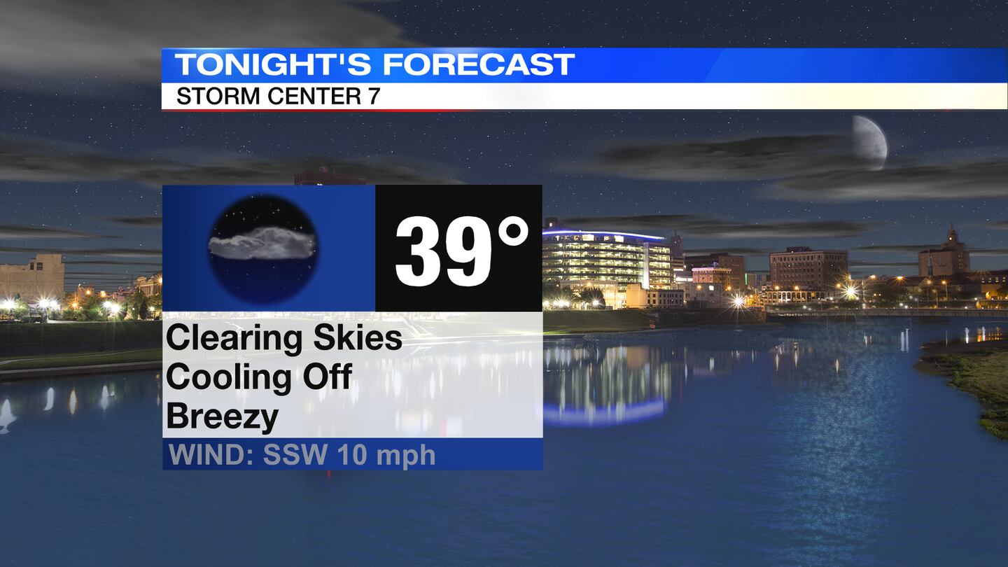
TODAY: Cloudy, windy, and wet through the evening, but showers will begin to taper off. Drying out overnight with decreasing clouds. Still breezy into the morning. Temperatures tonight will dip into the upper 30s. Wind Chills will be closer to 30 degrees first thing in the morning.
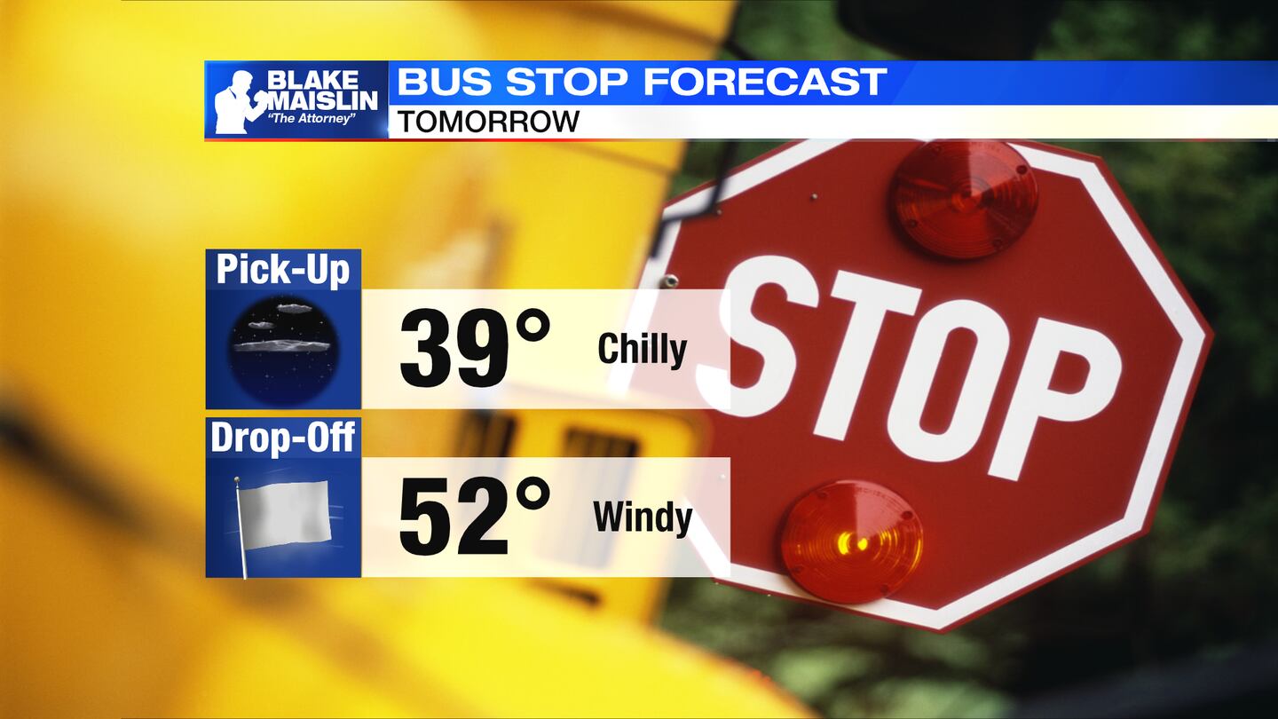
TOMORROW: Sunshine early will give way to more clouds into the afternoon. It will be a cooler day with highs in the lower to middle 50s. Still breezy with gusts up to 30mph, so this will make it feel like the 30s and 40s through the day. A few passing showers may return late afternoon into the evening. Slight chance of a few flurries Friday night as temperatures drop into the lower 30s.
SATURDAY: A cold morning in the lower 30s. Some sun returns with a chilly afternoon with highs in the lower 40s. Clouds increase Saturday night.
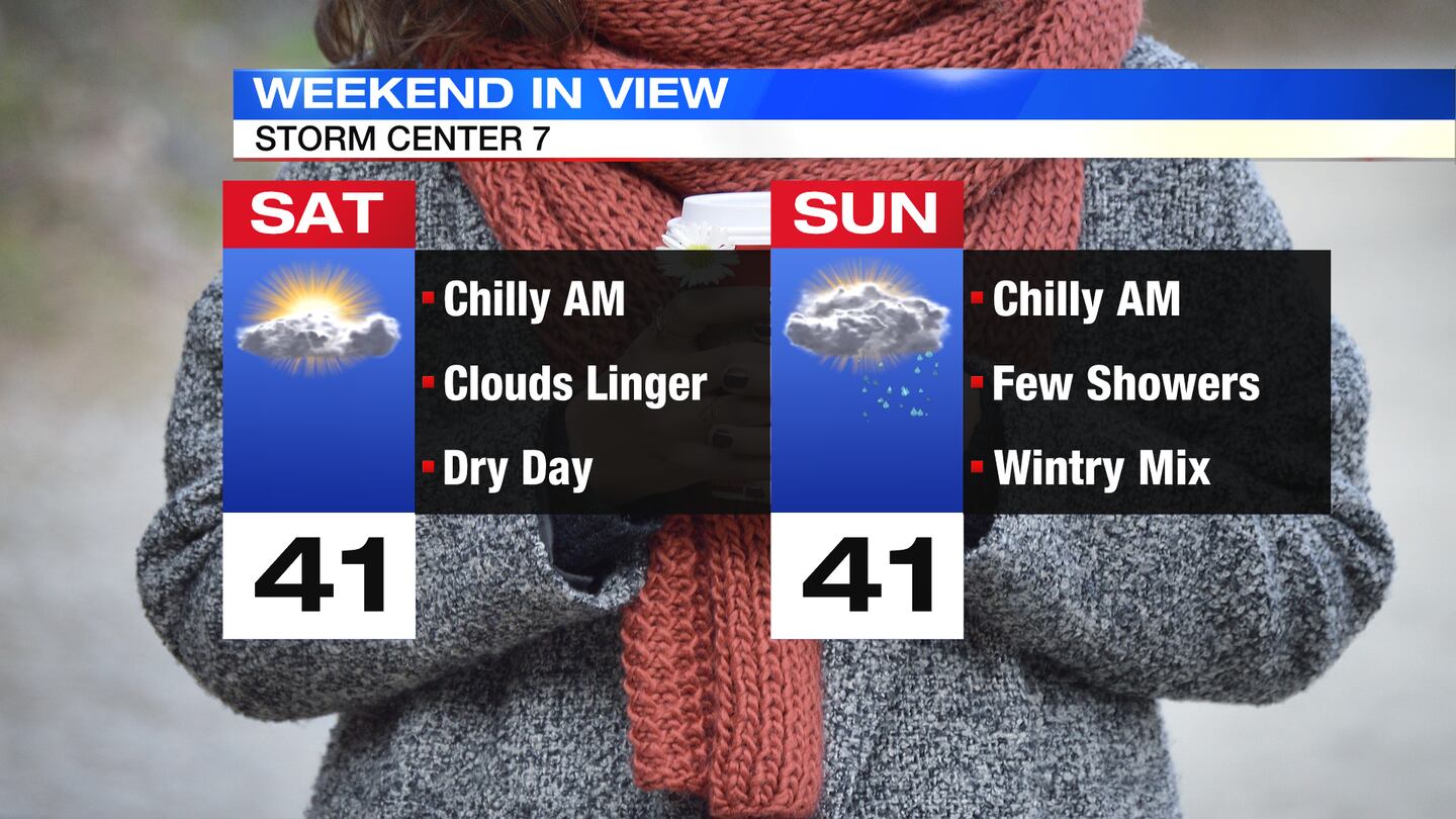
SUNDAY: Mostly cloudy and chilly again. Chance of a rain/snow mix early then chilly rain showers in the afternoon. Showers will taper into the night, but as temperatures dip, any moisture leftover may switch to a few snowflakes. Highs in the lower 40s.
MONDAY: Slight chance of a few sprinkles or flurry early otherwise mostly cloudy, breezy, and chilly. Highs in the lower 40s.
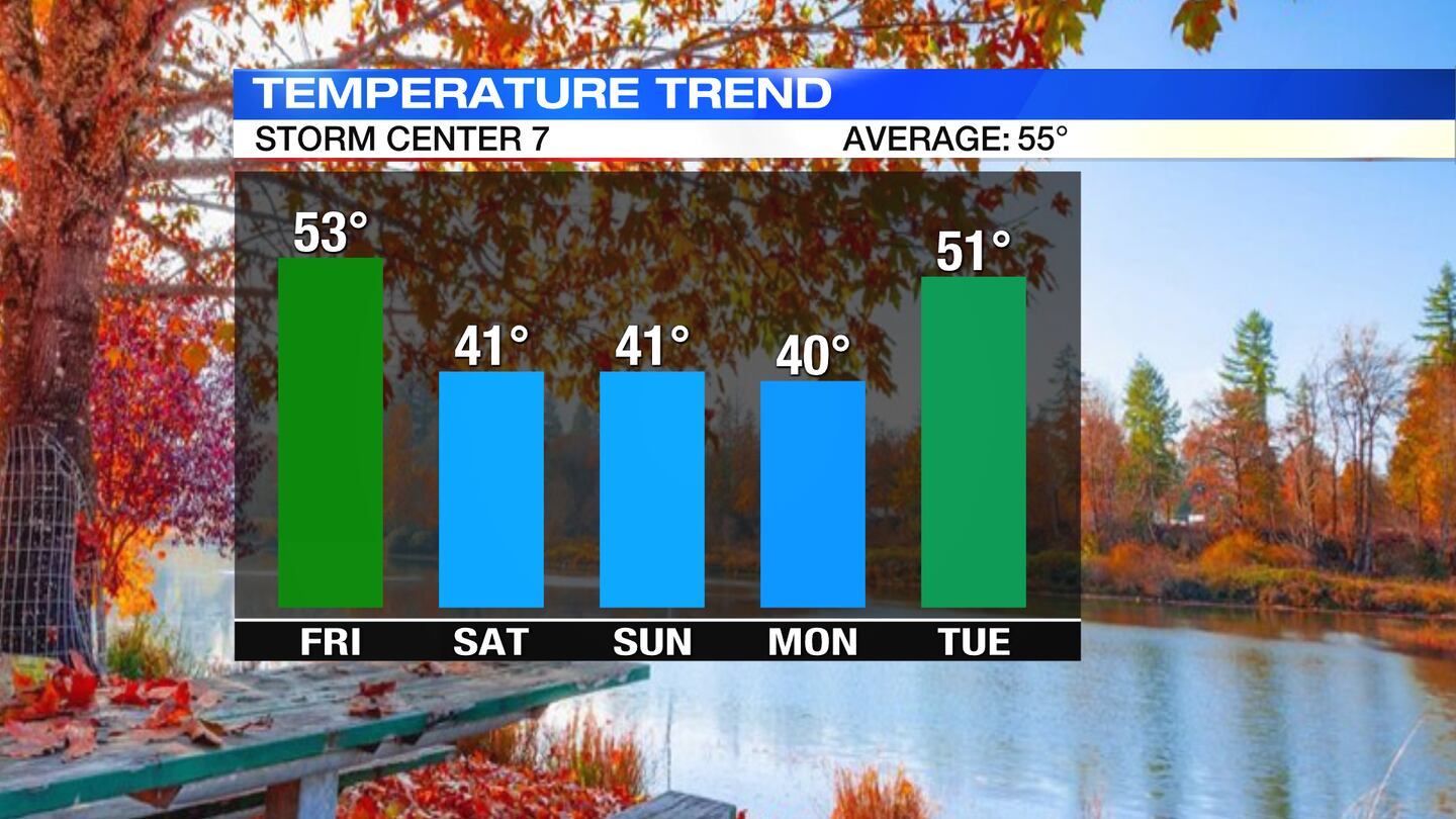
TUESDAY: Partly sunny and chilly. Highs around 50 degrees.
WEDNESDAY: Partly sunny and windy for Wednesday, but milder. Highs around 60 degrees. Chance for rain into the evening.
THURSDAY: Scattered rain showers early, otherwise cloudy and cooler. Highs in the lower 50s.
©2021 Cox Media Group


