QUICK-LOOK FORECAST:
- Isolated flurries/sprinkle this evening
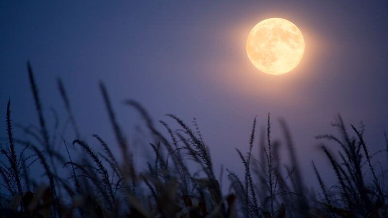
- Lunar eclipse overnight
- Much cooler late week/weekend
>>TRACK THE CONDITIONS: Live Doppler 7 Radar
DETAILED FORECAST:
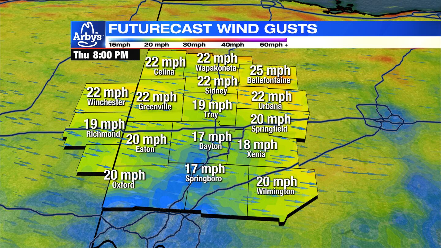
TODAY: Increasing clouds with a few flurries/snow showers or sprinkle around but no accumulation. Breezy to gusty and cold with temps in the 30s.
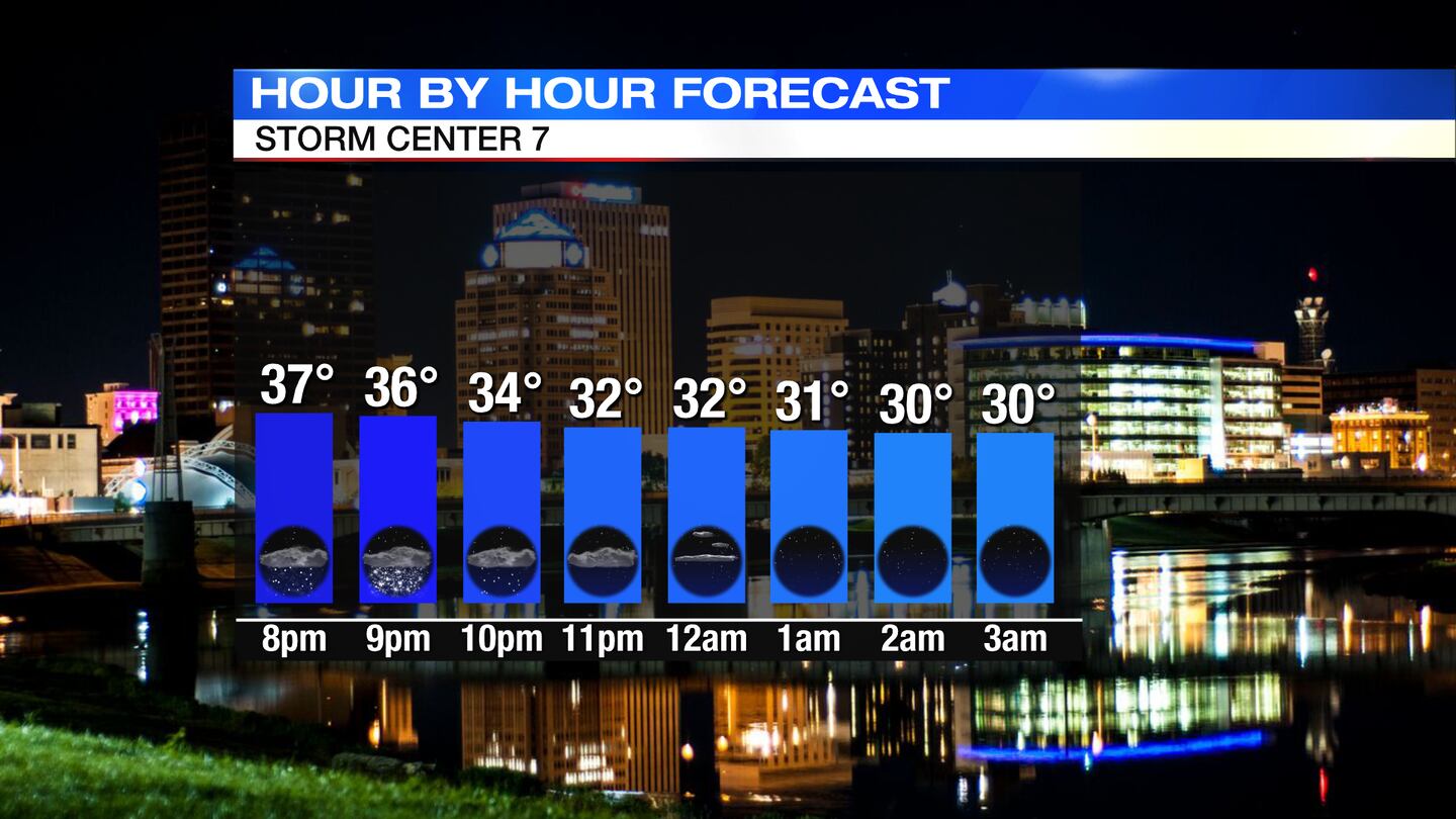
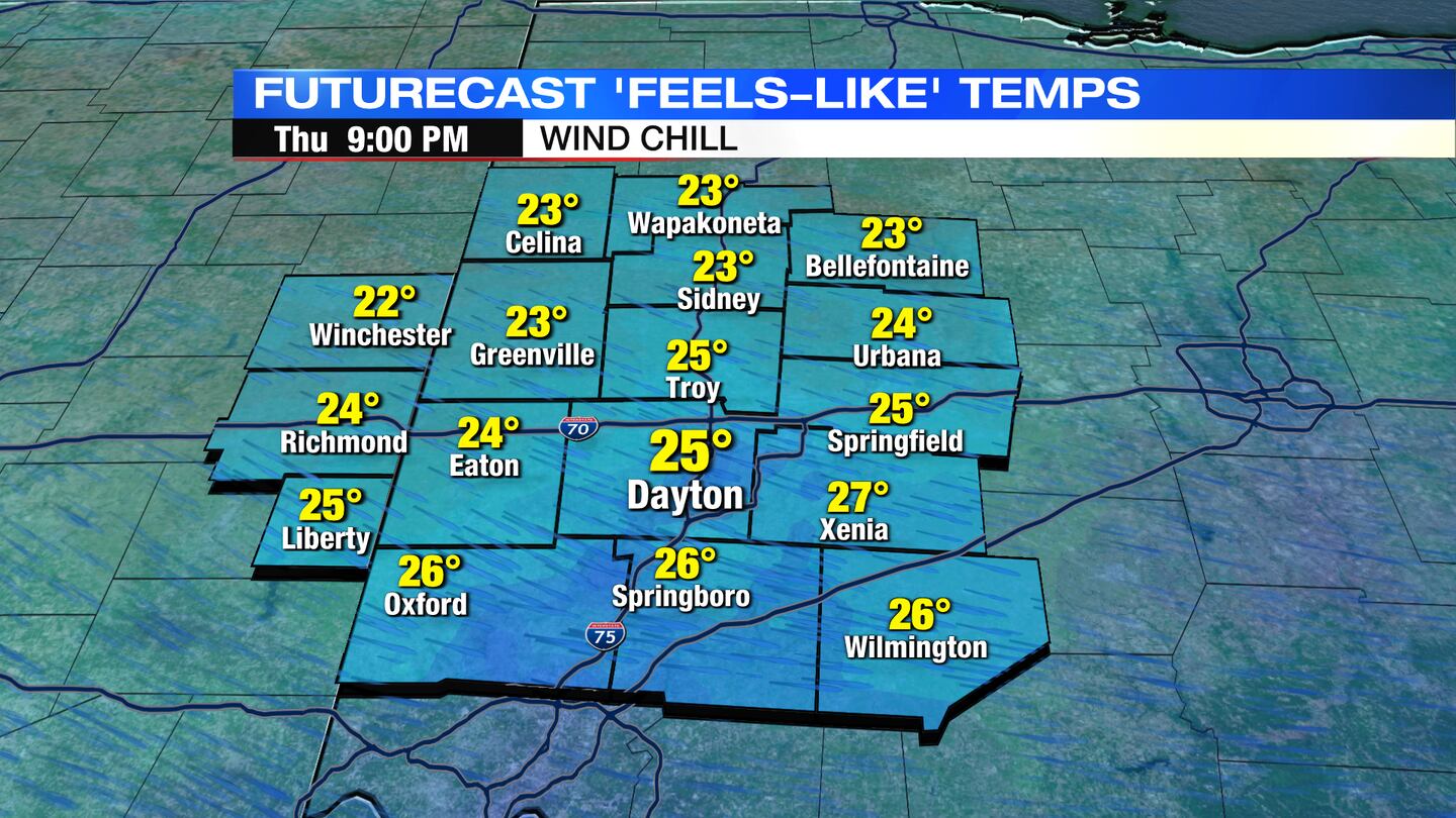
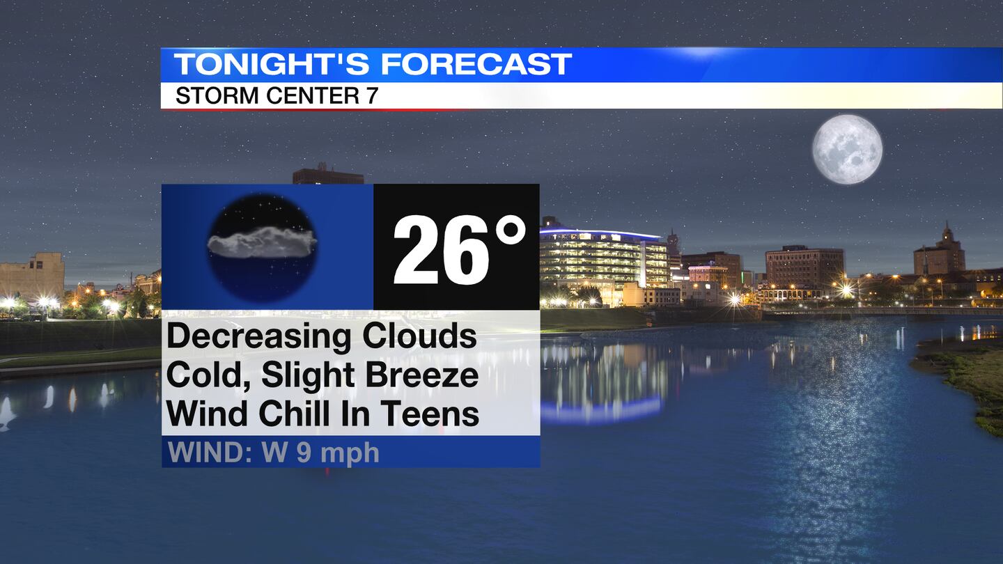
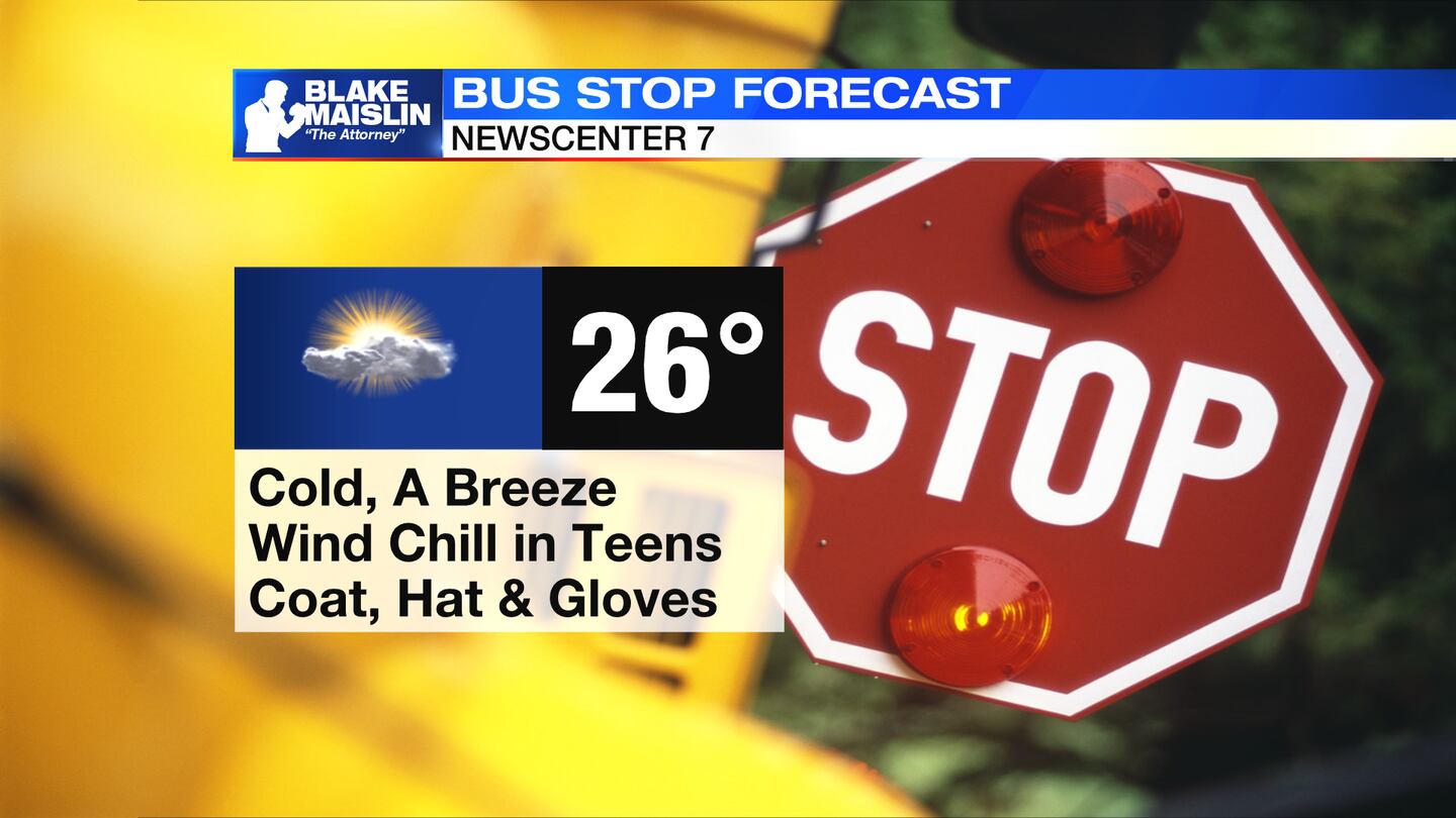
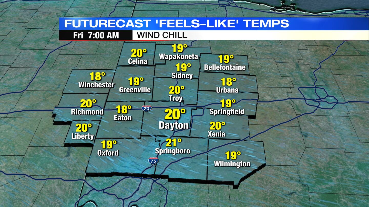
Overnight, partially decreasing clouds for partly/mostly clear skies, cold and breezy with temps in the mid 20s. Wind chills in the teens first thing in the morning. Skies clear enough to see the partial lunar eclipse from 2am-6am.
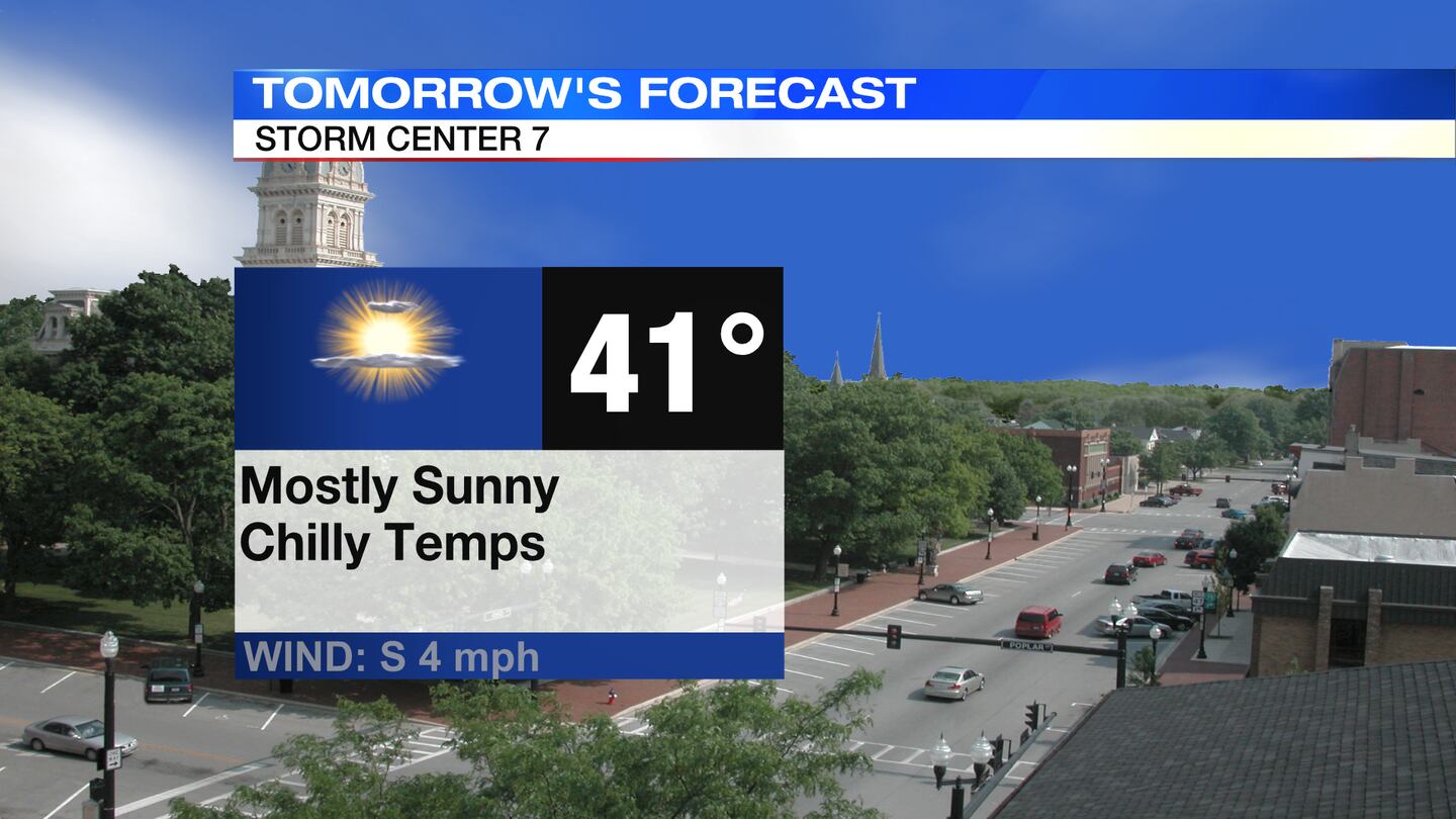
FRIDAY: Mostly sunny and chilly. Highs in the lower 40s.
SATURDAY: Partly cloudy and mainly dry. High temperatures should be a few degrees warmer than Friday in the upper 40s.
SUNDAY: More clouds and the chance for a few showers. High temperatures topping out in the lower 50s.
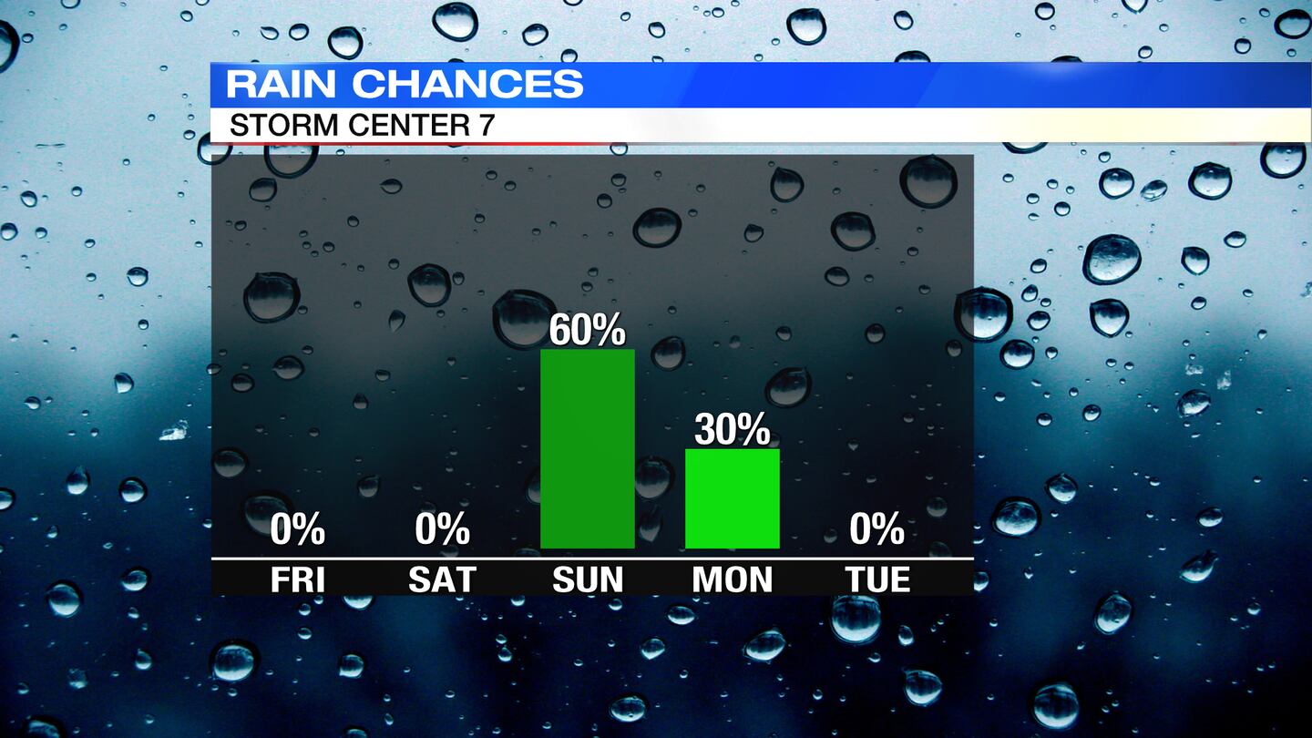
MONDAY: Mostly cloudy skies with a passing flurry or sprinkle possible. Cool and breezy with highs only in the lower 40s.
TUESDAY: Mostly sunny and cold with highs only in the upper 30s.
WEDNESDAY: Partly to mostly sunny skies. A few passing showers/isolated flurries, especially in the evening. Not as chilly, but still cool. Highs in the middle 40s.
©2021 Cox Media Group