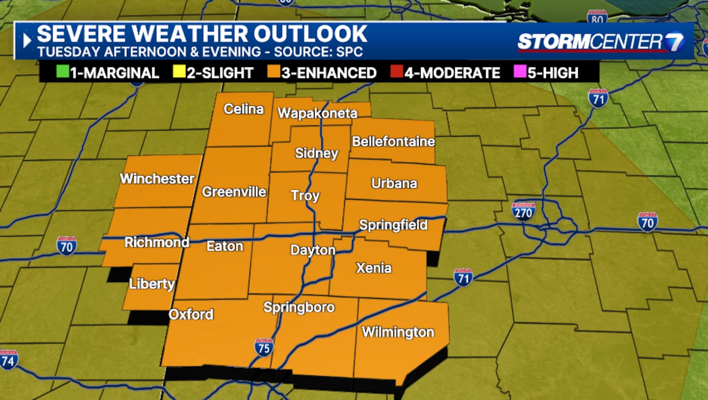
The Miami Valley will see the chance of severe weather over the next two days.
Storm Center 7 has been monitoring this system for days. Chief Meteorologist Austin Chaney will continue tracking these storms and have the latest starting on News Center 7 at Noon and this evening beginning with News Center 7 at 5:00.
>>TRACK THE LATEST CONDITIONS: Live Doppler 7 Radar
The entire Miami Valley is under an enhanced risk for severe storms today, a level three out of five, according to the Storm Prediction Center.
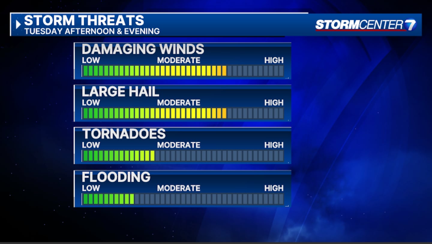
Both days will bring the risk of all weather hazards including damaging winds, large hail, and a few tornadoes.
>>Severe storms possible for entire area today, tomorrow
>>Severe Weather: Slight vs Enhanced Risk
TIMING:
Tuesday will feature multiple rounds of storms. The greatest concern will be during the late afternoon hours through the early evening, Ritz said.
This is when we’ll have the best overlap of wind shear and instability. But it does not look like the storms will come through as a line.
SEVERE THREATS:
All severe threats are on the table for Tuesday, according to Ritz.
This includes damaging winds, large hail, and a few tornadoes.
Individual storm cells or clusters of storms may move through. This means, some areas may get hit with more than one storm while some areas may miss out entirely.
This also signifies potential supercell development and can lead to dangerous tornadoes.
WHAT’S NEXT:
There is still some uncertainty about what Wednesday will bring, Ritz states.
“We’ll have to get closer to get more clarity, but another late-day severe weather risk is well within the realm of possibility,” she said.
Our Storm Center 7 team of meteorologists will continue to track the system ahead of the storms.
We will bring you the latest information on air and online.
©2024 Cox Media Group


