Severe Storms possible this afternoon. Chief Meteorologist McCall Vrydaghs and WHIO Meteorologist Dontae Jones have an update on what’s to come.
Posted by WHIO on Wednesday, June 10, 2020
>>SEVERE WEATHER: Difference between Watch vs. Warning
QUICK-LOOK FORECAST:
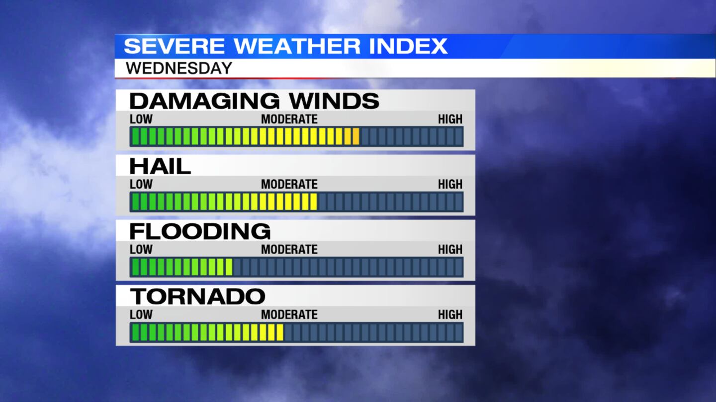
- Severe storms develop into the early evening
- Damaging winds, large hail, and even tornadoes are possible
- Drying out tonight
- Cooler temperatures this weekend
>> TRACK THE CONDITIONS: Live Doppler 7 Radar
>> STAY INFORMED: Download the WHIO Weather App
DETAILED FORECAST:
TONIGHT: Widespread severe storms will develop in the late afternoon and early evening, Storm Center 7 Chief Meteorologist McCall Vrydaghs said.
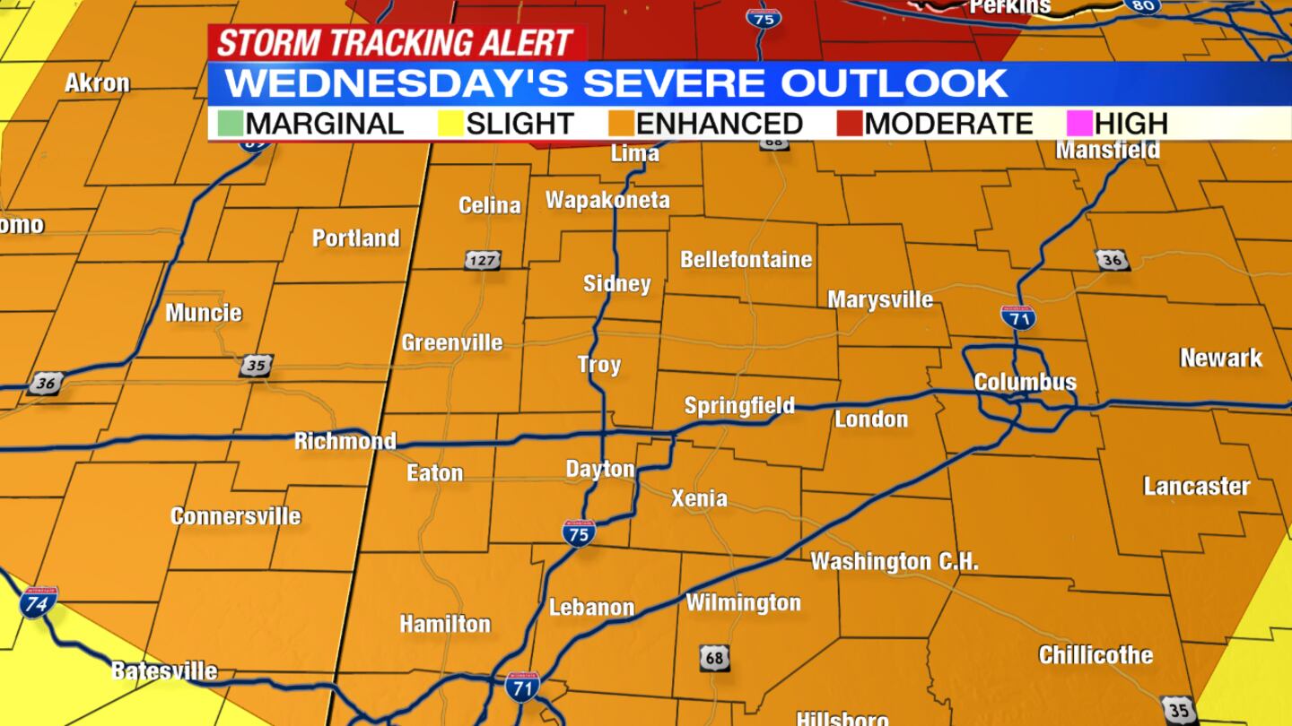
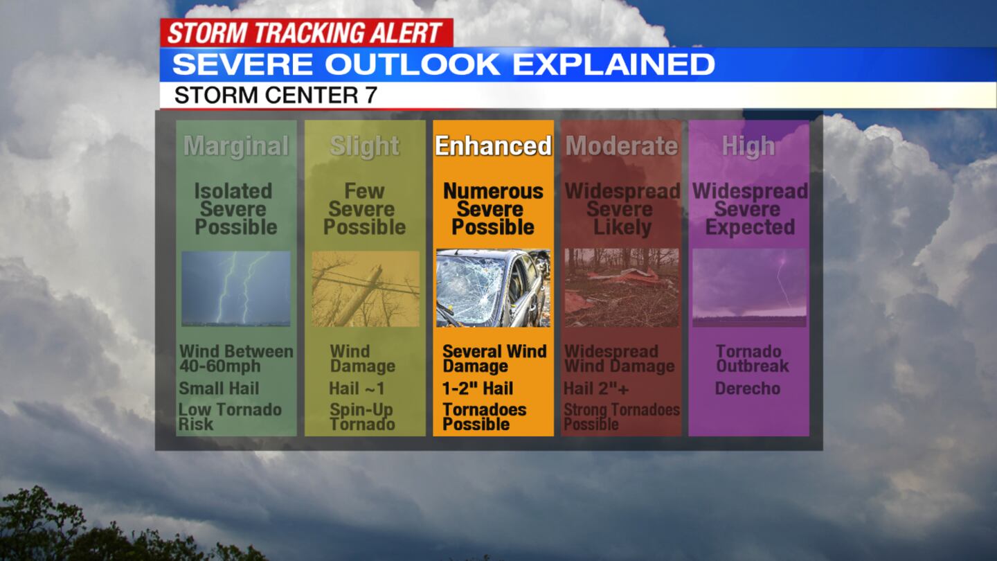
>>SEVERE WEATHER: Difference between slight and enhanced risk
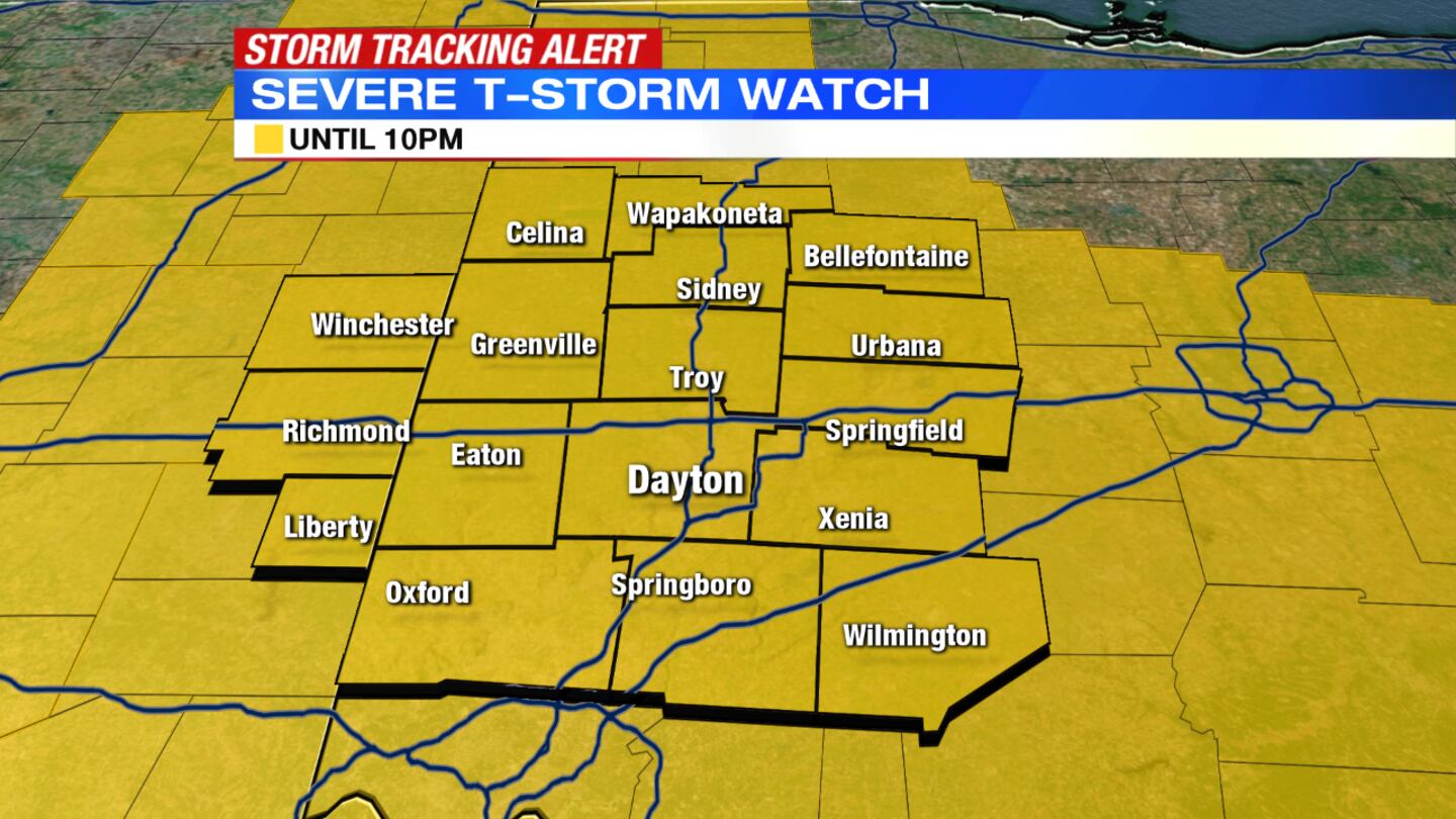
The timing of concern is between 3 p.m. and 7 p.m., when the greatest threat of severe storms is possible. Storms will have the potential to bring damaging wind, large hail and even a few tornadoes.
“The Storm Prediction Center has the Miami Valley under an “Enhanced” risk for severe storms which isn’t something we get very often,” Vrydaghs said. “Please stay weather aware as the storms develop.”
OVERNIGHT: Conditions dry out after the storms move out as a cold front pushes through the area. Less humid conditions arrive, with partly cloudy skies and lows around 60 degrees overnight.
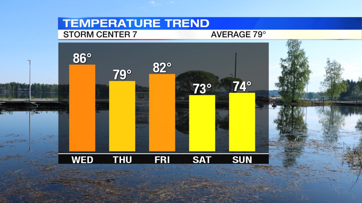
THURSDAY: Expect a nice and breezy day with sunshine returning, highs around 80 degrees and lower humidity.
FRIDAY: This will be a nice end to the week with partly cloudy skies and highs in the lower 80s.
SATURDAY: There will be some scattered clouds that develop with a possible isolated rain shower early in the morning. There will be more dry time for the afternoon. Highs will be in the low 70s.
SUNDAY: It should stay dry with sunshine and low humidity. Highs are expected to be in the middle 70s.
MONDAY: Partly cloudy skies are expected with highs in the upper 70s.
© 2020 Cox Media Group


