
>>TRACK THE CONDITIONS: Live Doppler 7 Radar
QUICK-LOOK FORECAST:
- Few flurries or snow showers tonight
- Bitter wind chills by Saturday morning
- Dry, but chilly weekend
>> Stay Alert: Download the free WHIO weather app
DETAILED FORECAST:
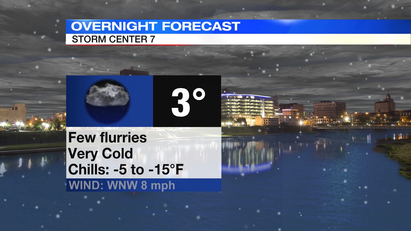
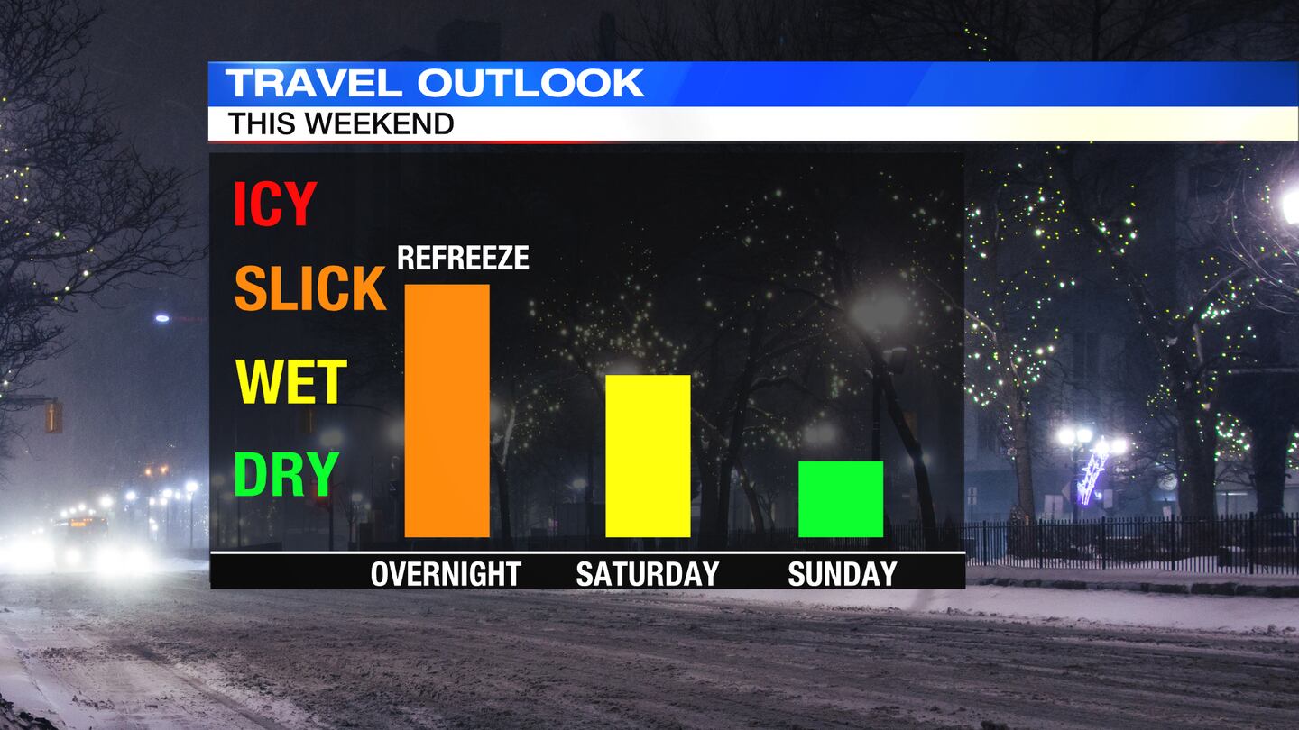
TONIGHT: Clouds linger into the night with a few flurries or passing snow showers still possible, Storm Center 7 Meteorologist McCall Vrydaghs said. Refreeze is likely on roads left wet or untreated.
>> STAY INFORMED: Latest school closings and delays
Temperatures will drop into the lower single digits with wind chills -5 to -15. Limiting your time outdoors overnight is advised.
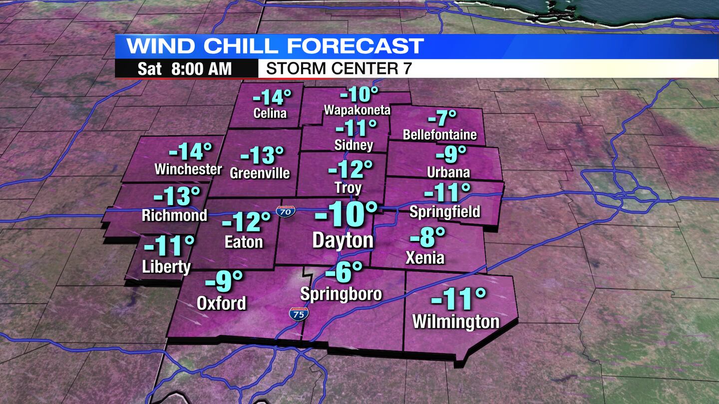
SATURDAY: A very cold morning, with temperatures near zero to start. Clouds early with a stray flurry or snow shower will give way to more sunshine for the afternoon.
>> How are wind chill values calculated? Storm Center 7 Meteorologists explain
Highs for the day will be roughly 20 degrees below normal in the upper teens. Normal highs this time of year should be near 40 degrees. Skies clear into Saturday night and temperatures drop back into the single digits with sub-zero wind chills again.
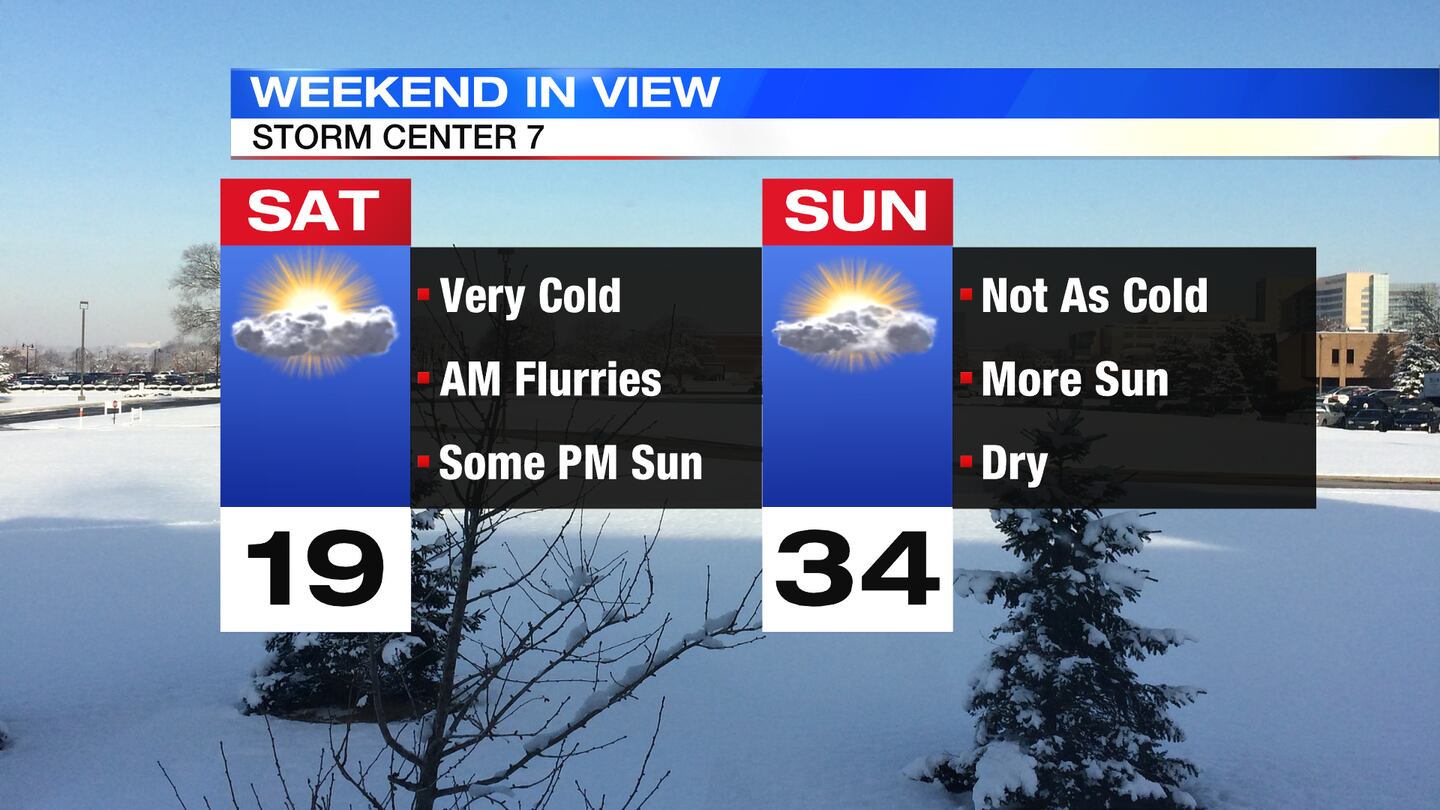
SUNDAY: Another cold start to the day, but temperatures will rebound a bit better for the afternoon. Highs in the lower to middle 30s are expected with more sunshine.
MONDAY: Sun gives way to clouds on Monday and a bit breezy as a weak cold front passes by; a stray flurry is possible. Highs will be in the lower 30s.
>> Wind chills explained: How they are calculated, advisories, and tips to stay safe
TUESDAY: A chilly day, but mostly sunny with highs in the lower 30s.
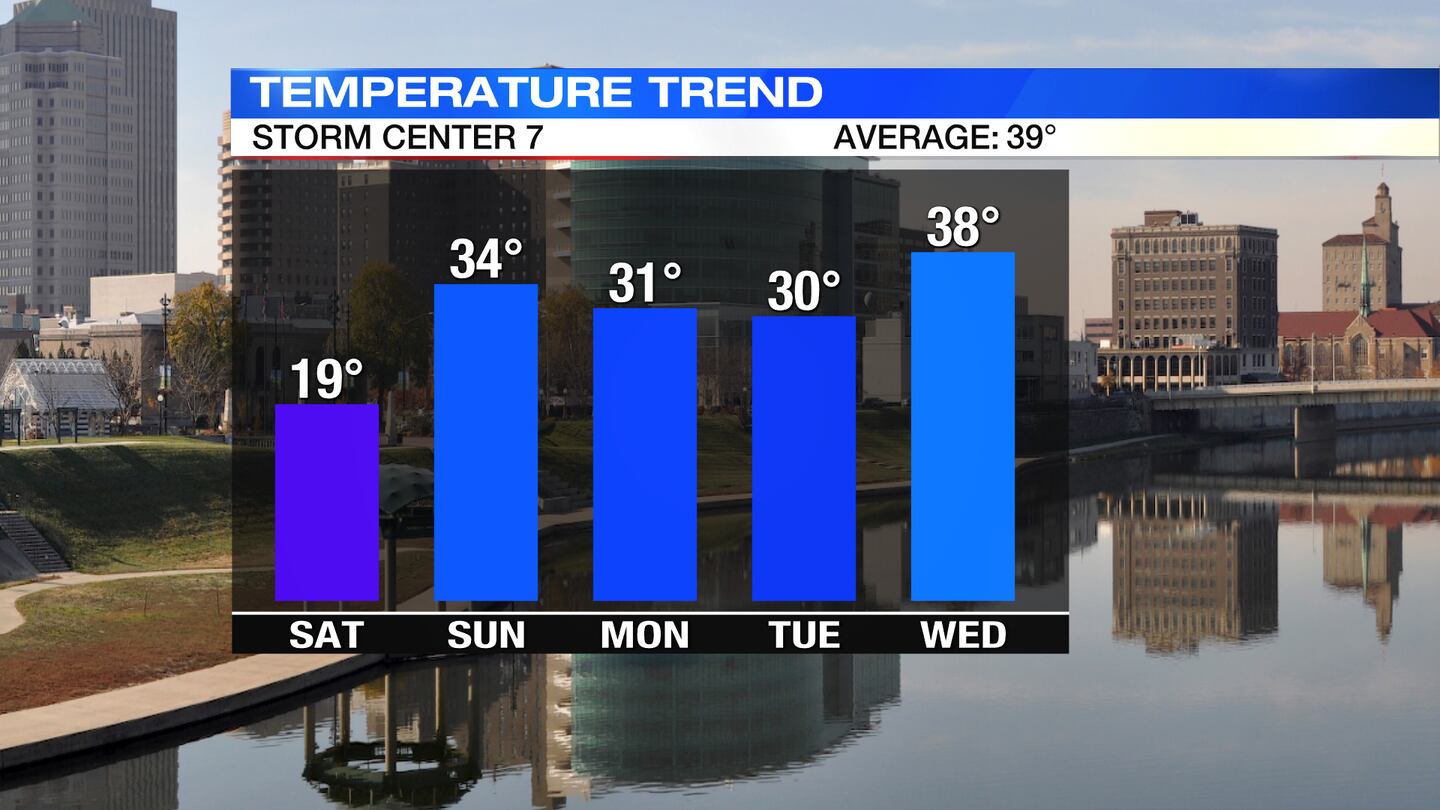
WEDNESDAY: Sun and a few clouds for Wednesday. Highs closer to normal in the upper 30s.
THURSDAY: Partly sunny and a bit cooler. Highs in the middle 30s.Chance for an isolated sprinkle or flurry late in the day.
FRIDAY:
©2022 Cox Media Group


