QUICK-LOOK FORECAST:
- Accumulating snow likely Thursday into Friday
- Dangerously cold again this weekend
- Warmup arrives starting Monday
>> TRACK THE LATEST CONDITIONS: Live Doppler 7 Radar
DETAILED FORECAST:
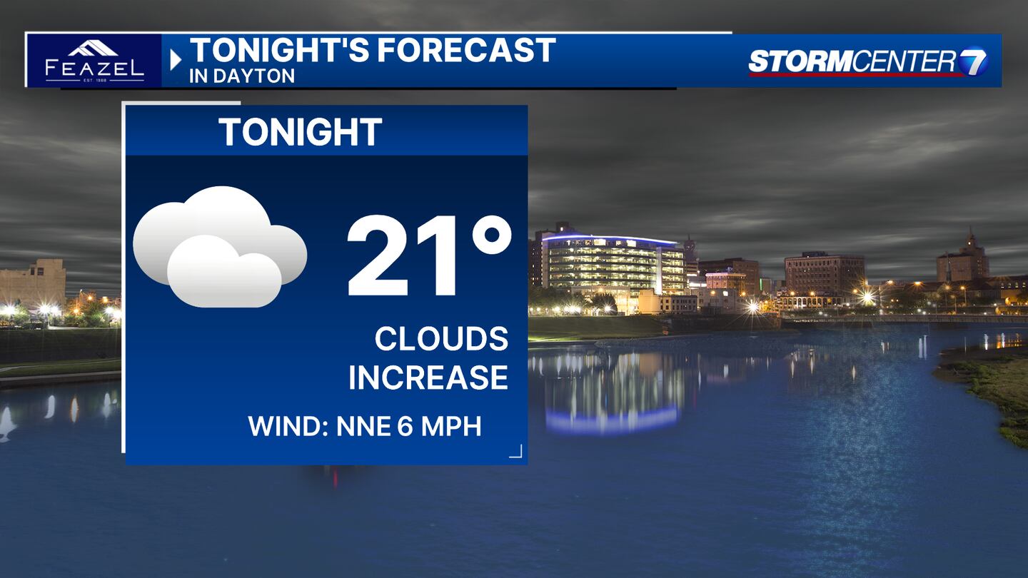
WEDNESDAY: Cold with clouds on the increase tonight, according to Storm Center 7 Chief Meteorologist Austin Chaeny. Lows drop into the lower 20s which is cold, but not as dangerously cold as the last several nights.
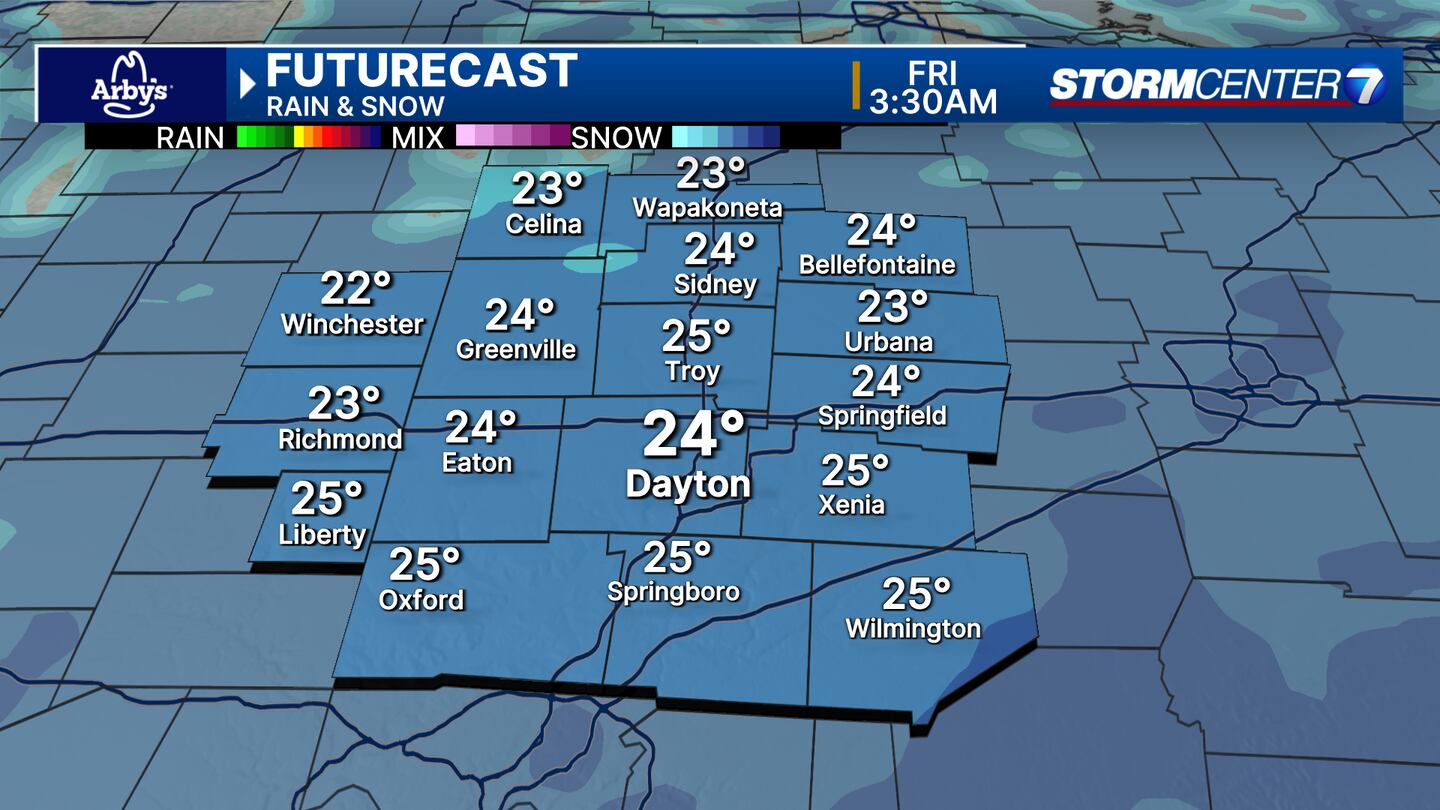
THURSDAY: Clouds increase with a chance of snow arriving during the afternoon and evening. It may take a while for snow to initially overcome dry air, so don’t expect widespread coverage during the day. Highs in the upper 20s. Snow becomes more widespread overnight with accumulating likely by then.
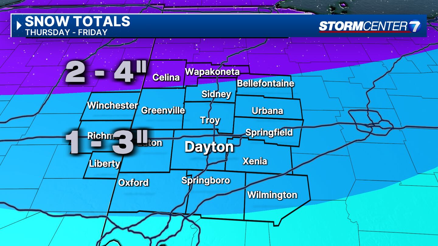
FRIDAY: Cold with snow showers likely. Highs in the lower 20s. Snow would not have any problem accumulating with cold temperatures and cold ground temperatures on Thursday and Friday. Snowfall estimates look to be in the 1-3 inch range through Friday. Mercer and Auglaize counties may have slightly higher totals near 4 inches.
SATURDAY: Single-digit low temperatures Saturday morning. Some morning flurries are possible. Mostly cloudy afternoon with highs in the mid-20s.
SUNDAY: Mostly sunny. Frigid morning and cold afternoon. Daytime highs climb to the mid-20s.
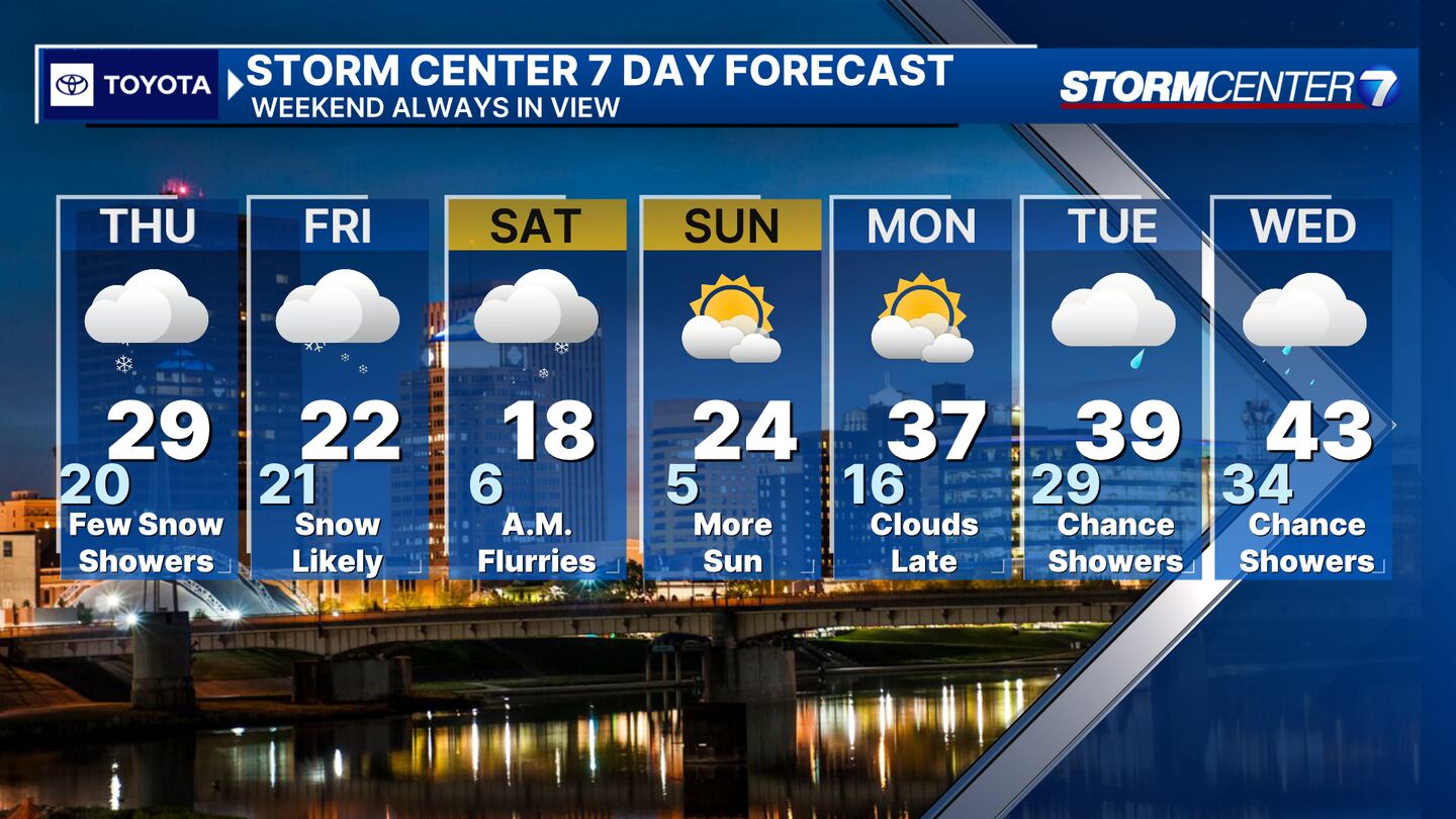
MONDAY: Temperatures climb back above freezing for the first time in 10 days! Clouds increase but we stay dry.
TUESDAY: Cloudy with a chance for rain. Highs climb to the upper 30s.
WEDNESDAY: Cloudy with a chance for rain. Highs in the lower 40s.
©2024 Cox Media Group


