QUICK-LOOK FORECAST:
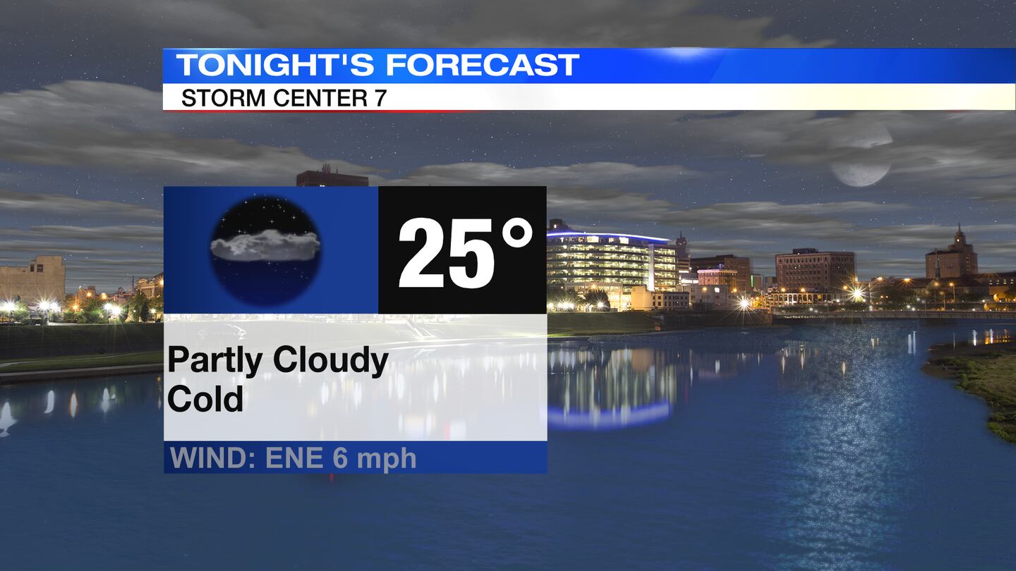
- A few clouds overnight; cold
- Rain arrives Sunday, few flakes mixed in up north
- Coldest air of the season so far next week
>>TRACK THE LATEST CONDITIONS: Live Doppler 7 Radar
DETAILED FORECAST:
FRIDAY: Colder air tonight with lows in the mid 20s and partly cloudy skies.
SATURDAY: Some sunshine with clouds increasing later in the day. Dry and cold with highs in the low 40s.
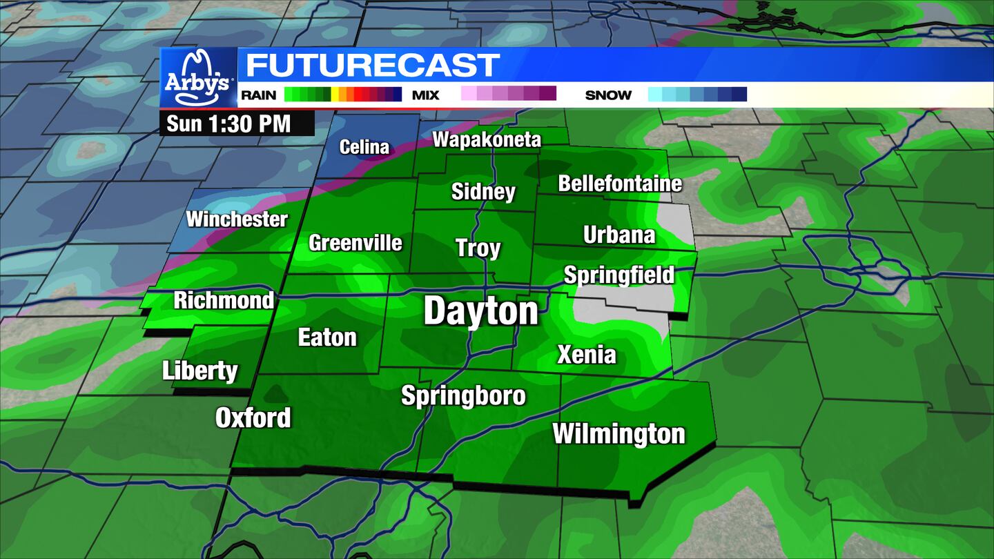
SUNDAY: Cloudy, chilly, and wet. Scattered showers with highs in the low to middle 40s. A couple of models try to throw a few wet snowflakes in, but temperatures likely stay too warm. Best chance will be in our far northern counties.
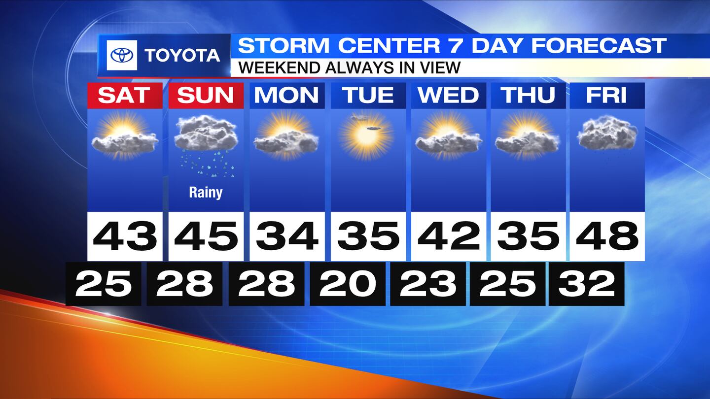
MONDAY: Mostly sunny with much colder temperatures arriving. Afternoon highs in the lower to mid 30s.
TUESDAY: Very cold start with lows around 20, and a few upper teens possible in outlying areas. Mainly sunny during the day and staying cold with highs only in the middle 30s.
WEDNESDAY: Mostly sunny and milder with highs climbing back to around 40 degrees.
THURSDAY: Partly cloudy skies and seasonably cool with highs in the middle 40s.
©2023 Cox Media Group