A flood has been reported on SR-219 near Burkettsville- Saint Henry Road in Mercer County, according to the National Weather Service
QUICK-LOOK FORECAST:
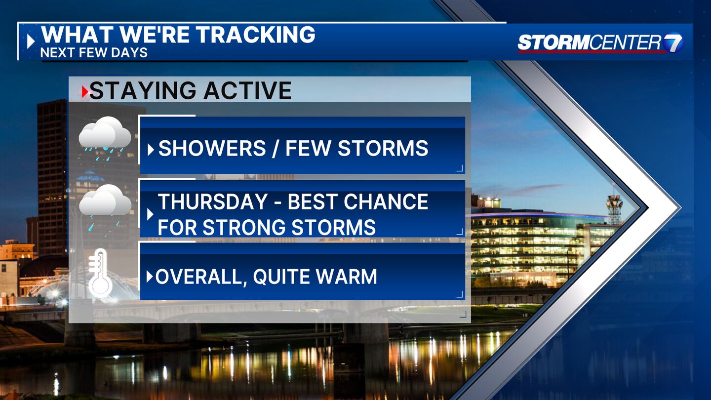
- Rain and storm chances through Friday
- Temperatures staying warm
- Extremely high pollen counts
>> TRACK THE LATEST CONDITIONS: Live Doppler 7 Radar
DETAILED FORECAST:
TUESDAY: Mostly cloudy to overcast skies through this evening along with the chance for showers and storms. Locally heavy rainfall will be the main threat with showers this evening. Showers decrease in coverage toward Wednesday morning. Mild with 60s this evening falling into the mid-50s overnight.
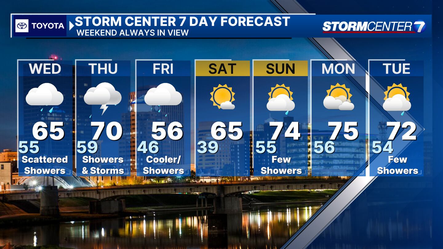
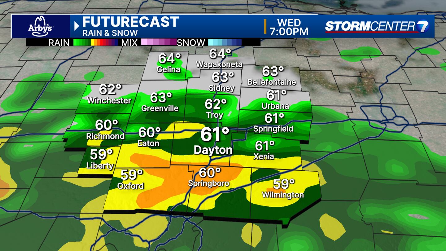
WEDNESDAY: Cloudy with more showers. Coverage picks up into the afternoon. A rumble of thunder possible. highs in the mid 60s.
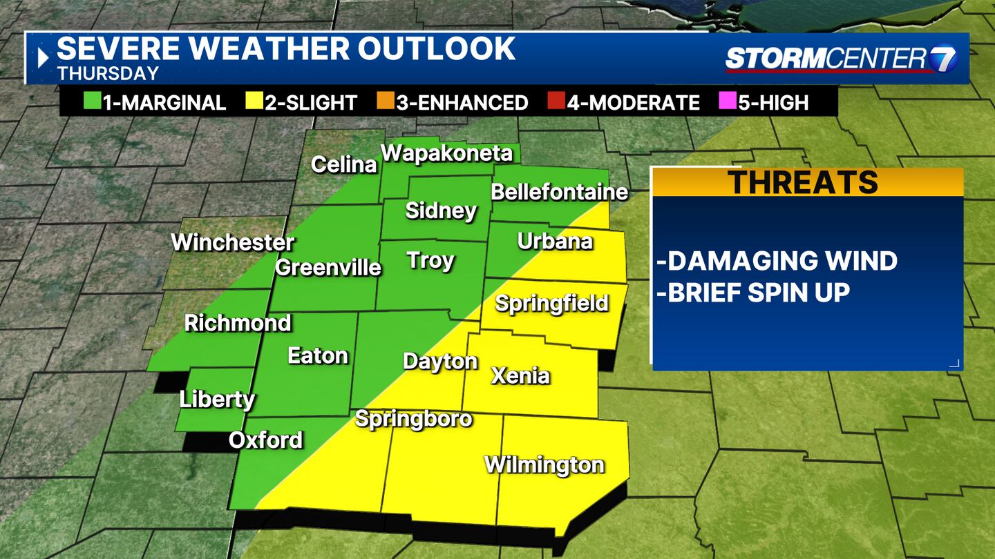
THURSDAY: Rainy and windy on Thursday. Thunderstorms and locally heavy rain possible. A few may become strong to isolated severe. Highs near 70.
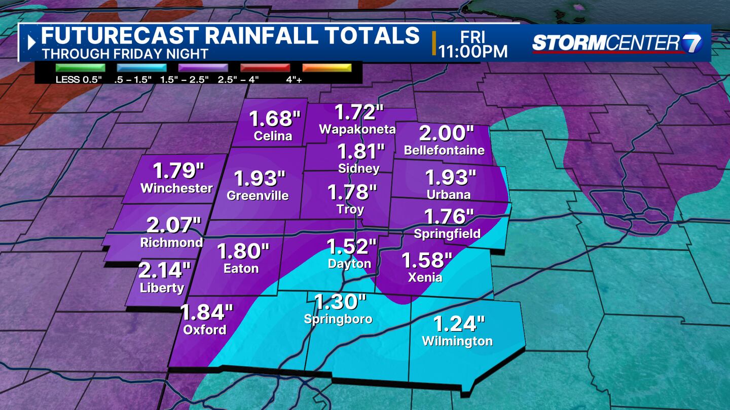
FRIDAY: Rainy and windy on Thursday. Thunderstorms and locally heavy rain possible. A few may become strong to isolated severe. Highs near 70.
SATURDAY: Partly cloudy. Nice with highs in the mid-60s.
SUNDAY: Partly cloudy. A chance of showers return. Warm with highs in the lower 70s.
MONDAY: Partly cloudy and dry for Monday with highs in the middle 70s.
TUESDAY: A stray shower or two return for Tuesday with highs in the lower 70s.
©2024 Cox Media Group