QUICK-LOOK FORECAST:
- Few strong to severe storms on Thursday
- Spring temperatures to continue
- Weekend is looking pretty good
>> TRACK THE LATEST CONDITIONS: Live Doppler 7 Radar
DETAILED FORECAST:
TONIGHT: Widespread rain showers likely tonight. The rain could come down heavy at times. There may be some embedded thunderstorms, but the risk for severe weather is very low at night. Breezy. Mild with lows in the upper 50s.
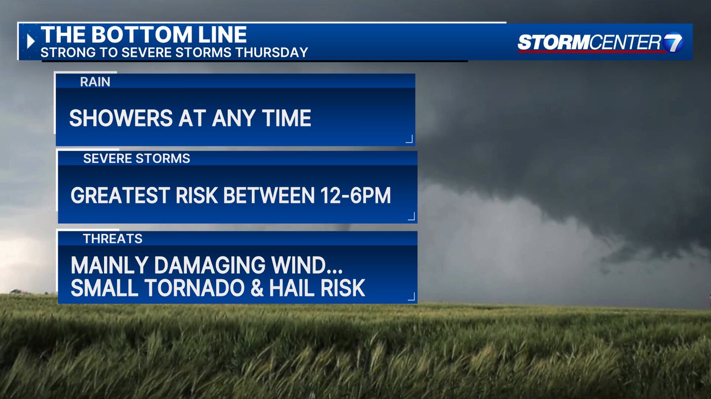
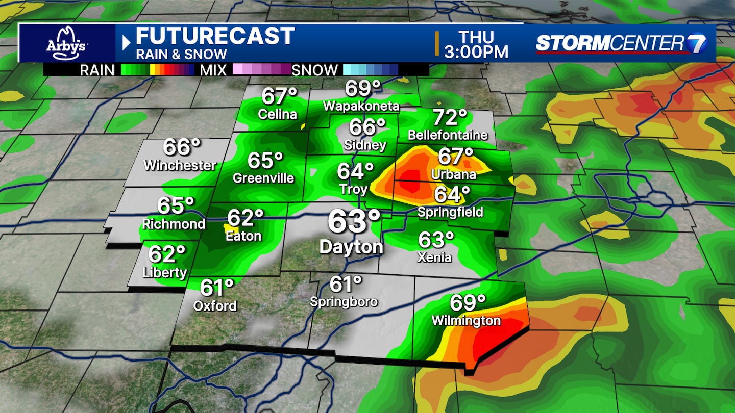
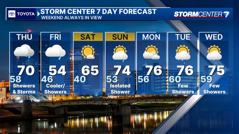
THURSDAY: Several rounds of showers and storms possible on Thursday. Keep the raingear near by all day.
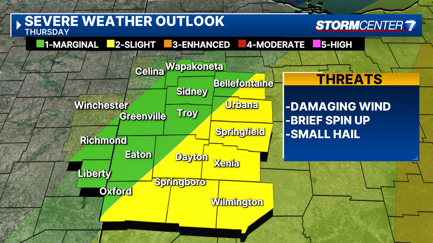
Thursday afternoon from lunchtime through about 6PM, some of the storms may become strong to severe.
Damaging winds will be the main hazard tomorrow, but a brief, isolated tornado and some hail cannot be ruled out. The greatest severe weather risk should stay to our east. Warm tomorrow with highs in the upper 60s to near 70.
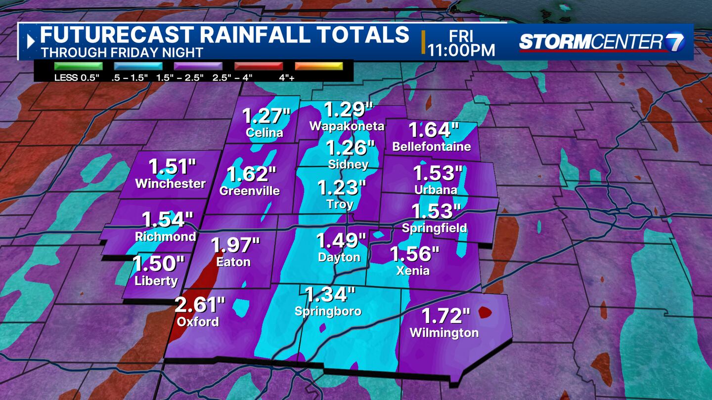
FRIDAY: Showers lingering into the day on Friday. Breezy and cooler with highs in the low to mid 50s.
SATURDAY: Partly cloudy. Nice with highs in the mid 60s.
SUNDAY: Partly cloudy with an isolated shower possible. Warm with highs in the lower 70s.

MONDAY: Partly cloudy and dry for Monday with highs in the middle 70s.
TUESDAY: Partly cloudy. A stray shower or two return for Tuesday with highs in the middle 70s.
WEDNESDAY: Partly cloudy, warm with a few showers or storms possible. Highs in the middle 70s.
©2024 Cox Media Group