QUICK-LOOK FORECAST:
- Chance for light accumulating snow on Saturday
- Few more snow showers Sunday
- Active weather continues next week
>> TRACK THE LATEST CONDITIONS: Live Doppler 7 Radar
DETAILED FORECAST:
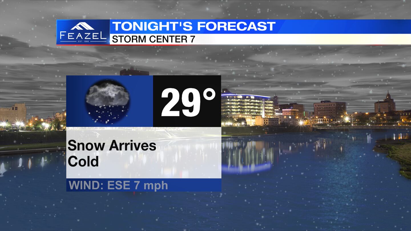
FRIDAY: Clouds increase followed by snow showers late tonight into early Saturday morning. Cold with lows around 30 degrees.
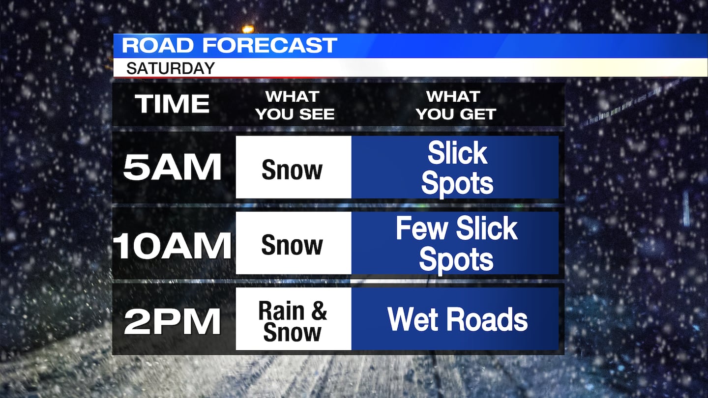
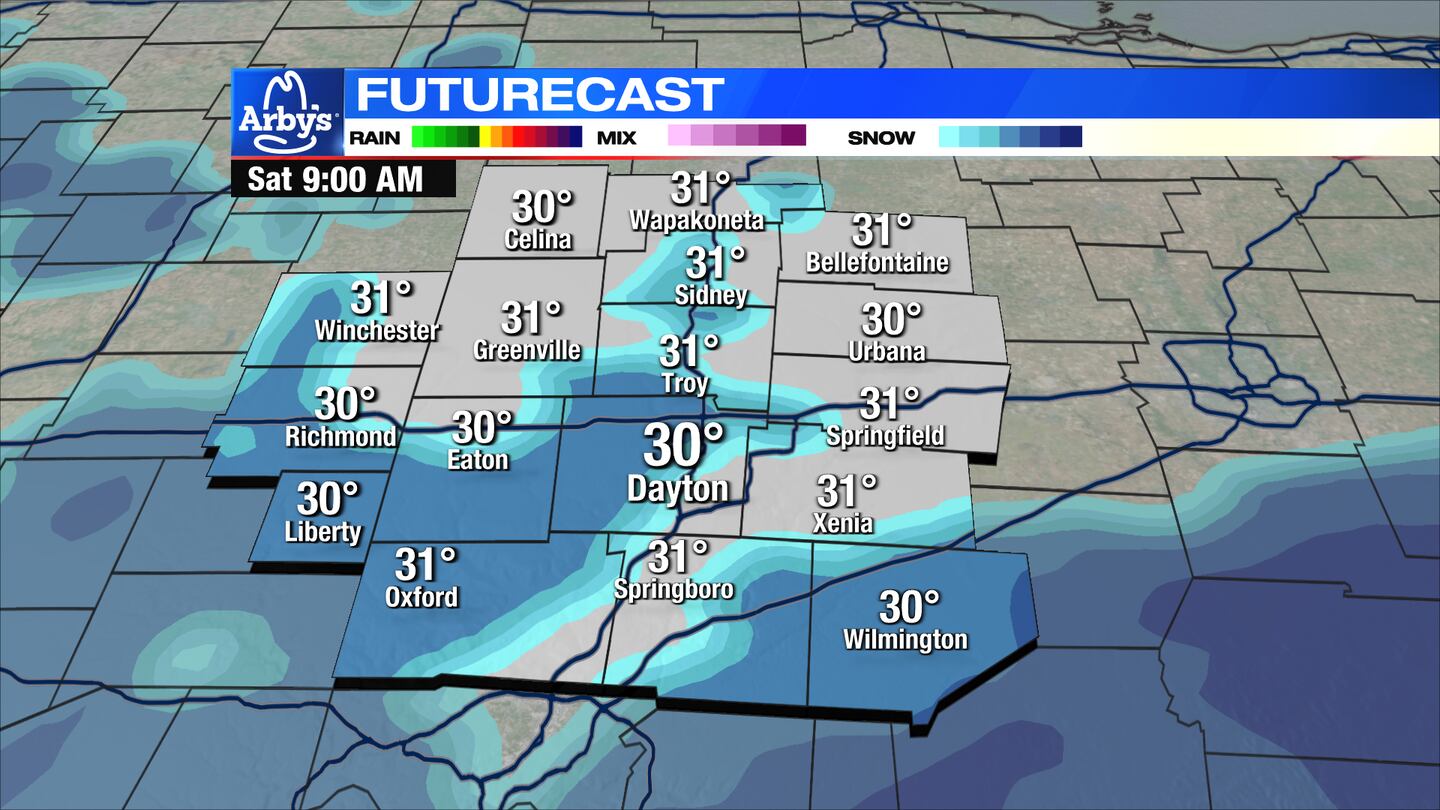
SATURDAY: Snow showers expected early Saturday morning. Light accumulation of less than 1″ possible across the northern Miami Valley. Dayton could see around 1.5″ of snow. Areas south of Dayton may get closer to 2 inches. Road issues will be most likely before the sun comes up on Saturday. As temperatures rise and snow showers end, road conditions should quickly improve.
SUNDAY: A quick moving system may bring a few more snow showers Sunday morning. These again may mix with rain as temperatures rise. An additional dusting of snow is possible. Highs in the upper 30s.
MONDAY: Mostly cloudy and seasonably mild with highs in the lower 40s.
TUESDAY: Either rain or snow is possible Tuesday morning. Quickly becoming all rain into Tuesday afternoon. Windy with gusts exceeding 30MPH. Highs in the mid-40s.
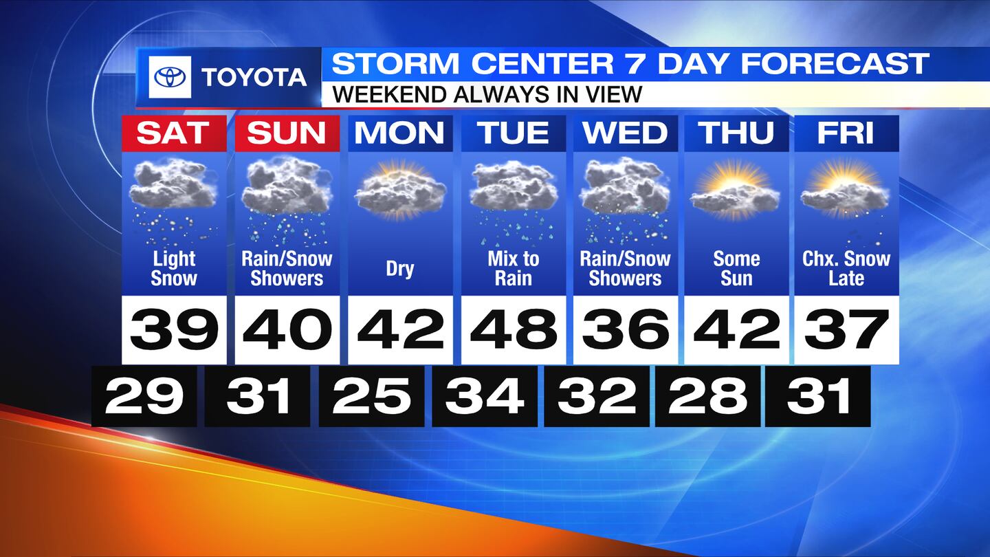
WEDNESDAY: Breezy with a chance for lingering snow showers. Colder with highs in the mid-30s.
THURSDAY: Mostly cloudy. Chilly with highs near 40.
FRIDAY: 7 days out, so subject to change. Partly cloudy with a chance for snow arriving at night. High temperatures in the upper 30s.
©2024 Cox Media Group


