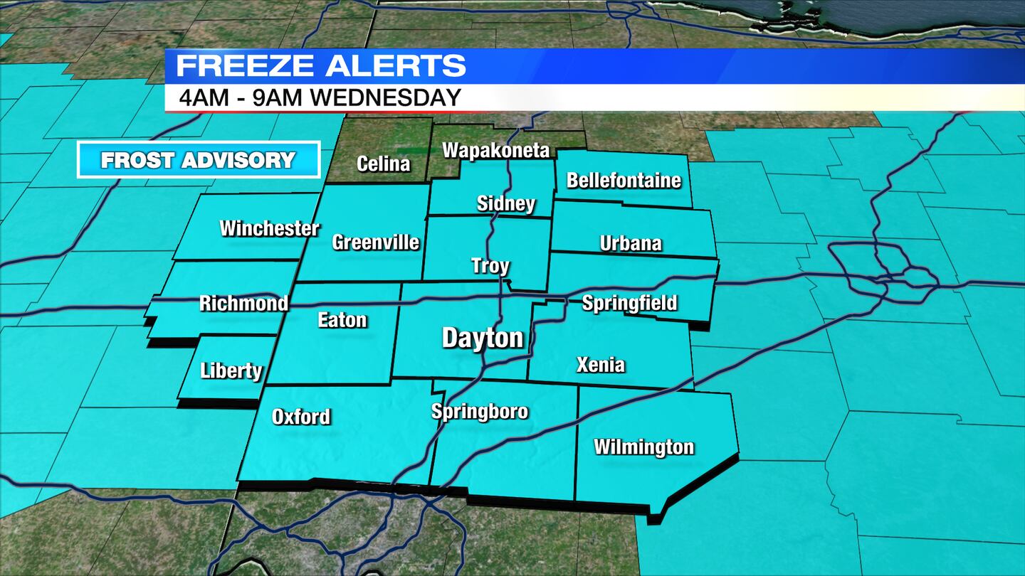
A Frost Advisory has been issued for the entire Miami Valley on Wednesday from 4 a.m. to 9 a.m.
QUICK-LOOK FORECAST:
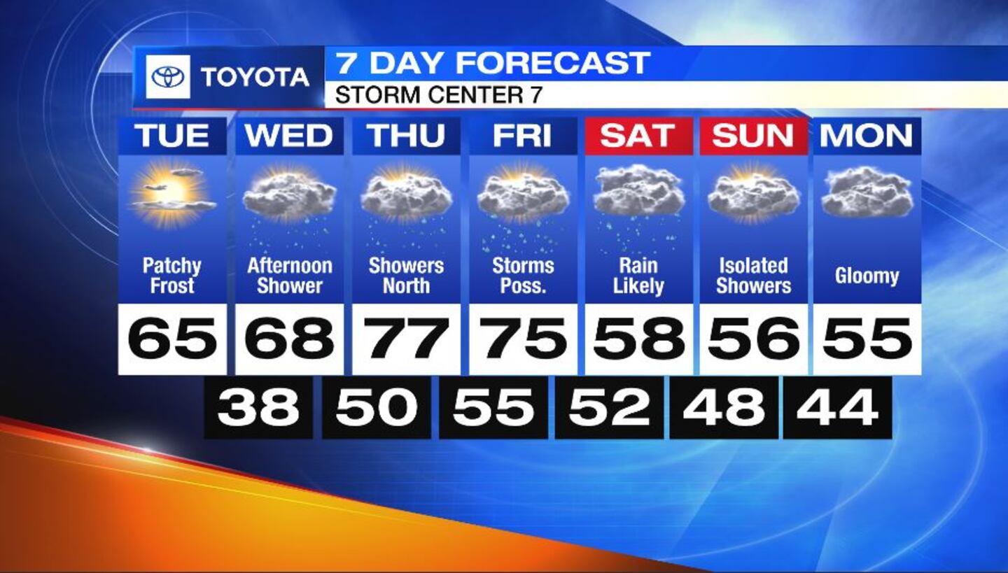
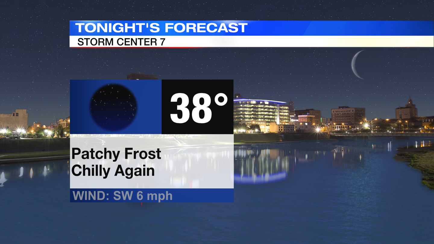
- Patchy frost again overnight
- Increasing rain chances, especially by this weekend
- Cooler, gloomy into next week
>>TRACK THE LATEST CONDITIONS: Live Doppler 7 Radar
DETAILED FORECAST:
OVERNIGHT: Clear skies overnight will allow temperatures to drop, according to Storm Center 7 Chief Meteorologist Austin Chaney. Lows should dip; into the mid and upper 30s again leading to another chance for patchy frost. A frost advisory is in effect.
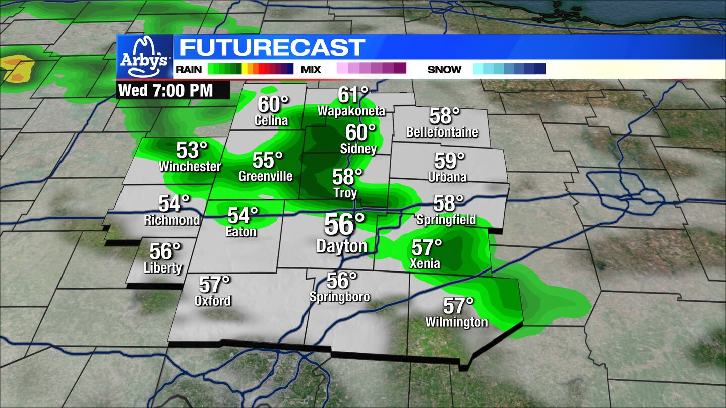
WEDNESDAY: Mostly sunny skies early, then clouds increase followed by a chance for a few showers Wednesday evening. High temperatures will range from the low 60s across the northern Miami Valley, to near 70 south of Dayton. Dayton should top out around 67. Winds gusting to 15-20MPH during the afternoon.
THURSDAY: A few showers possible across the northern Miami Valley Thursday morning, then a mainly dry and partly cloudy day. Highs reach the mid 70s.
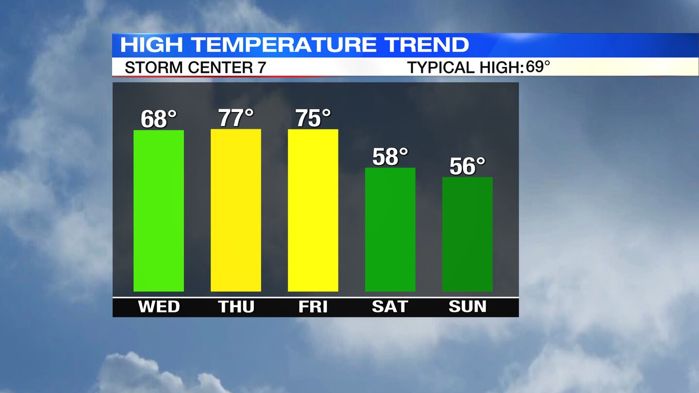
FRIDAY: Mostly sunny, warm and breezy during the day. An isolated shower possible during the afternoon with a much better chance for rain arriving Friday night. A few rumbles of thunder Friday night also. Highs in the mid 70s.
SATURDAY: Steady rain Saturday morning followed by lighter, scattered showers throughout the day. Cloudy. Breezy and much cooler with temperatures only rebounding to the upper 50s during the afternoon. Conditions do not look good for viewing the solar eclipse.

SUNDAY: Mostly cloudy to overcast with scattered, light showers possible. Highs in the mid 50s.
MONDAY: Gloomy with more clouds and showers hanging around. Highs in the mid 50s.
TUESDAY: More clouds and light showers possible. Highs in the mid 50s.
©2023 Cox Media Group