QUICK-LOOK FORECAST:
- Nearing Record Highs
- Few storms to cool us off
- “COOLER” temperatures next week

Heat Advisory - UNTIL 8:00 PM Friday for the entire Miami Valley except Randolph County
>>TRACK THE LATEST CONDITIONS: Live Doppler 7 Radar
DETAILED FORECAST:

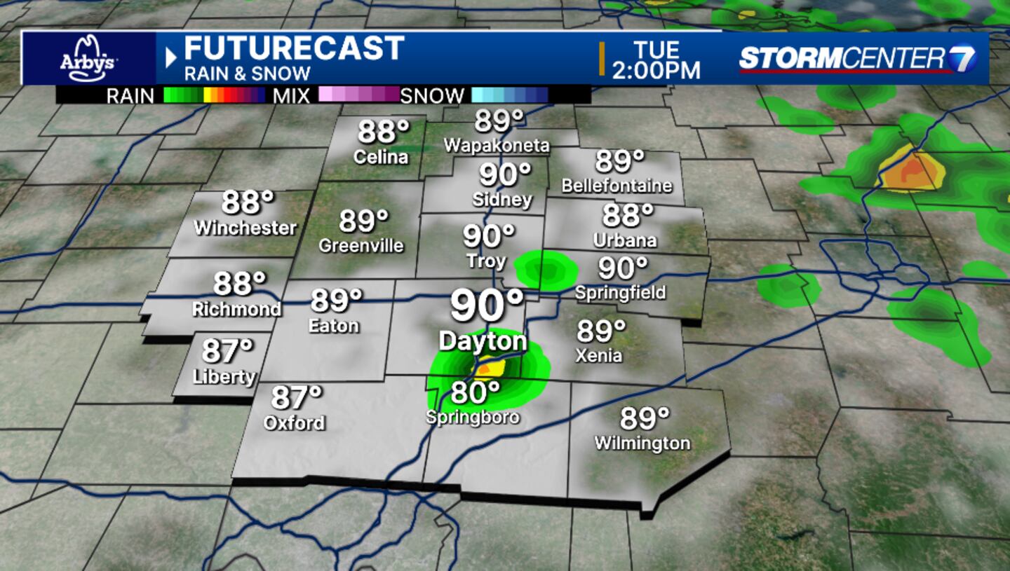
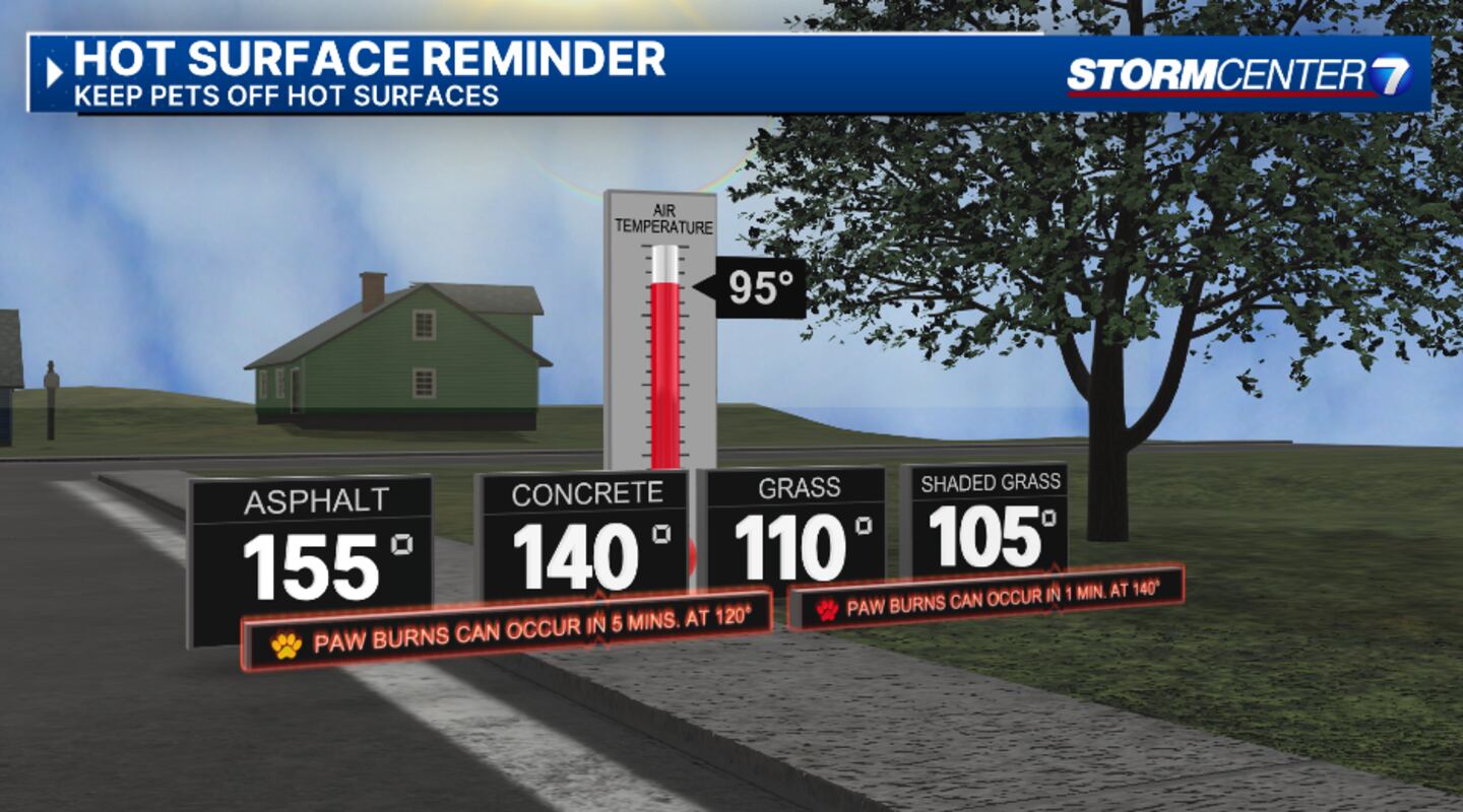
TUESDAY (HEAT): Heat wave continues with highs in the lower to middle 90s. Heat index values as high as 100. A couple pop-up showers or storms possible to provide brief relief from the heat in a few spots. Overnight lows will be in the 70s providing little relief.
WEDNESDAY (HEAT): Staying hot and a bit muggy with highs in the mid 90s and heat index values may exceed 100 at times. Overnight lows will be in the 70s providing little relief.
THURSDAY (HEAT): More heat. Partly cloudy with highs in the middle to potentially upper 90s. Heat index values over 100 possible. Overnight lows will be in the 70s providing little relief.
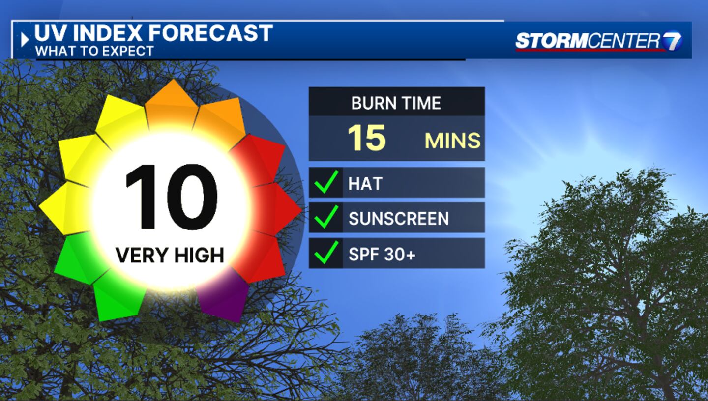
FRIDAY (HEAT): Continued heat and no sign of relief with highs in the middle 90s. Heat Index values around 100. Overnight lows will be in the 70s providing little relief.
SATURDAY (HEAT): Remaining hot with lows in the lower 90s. Heat index may fall below 100 here, but overall heat effects will continue due to the long duration of heat so I will maintain a Level 2 here for the time being.

SUNDAY: An isolated shower or thunderstorm may develop. Otherwise a touch cooler with highs near 90 degrees.
MONDAY: Partly cloudy. Perhaps a day below 90 degrees.
©2024 Cox Media Group