A La Niña Watch has been issued by the Climate Prediction Center. Similar to a severe thunderstorm or tornado watch, the Climate Prediction Center issues a La Niña Watch when the conditions are there for a La Niña to occur.
>>TRACK THE CONDITIONS: Live Doppler 7 Radar
In this case, they are giving a 55 percent chance of La Niña developing during the fall, and this may persist into wintertime.
A La Niña occurs when stronger than average trade winds over the equatorial Pacific push warm surface ocean water further west towards Asia. This brings up cooler water from deeper in the ocean to the surface through a process called upwelling. That then cooler surface water changes jet stream patterns over north America.
In general, La Niña winters have brought wetter than average and slightly warmer than average conditions to the Miami Valley, but that result isn’t a slam dunk. Each La Niña is different, and different factors such as the Arctic Oscillation play a role in how our weather shapes up.
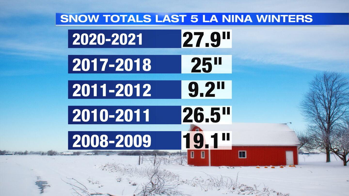
Over the last five La Niña winters, three have featured near or slightly above average snowfall. Two of the last five La Nina winters have brought us below average snowfall with the winter of 2008-2009 being significantly below average.
©2021 Cox Media Group


