QUICK-LOOK FORECAST:
- Briefly colder tonight through Friday
- Next rain chance Friday
- More warmth arrives this weekend
>> TRACK THE LATEST CONDITIONS: Live Doppler 7 Radar
DETAILED FORECAST:
HEADLINES:
WEDNESDAY: Our severe threat is long gone, and now we’re settling into the colder airmass behind the cold front, according to Storm Center 7 Chief Meteorologist Austin Chaney.
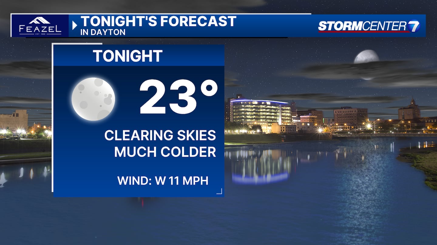
Tonight we’ll have clearing skies and falling temperatures. Lows drop to the mid-20s by morning with wind chills in the teens. No rain or snow is expected.
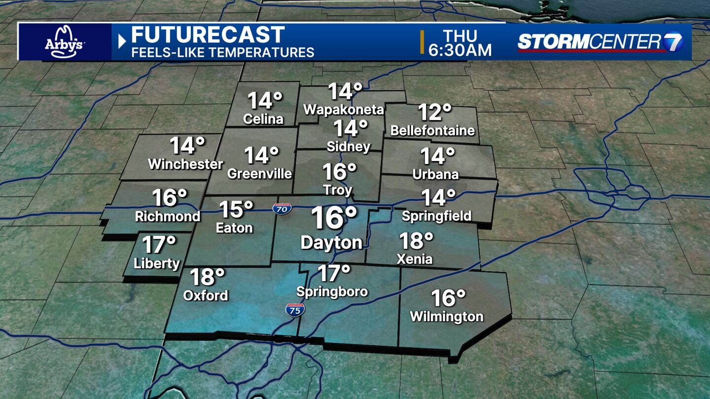
THURSDAY: Sunny skies but cool temperatures on Thursday. We only climb to the low 40s for highs. Thursday is the only day in our forecast with near to below-normal temperatures. Every other day looks to be warmer than normal.
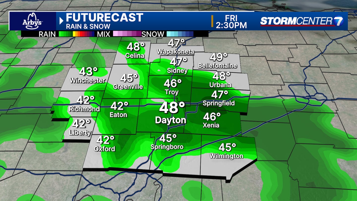
FRIDAY: Increasing clouds with a chance for showers into Friday afternoon. Highs in the upper 40s.
SATURDAY: Morning clouds, afternoon sunshine with highs in the upper 50s to near 60.
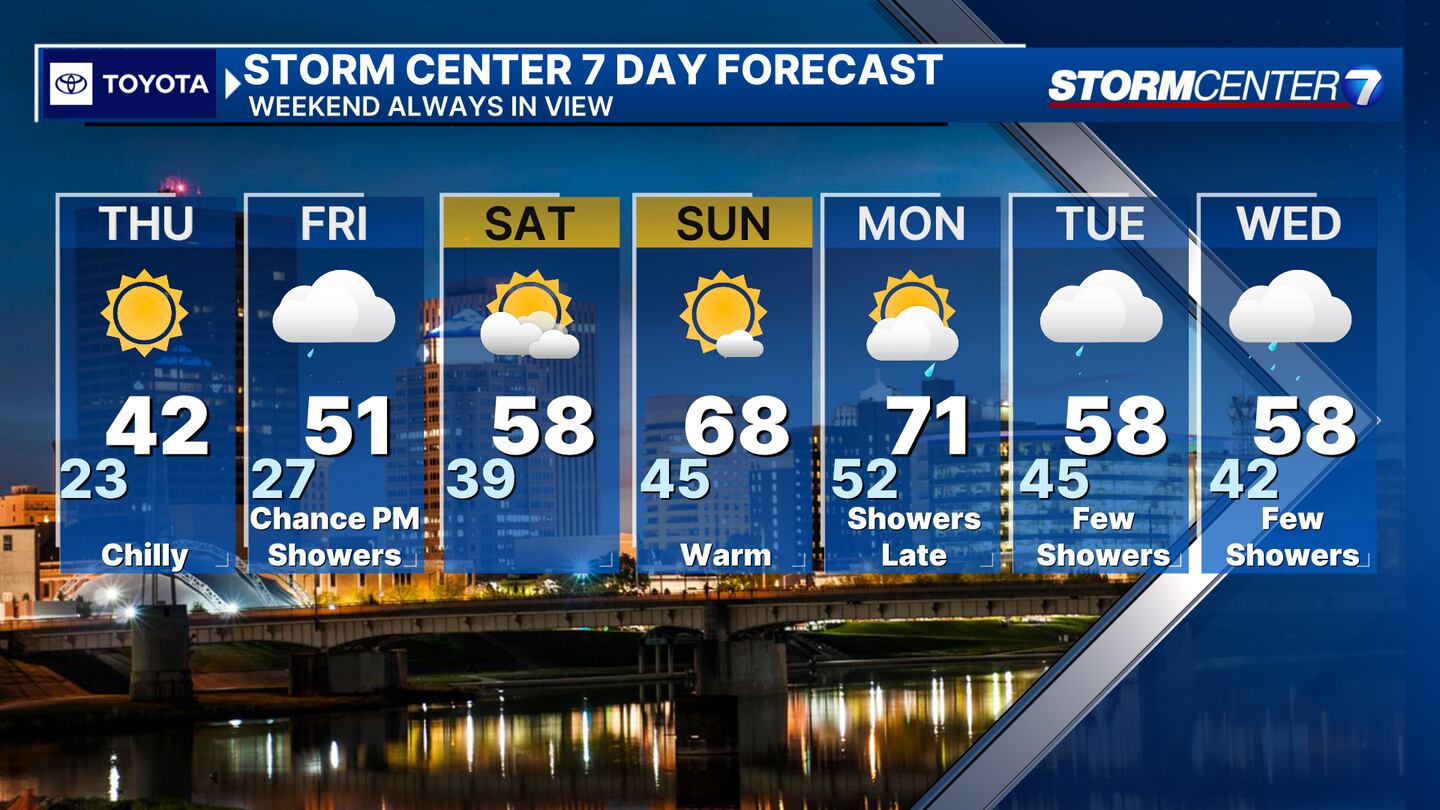
SUNDAY: Mostly sunny, warm and breezy. Highs climbing to the upper 60s.
MONDAY: Increasing clouds but still warm and breezy. Low 70s for highs! A few showers possible at night.
TUESDAY: A slight chance for showers. Otherwise mostly cloudy with highs in the upper 50s.
WEDNESDAY: A chance for showers with highs in the upper 50s.
©2024 Cox Media Group


