A Wind Advisory has been issued for the entire Miami Valley from 11 a.m. on Friday until 8 a.m. on Saturday.
QUICK-LOOK FORECAST:
- Next storm system arrives Friday
- Mainly rain & wind, some snow
- Dangerously cold early next week
>> TRACK THE LATEST CONDITIONS: Live Doppler 7 Radar
DETAILED FORECAST:
THURSDAY: Mostly cloudy. Mainly dry for the afternoon. Highs near 40.
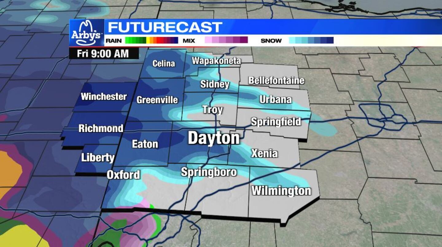
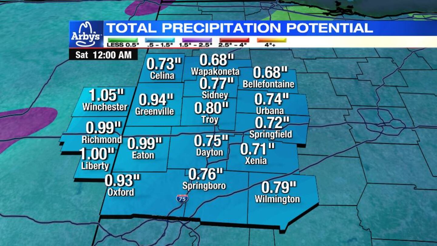
FRIDAY: A sloppy day is expected Friday. Precipitation may begin as a brief mix of rain, sleet, and snow Friday morning before quickly changing to all rain Friday afternoon.
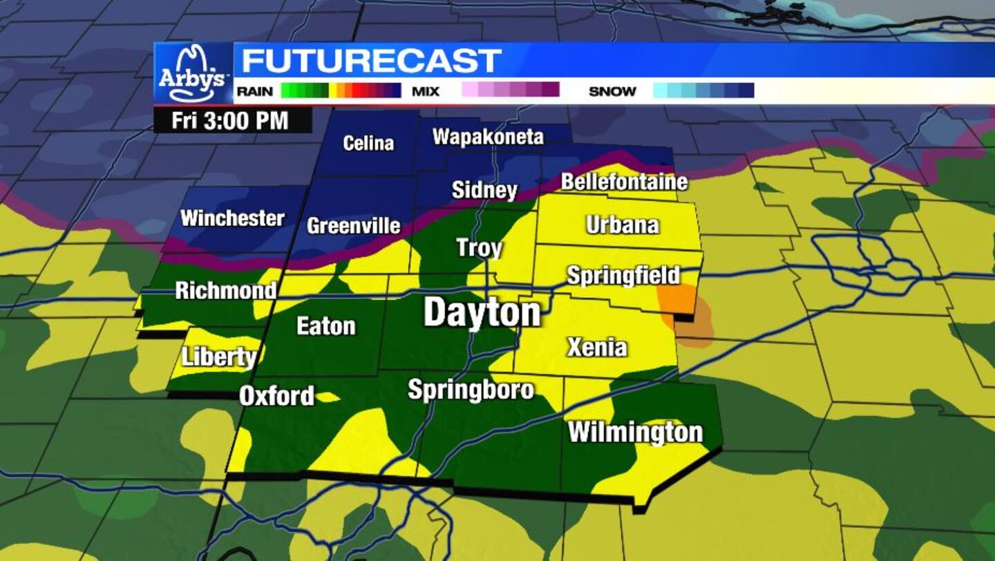
Highs climb to the middle 40s. Very windy with some gusts exceeding 40 m.p.h.
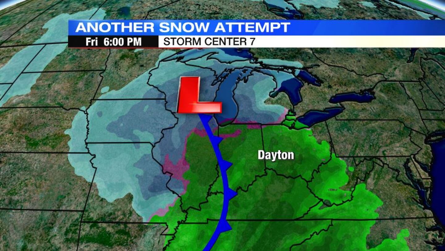
Friday night, moisture is pulling away as colder air arrives. The overlap of whatever moisture is left will result in some light snow showers.
SATURDAY: Snow showers are possible, especially early Saturday. An early look at accumulations suggests they should be light, generally less than an inch. Colder air begins to arrive. Daytime highs only rebound to the upper 20s.
SUNDAY: A few lingering snow showers are possible. Very cold. Morning lows are in the low teens. Afternoon highs below 20 degrees. Wind chills in the single digits.
MONDAY: Dangerously cold Monday. Lows in the single digits with subzero wind chills. Afternoon highs in the teens. A slight chance for snow showers, with better chances south of Dayton.
TUESDAY: Dangerously cold again. Colder than Monday with lows ranging from zero to 5 degrees. Afternoon highs in the mid-teens. Subzero wind chills are likely again. Some light snow showers may be around Tuesday morning, again with the best chances south of Dayton.
WEDNESDAY: A third morning of low temperatures at or below 10 degrees. Afternoon highs climb back into the middle 20s. Dry with partly cloudy skies.
©2024 Cox Media Group


