QUICK-LOOK FORECAST:
- Stubborn clouds early, some breaks Sunday
- Unseasonably warm Monday
- Showers, cooler Tuesday into midweek
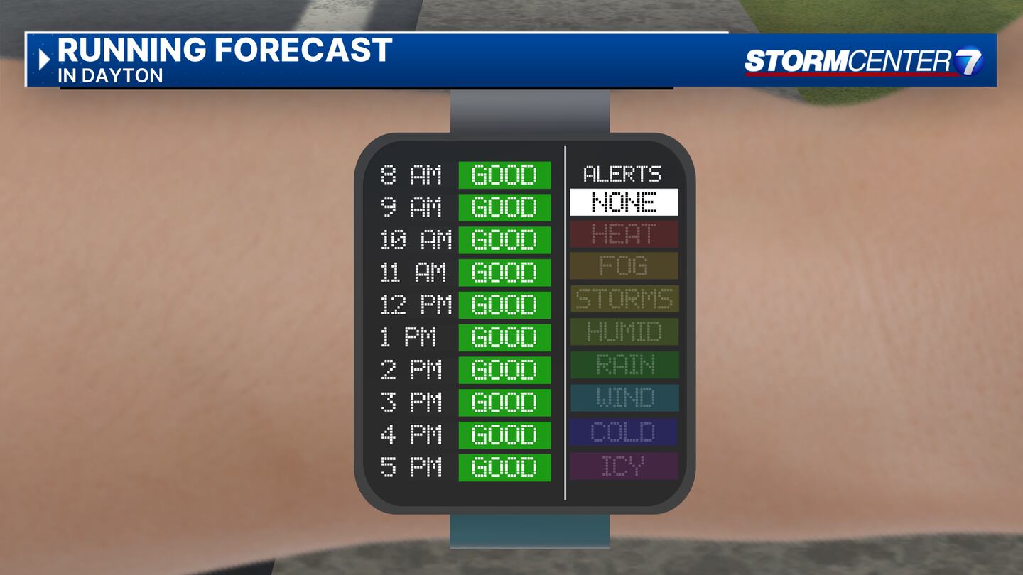
>> TRACK THE LATEST CONDITIONS: Live Doppler 7 Radar
DETAILED FORECAST:
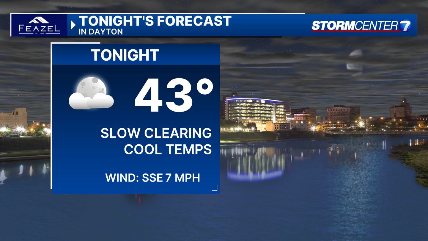
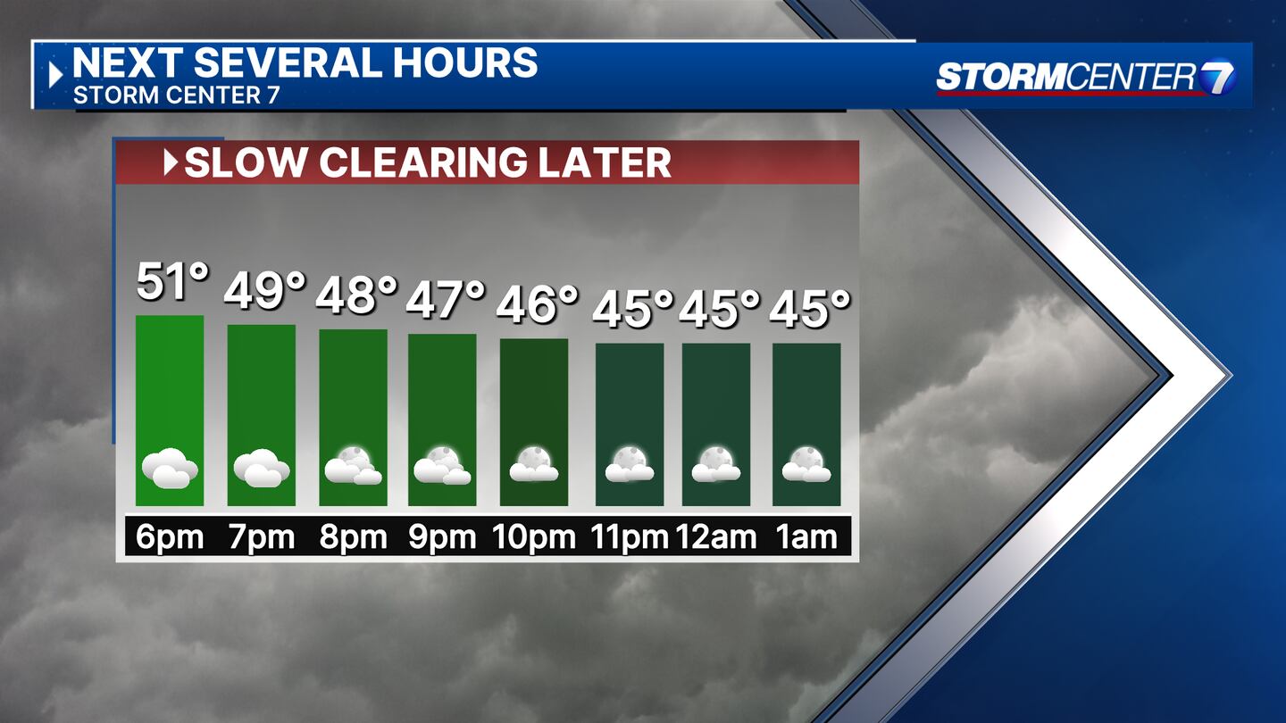
SATURDAY: Stubborn cloudiness will be slow to clear with lows in the lower 40s for most, according to Storm Center 7 Weather Specialist Nick Dunn.
SUNDAY: Sunshine will gradually become more persistent on Sunday. This will help us warm into the lower to middle 60s.
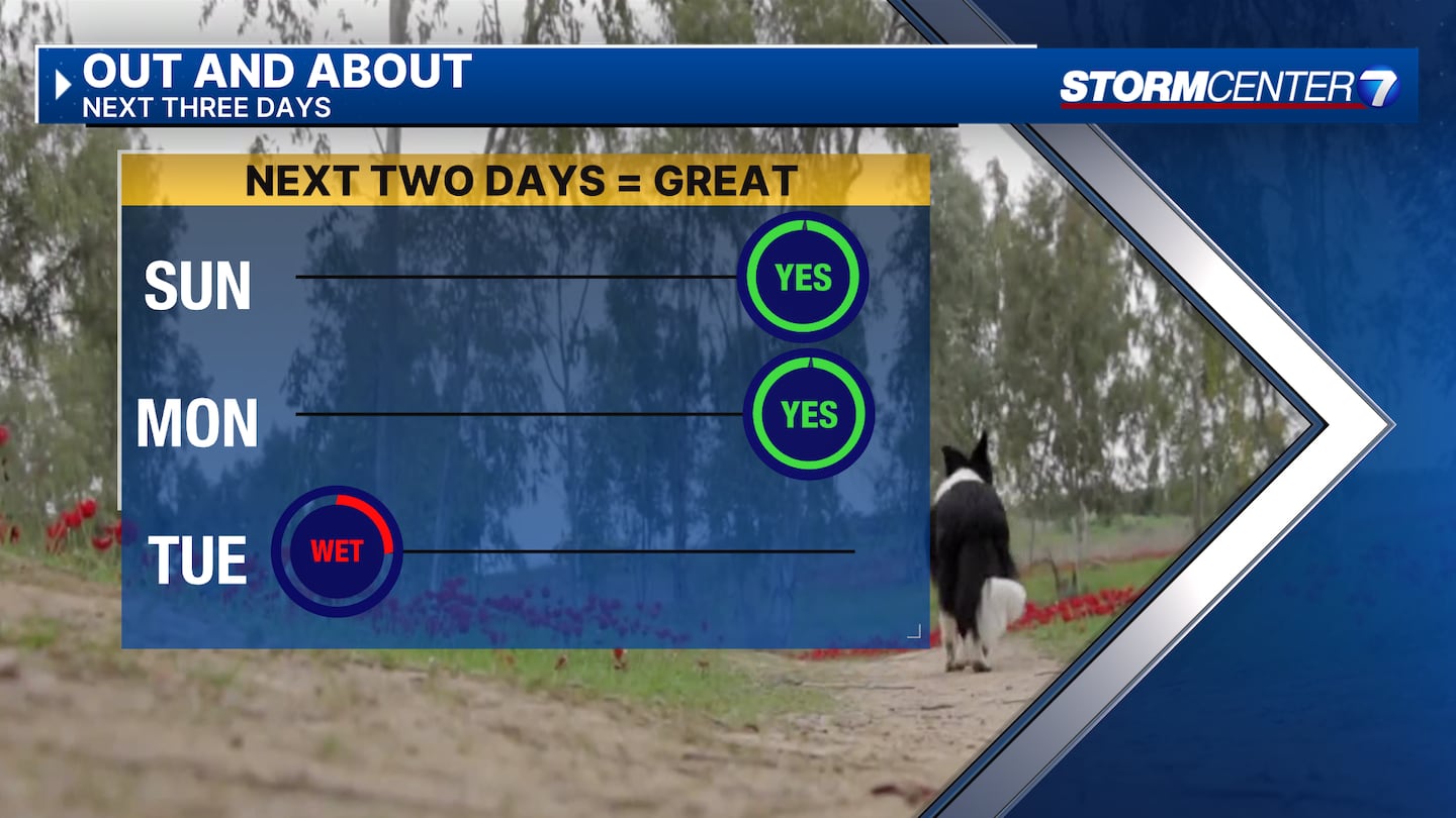
MONDAY: Sunshine early with more clouds arriving late in the day. Low to middle 70s for highs! Our current forecast calls for a high of 74. That wouldn’t quite come close to the record of 77, but it would still be way above the typical high of 47. A bit breezy as well. A stray shower is not impossible late, with better chances overnight!
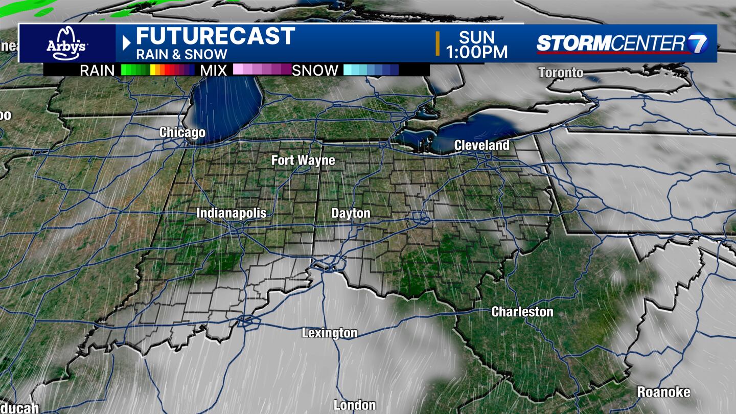
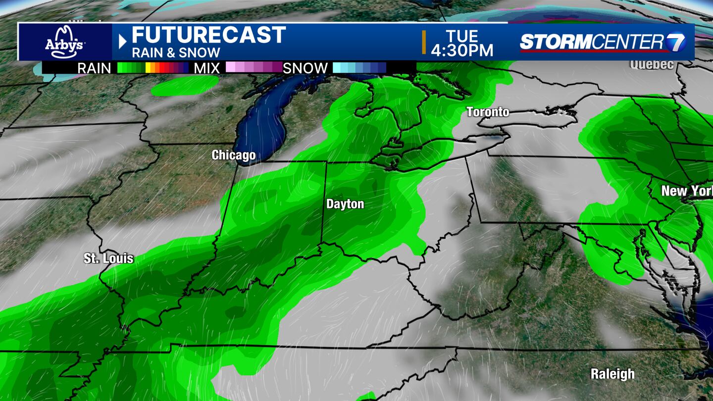
TUESDAY: Tracking a good chance for showers and a few thunderstorms on Tuesday. An early look at this system would suggest severe weather is unlikely despite the warmth with highs in the mid-60s.
WEDNESDAY: A chance for showers mainly early in the day. Highs in the upper 50s.
THURSDAY: Some sunshine mixed with clouds and drier. Highs in the mid to upper 50s.
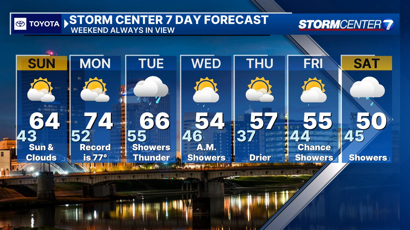
FRIDAY: Cloudy with a chance for showers. Highs in the middle 50s.
SATURDAY: Cloudy skies hang around with rain showers with highs in the upper 40s to around 50.
©2024 Cox Media Group


