QUICK-LOOK FORECAST:
- Thanksgiving looking cool, dry
- Colder air looming
- Next chance for showers arrives Sunday
>>TRACK THE LATEST CONDITIONS: Live Doppler 7 Radar
DETAILED FORECAST:
TUESDAY: Cloudy skies with patchy mist or drizzle are possible this evening into tonight, according to Storm Center 7 Chief Meteorologist Austin Chaney. Cool. Lows make it down to around 40 by tomorrow morning.
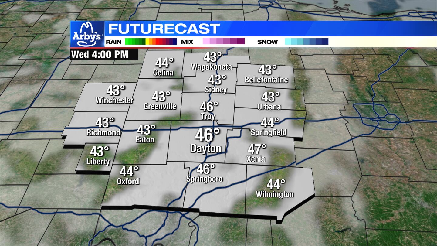
WEDNESDAY: An overall gloomy day on Wednesday. Cloudy with some mist or drizzle possible early. Some breaks in the clouds possible late in the day. Chilly with highs in the mid-40s.
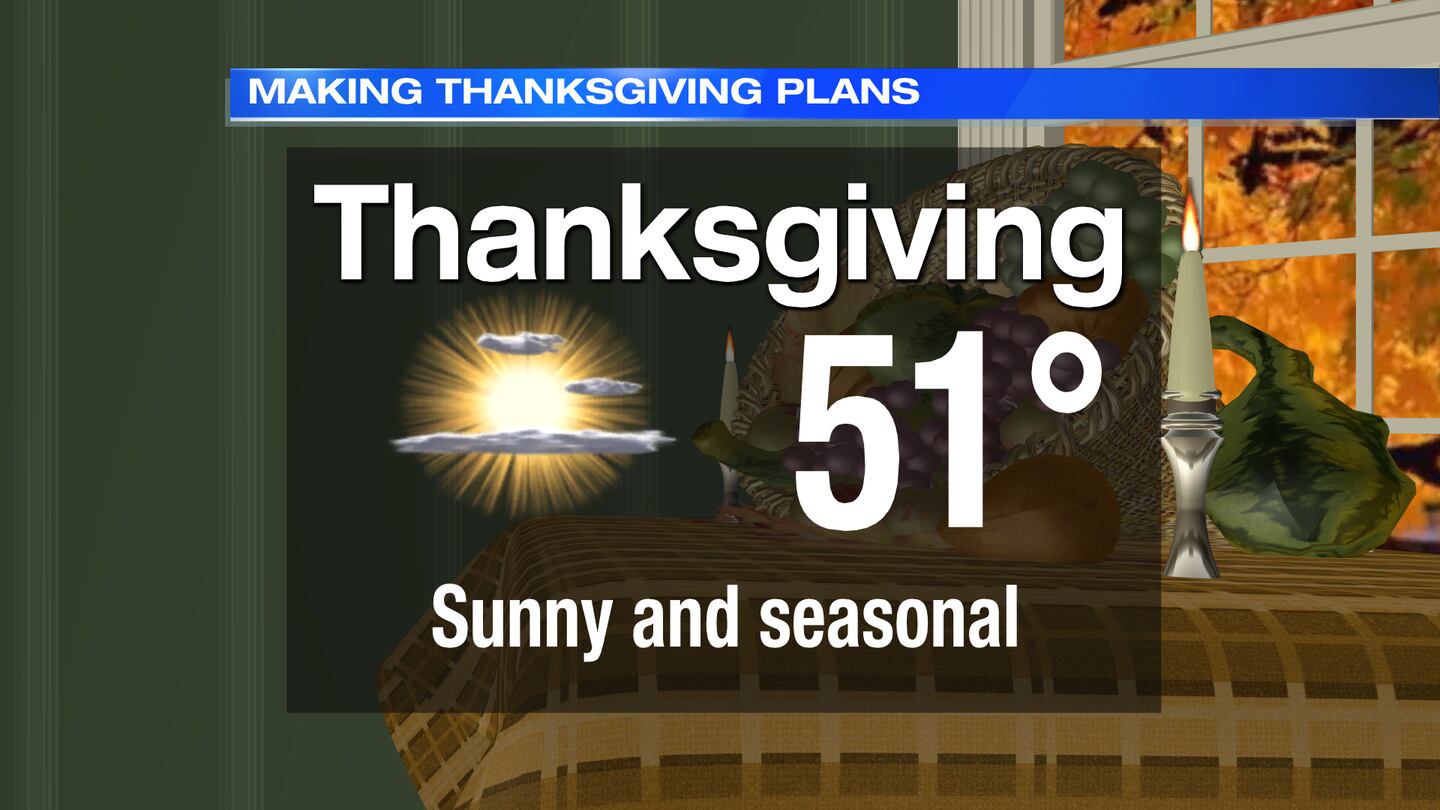
THURSDAY/THANKSGIVING: Turning mostly sunny for Thanksgiving day. A bit milder with highs near 50 degrees.
FRIDAY: A colder airmass spills in come Friday. Mostly sunny, but highs only in the low to mid-40s.
SATURDAY: Clouds increasing, currently looking dry though. Highs in the low 40s.
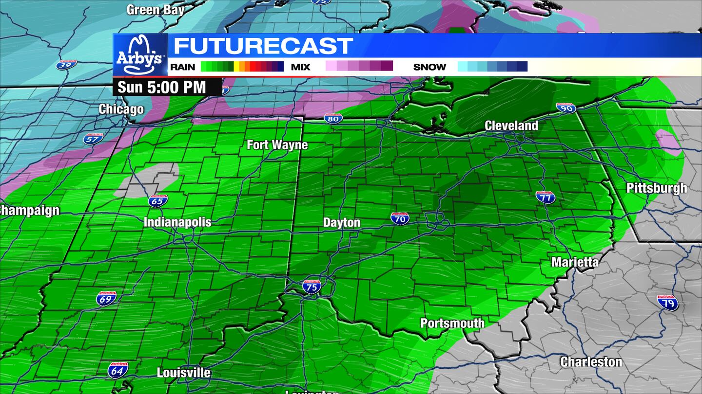
SUNDAY: Mostly cloudy with a few showers possible on Sunday. As of now, this looks to be mainly light rain showers with highs in the lower 40s, but some wet snowflakes can’t be ruled out Sunday night as temperatures fall.
MONDAY: Partly cloudy. Chilly with highs in the upper 30s to near 40.
TUESDAY: Partly cloudy. Chilly with highs in the upper 30s to near 40.
©2023 Cox Media Group