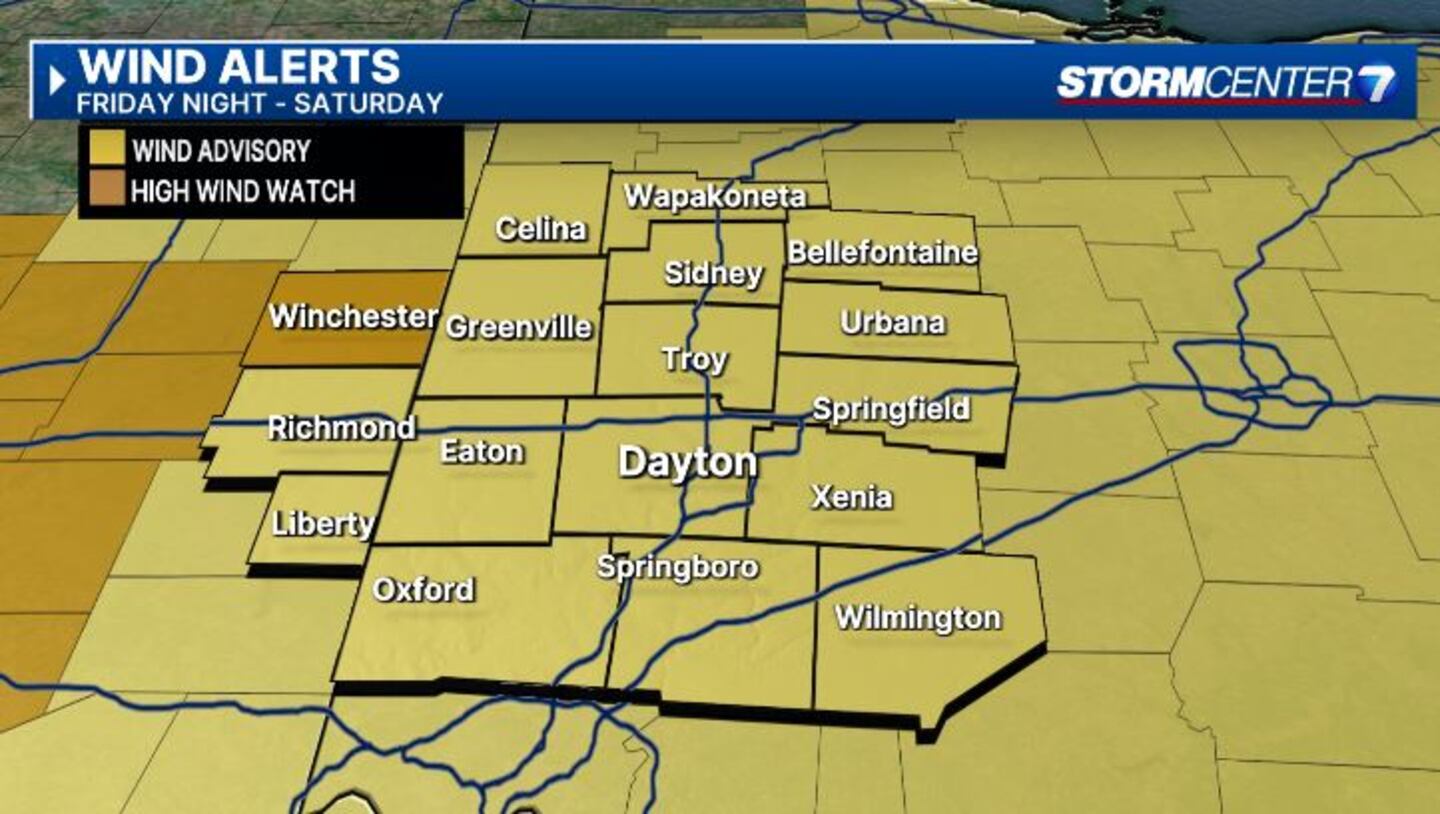
A Wind Advisory for the Miami Valley continues through 8 a.m. Saturday and includes Butler, Champaign, Clark, Clinton, Darke, Greene, Logan, Mercer, Miami, Montgomery, Preble, Shelby, and Warren counties in Ohio. It is also in effect for Union and Wayne counties in Indiana.
A High Wind Warning is in effect for Randolph County in Indiana from 4 p.m. until 8 p.m. Friday.
QUICK-LOOK FORECAST:
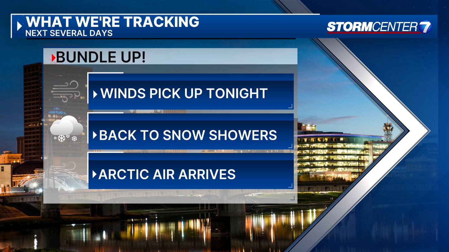
- Winds increase tonight
- Rain showers change over to snow showers
- Extreme cold sets in
>> TRACK THE LATEST CONDITIONS: Live Doppler 7 Radar
DETAILED FORECAST:
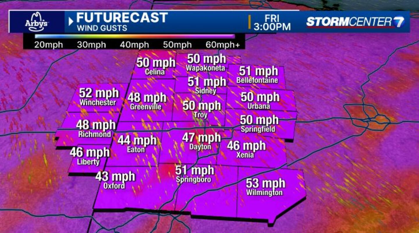
TONIGHT: Winds speeds start to increase through the evening. Some gusts 40 to 50 mph remain possible, especially into tonight, according to Storm Center 7 Meteorologist Austin Chaney. The heaviest precipitation moves out, but lingering moisture could come in the form of scattered light snow showers from late tonight into early Saturday.
Additional snowfall accumulation should be light. Even where snow doesn’t fall, roads could become slick because of rapidly falling temperatures combining with wet pavement from earlier rain.
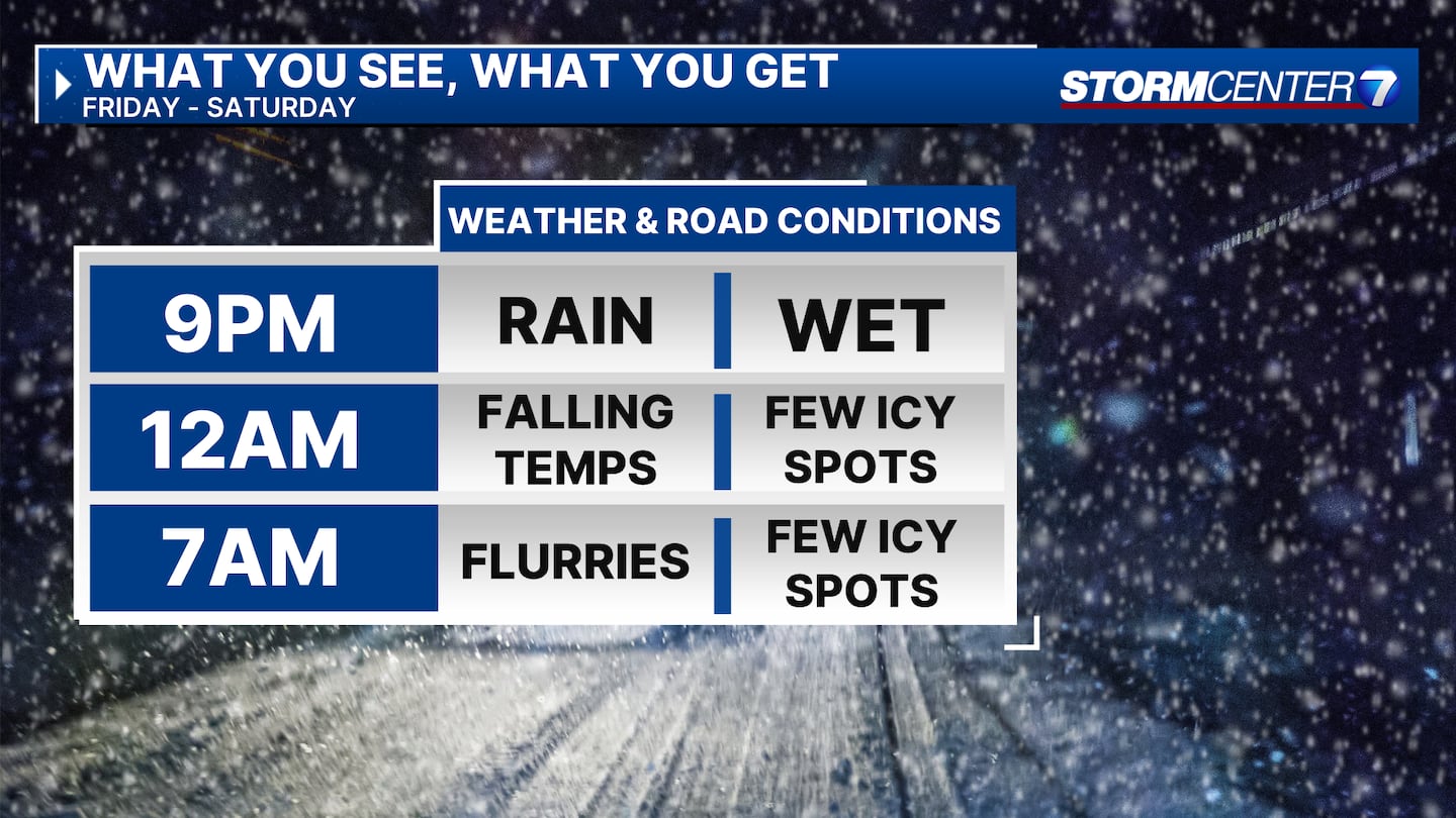
Lows overnight Friday drop into the lower 20s.
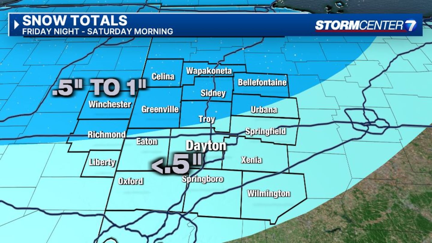
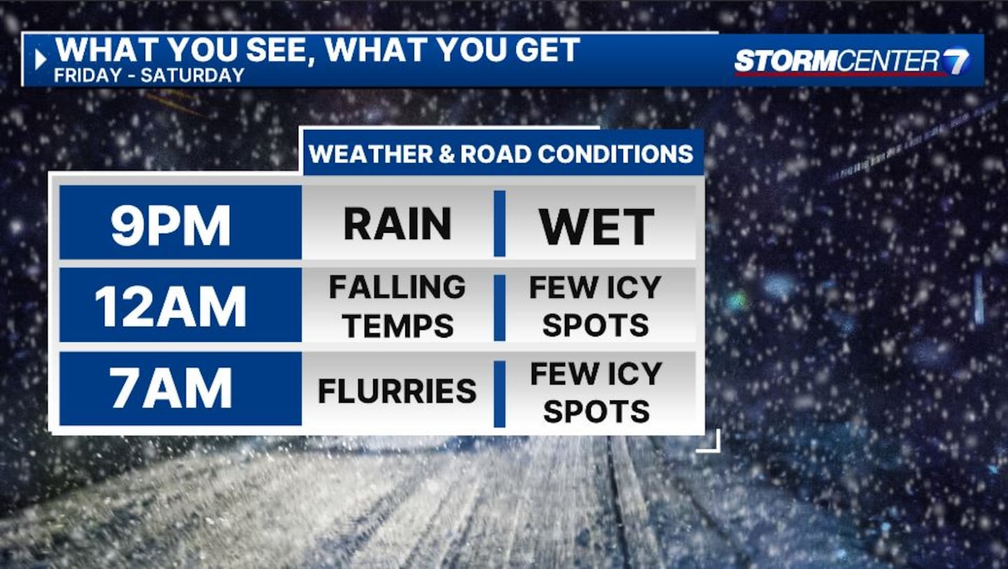
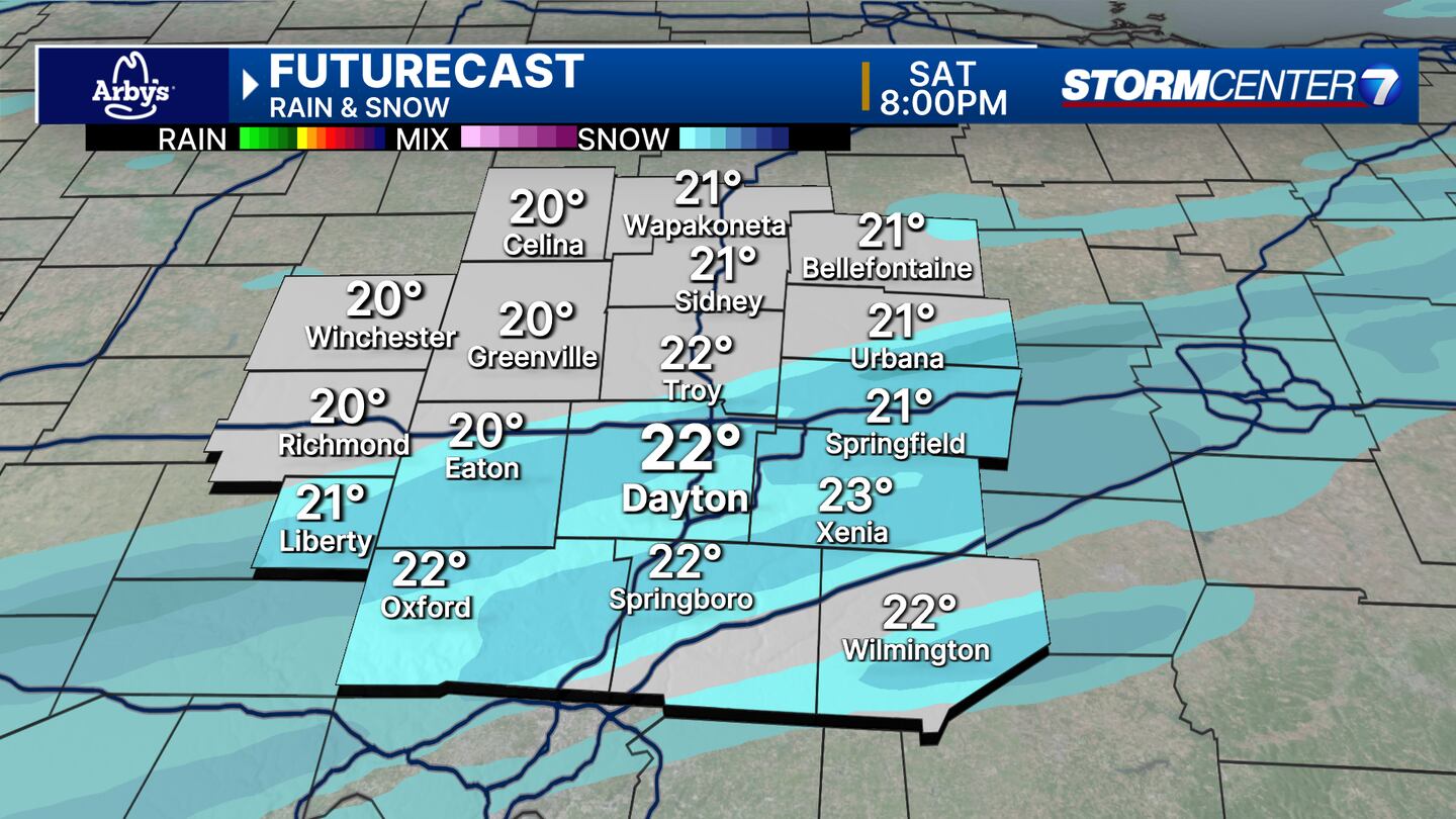
SATURDAY: A few snow showers may still be around real early, then dry for much of the day. Look for a few flurries or light snow showers Saturday evening. With low temperatures, anything that falls will stick, but accumulations are still expected to be light. Afternoon highs rebound to the mid- and upper 20s. It will stay windy.
SUNDAY: Mostly cloudy and dangerously cold. Lows in the single digits Sunday morning with wind chills zero to minus 10 degrees. Only climbing to the low teens by the afternoon.
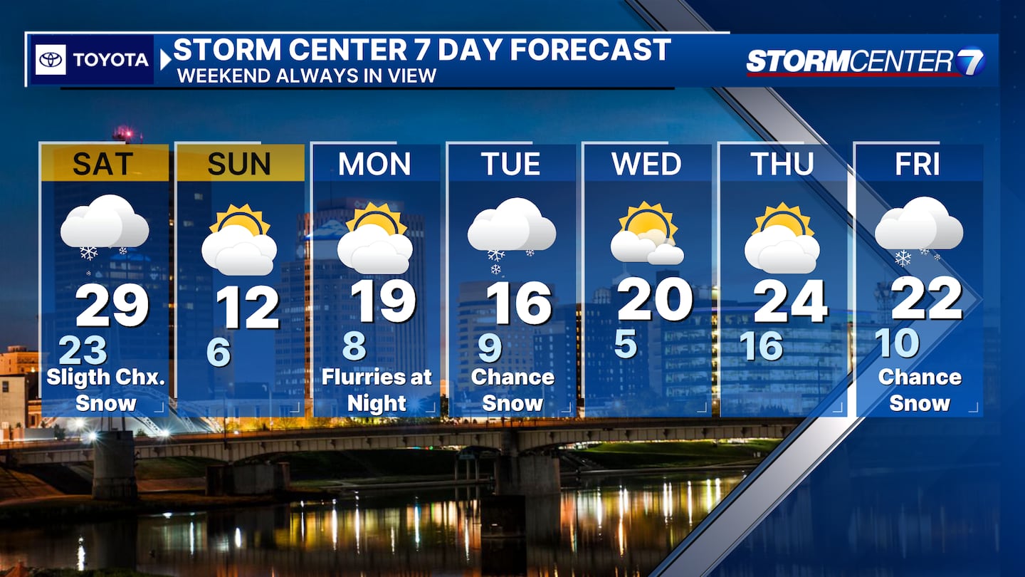
MONDAY: Dangerously cold. Lows in the single digits with subzero wind chills. Afternoon highs in the teens. Mostly cloudy skies.
TUESDAY: Dangerously cold again. Colder than Monday with lows ranging from zero to 5 degrees. Afternoon highs in the mid-teens. Subzero wind chills are likely again. Light snow showers remain a possibility, but confidence is low on coverage and snowfall amounts.
WEDNESDAY: A third morning of low temperatures at or below 10 degrees. Afternoon highs climb back into the middle 20s. Dry with partly cloudy skies.
THURSDAY: Mostly cloudy with a few flurries. Cold, but not quite as bad. Lows in the upper teens and highs in the mid-20s.
FRIDAY: Cold with a chance for snow. Highs in the low 20s.
©2024 Cox Media Group


