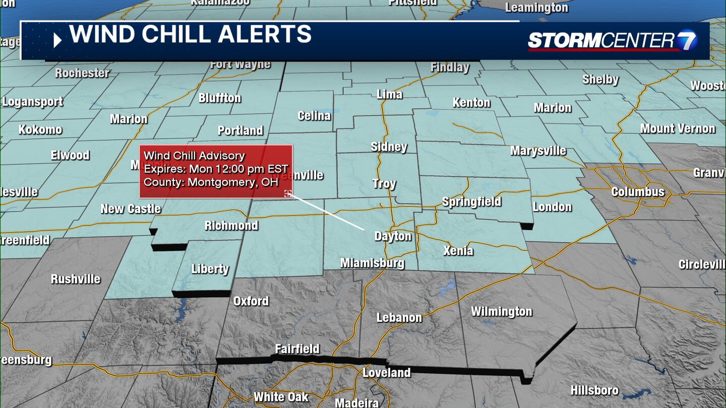
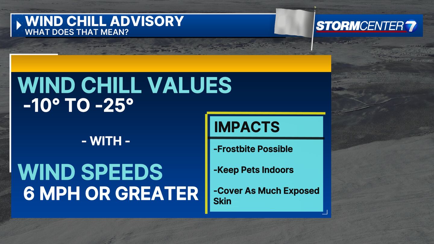
Wind Chill Advisory: Valid from 11 p.m. Saturday until noon Monday for Wayne and Union counties in Indiana, and Mercer, Auglaize, Logan, Darke, Shelby, Montgomery, Clark, Greene, Miami, and Preble counties in Ohio.
QUICK-LOOK FORECAST:
- Below freezing the entire week likely
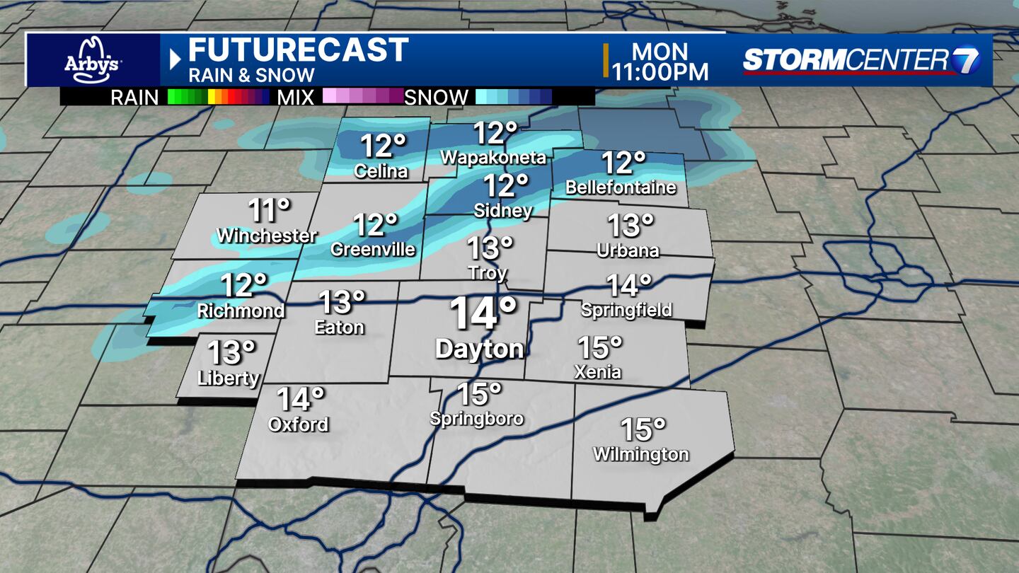
- Light passing snow showers Monday night
- Another potential snow system into Friday
>> TRACK THE LATEST CONDITIONS: Live Doppler 7 Radar
DETAILED FORECAST:
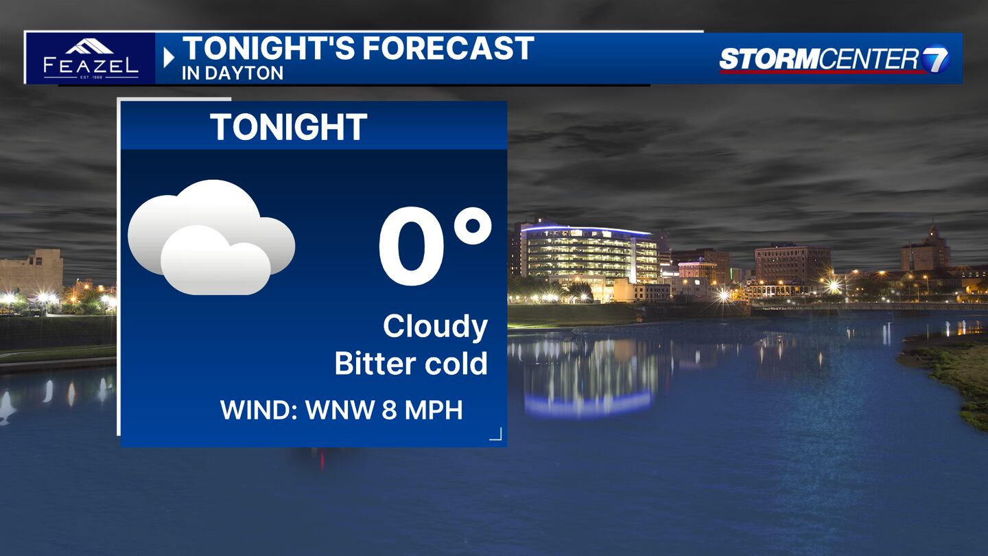
SUNDAY (COLD): A few clouds moving in and bitter cold with lows approaching 0 degrees. Wind chill values below -10 degrees.
MONDAY (COLD): Mostly sunny with highs in the mid-teens. Some light snow showers are possible at night.
TUESDAY (COLD): Partly sunny with highs in the low teens. Subzero wind chills are likely again.
WEDNESDAY (COLD): A third morning of low temperatures at or below 10 degrees. Milder as afternoon highs climb back into the middle 20s. Dry with generally sunny skies.
THURSDAY (COLD): Mostly cloudy skies and much milder but still below freezing with lows approaching 30. A chance of snow later at night.
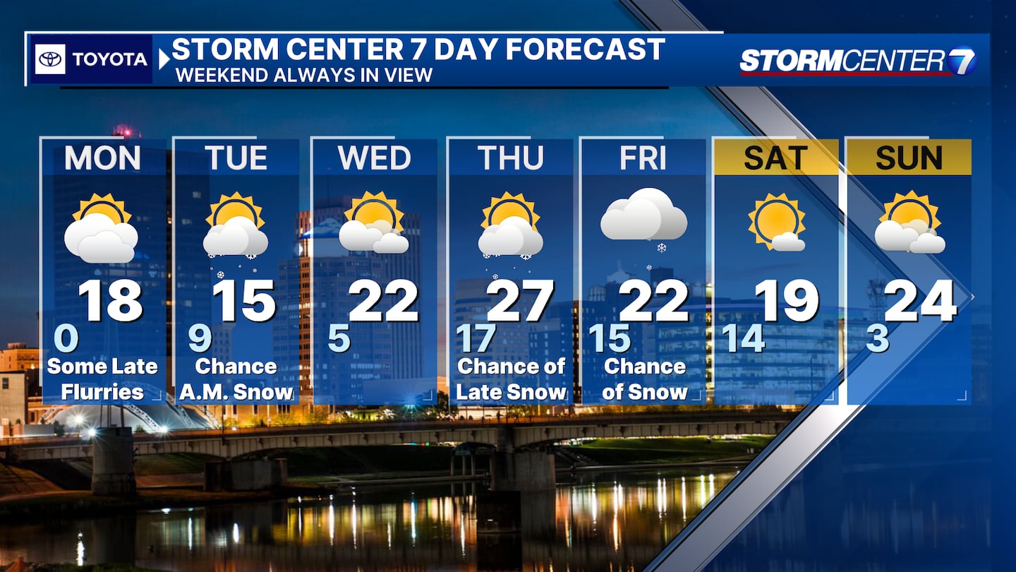
FRIDAY (COLD, POSSIBLE SNOW): Cold with a chance for snow. Highs dropping again into the lower 20s.
SATURDAY (COLD): Morning temps may be below 0°. Partly sunny and cold with highs in the upper teens.
SUNDAY (COLD): Morning temps may be below 0°. Mostly sunny with highs in the low 20s.
©2024 Cox Media Group


