
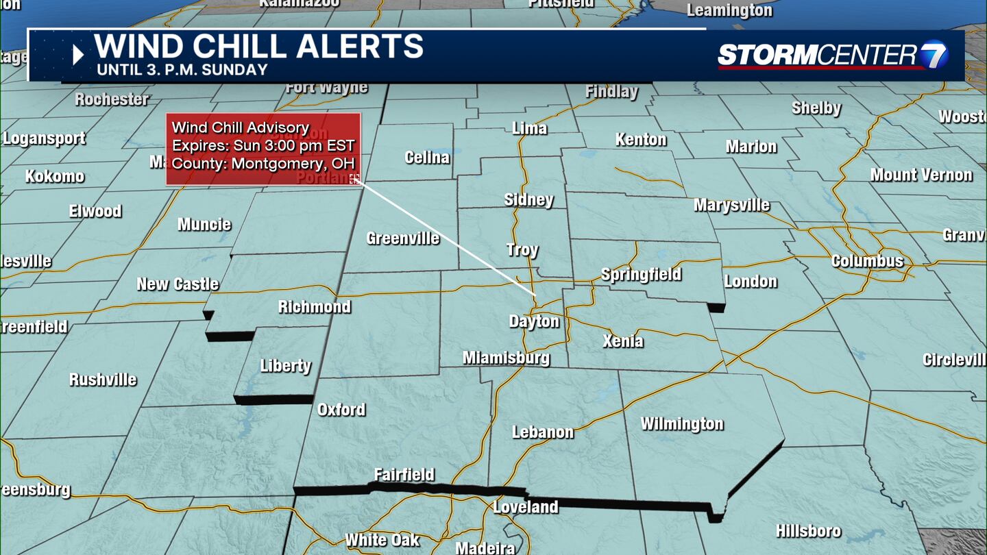
Wind Chill Advisory: Valid from 11 p.m. Saturday until 3 p.m. Sunday for Wayne and Union counties in Indiana, and Mercer, Auglaize, Logan, Darke, Shelby, Montgomery, Clark, Greene, Miami, and Preble counties in Ohio
Wind Chill Advisory: Valid from 1 a.m. Sunday to 1 p.m. Sunday for Butler, Warren, and Clinton counties.
Wind Chill Advisory: Valid from 7 p.m. Saturday to 1 p.m. Sunday for Randolph County in Indiana
QUICK-LOOK FORECAST:
- Light show showers tonight
- Dangerous Cold Temperatures setting in
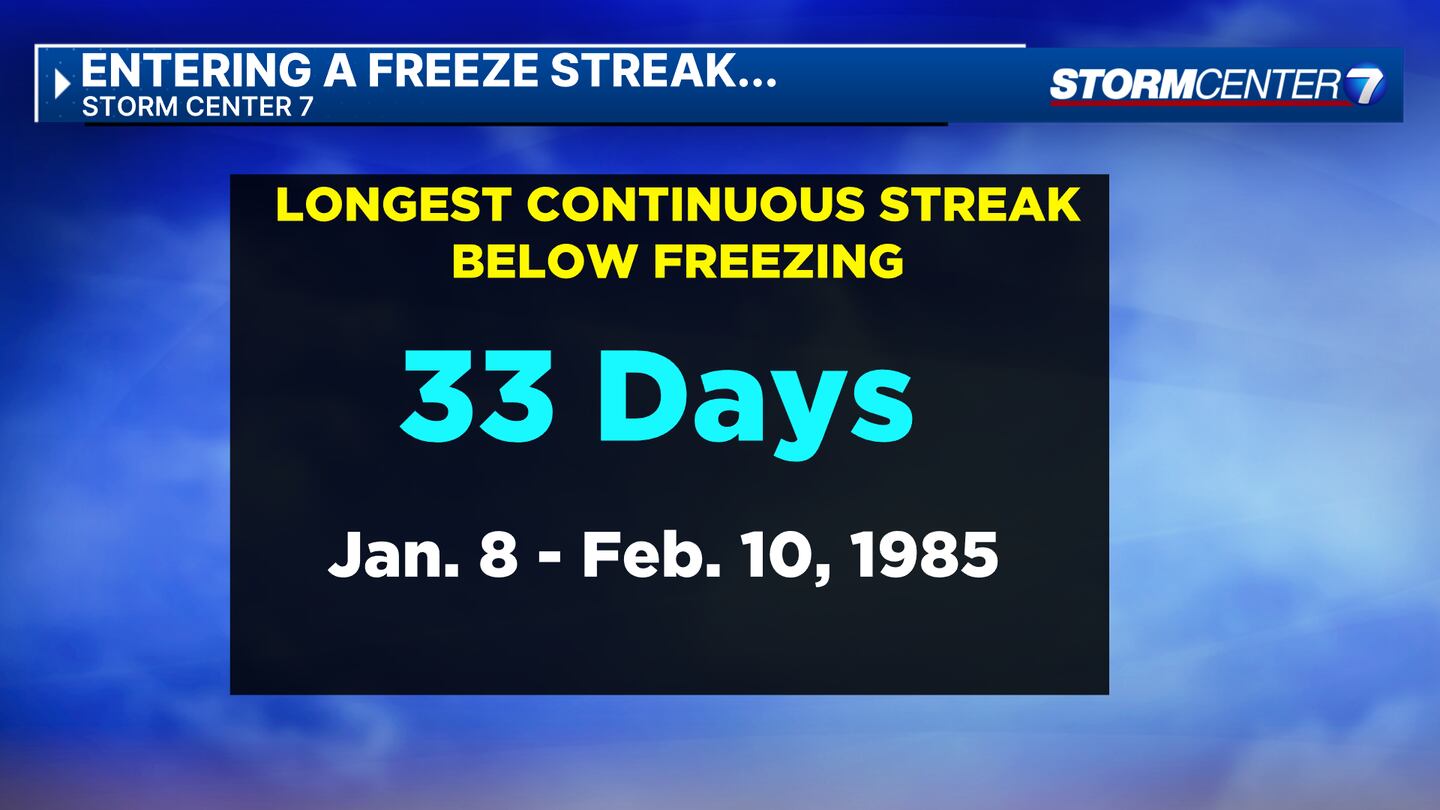
- 10+ days continuously below freezing potentially
>> TRACK THE LATEST CONDITIONS: Live Doppler 7 Radar
DETAILED FORECAST:
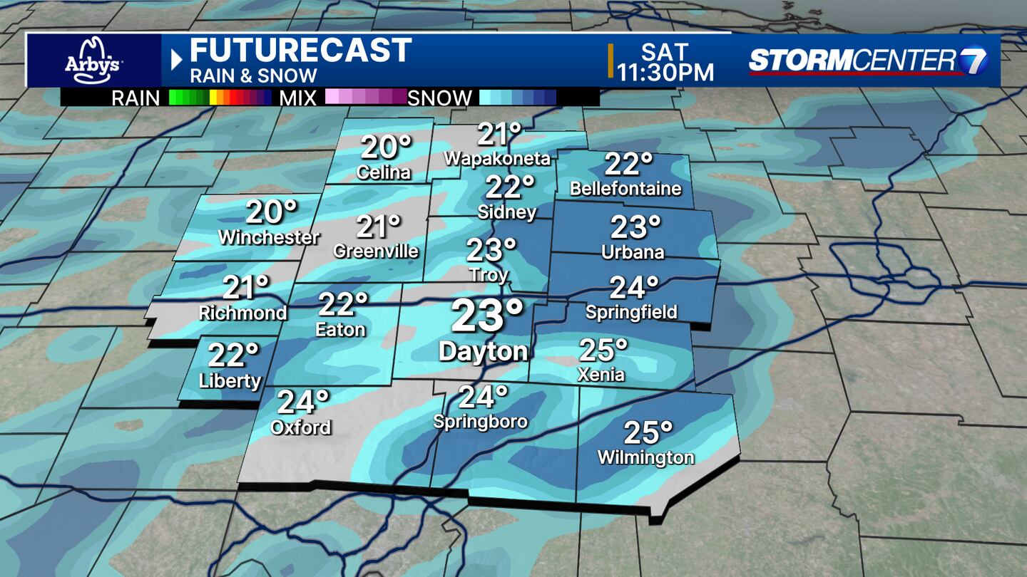
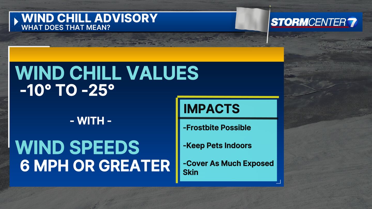
SATURDAY (COLD AND SNOW): Passing snow showers as temperatures drop to the single digits. Dangerous wind chills could reach -25 degrees.
SUNDAY (COLD): Mostly cloudy. Dangerously cold. Lows in the single digits Sunday morning with wind chills -5 to -20. Only climbed to the low teens Sunday afternoon with wind chills not improving very much into the afternoon.
MONDAY (COLD): Dangerously cold Monday. Lows in the single digits with subzero wind chills once again. Afternoon highs in the teens. Mostly cloudy skies
TUESDAY (COLD): Dangerously cold again. Colder than Monday with lows ranging from zero to 5 degrees. Afternoon highs in the mid teens. Subzero wind chills likely again. >Light snow showers remain a possibility, but confidence is low on coverage and snowfall amounts.
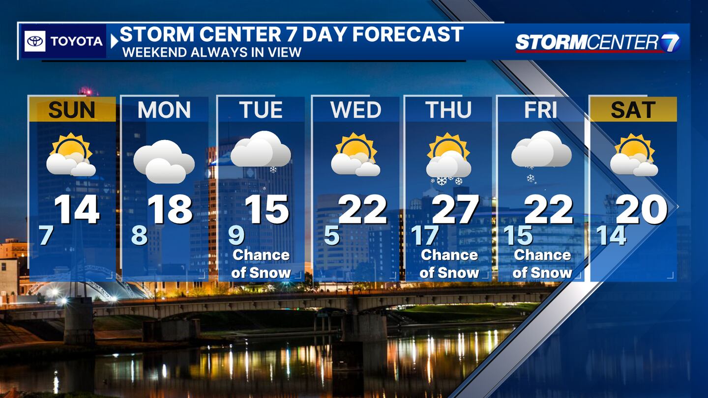
WEDNESDAY (COLD): A third morning of low temperatures at or below 10 degrees. Afternoon highs climb back into the middle 20s. Dry with partly cloudy skies.
THURSDAY (COLD): Mostly cloudy skies. Cold, but not quite as bad. Lows in the upper teens and highs in the mid-20s.
FRIDAY: Cold with a chance for snow. Highs in the lower 20s.
©2024 Cox Media Group


